A Mineral King Mission
Peaks: Coyote Peaks, Angorra Peak, Florence Peak, Vandever Mountain
June 2024
Anthony and I have done most of the major trails and routes in the Sierra, and so we’ve turned our attention to the more obscure reaches of the range. We are slowly chipping away at the SPS list—comprised of 247 stunning Sierra peaks—which takes us to basically every nook and cranny of the Sierra. This is why found myself waking up at 4 a.m. on a Wednesday to drive seven hours in the morning and hike 23 miles in the afternoon to meet Anthony at Coyote Lakes Pass deep in the southern Sierra.
Anthony and I touched base on the phone a few days before the trip, confirming a rough time and location to meet each other. He would hike in from the east side, taking about three days. And I’d be coming from the west in a day, as I didn’t have the luxury of unemployment.
The drive to Mineral King was straightforward, though not only did I not hav A/C, but my fans didn’t work due to an inconveniently located mouse nest. So I drove through the hundred degree heat of the central valley wit the windows down. Eventually I got to the much cooler Mineral King trailhead, organized my gear, wrapped the car up in a tarp (that wasn’t quite large enough) to prevent marmots from wreaking havoc on the van, and set off hiking. I had done the majority of this hike a few years back with Anthony and remembered there being a fair amount of bushwhacking. The climb up to Farewell Gap was hot but beautiful, and I made short work of it. A few sketchy stream crossings had me concerned about what larger crossings may yet lay ahead since it was probably peak melt, but I didn’t let that thought sour my mood for the time being.
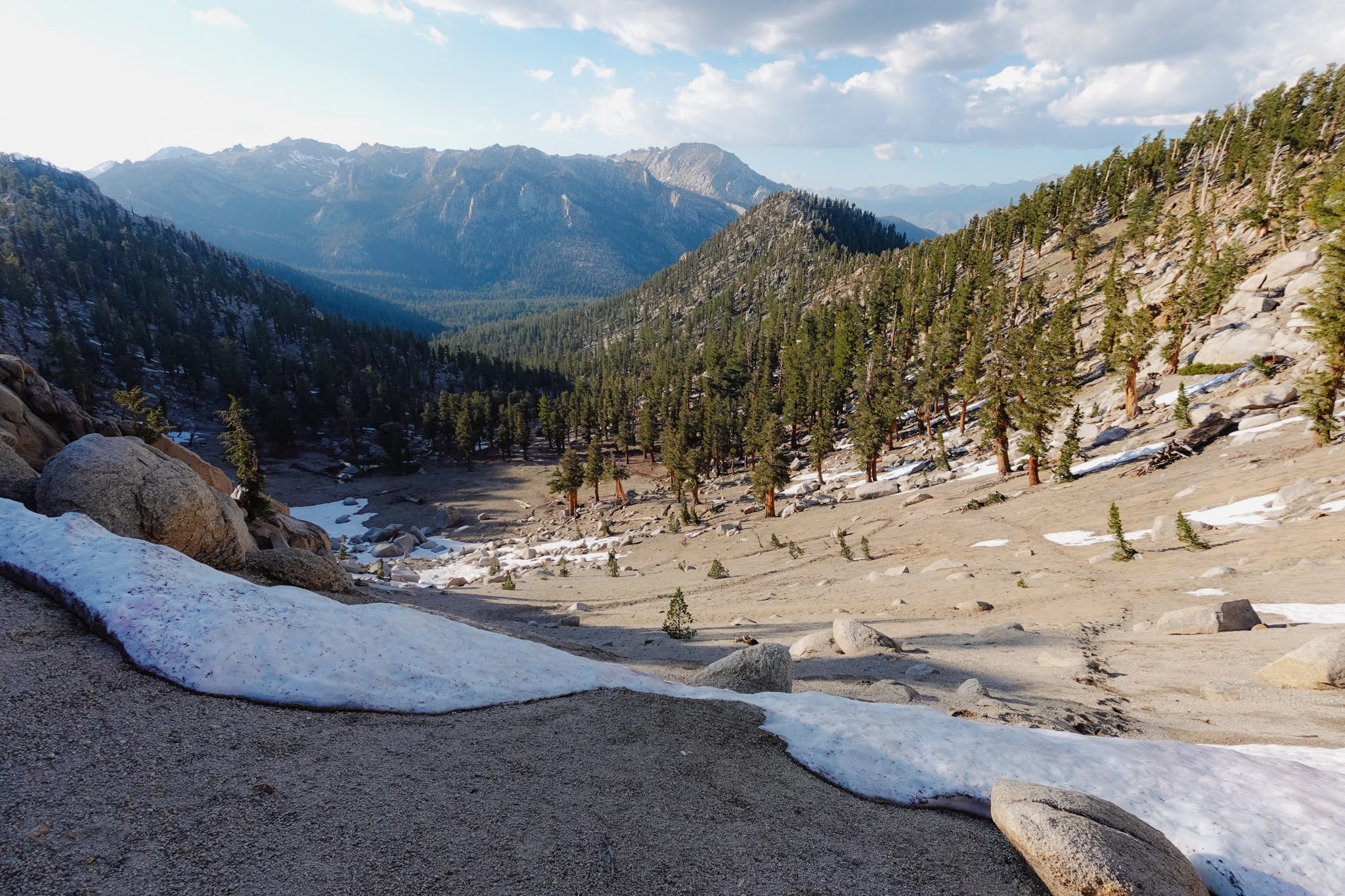
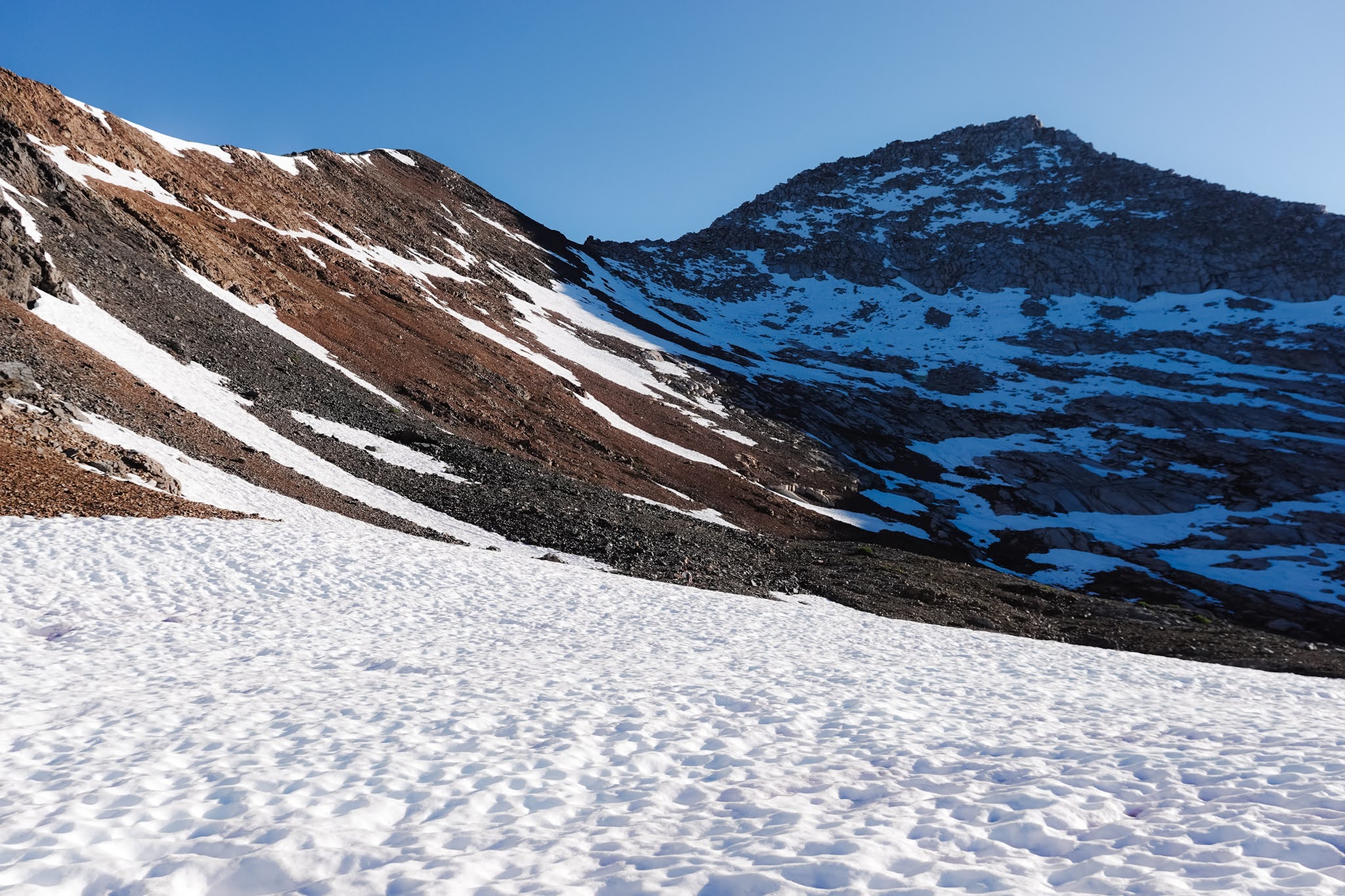
On the north side of the pass, I was greeted by some snow, which fortunately had a small break in it allowing for safe passage. From here the trail was much better than I remembered. Eventually, it did taper off, and I found myself thrashing through spiky shrubs and dense brush for a few hours as I made my way southeast. I reached Coyote Pass (not to be confused with my destination for the night, Coyote Lakes Pass) in good time, and pressed on down the valley directly to my east. There still wasn’t much of a trail, which was fine by me as the terrain was relatively low density forest which made for good cross country travel.
Before long, I cut south off the “trail” and headed up to Coyote Lakes Pass. I made a small sign out of sticks for Anthony in case he hadn’t reached this junction yet. As I climbed I wondered if and when I would see him. I caught sight of a couple vague footprints in the dirt, and the odd footprint in the snow. It is such a remote and seldom visited part of the range that I suspected these traces to be my comrade’s. After climbing for about an hour, I saw the pass ahead. I let out a loud “whoop!” and to my surprise, heard a “whoop whoop!” shouted back at me from the top of the pass. Looking up, I could just make out Anthony trudging his way up above me, maybe five minutes ahead. What crazy timing!
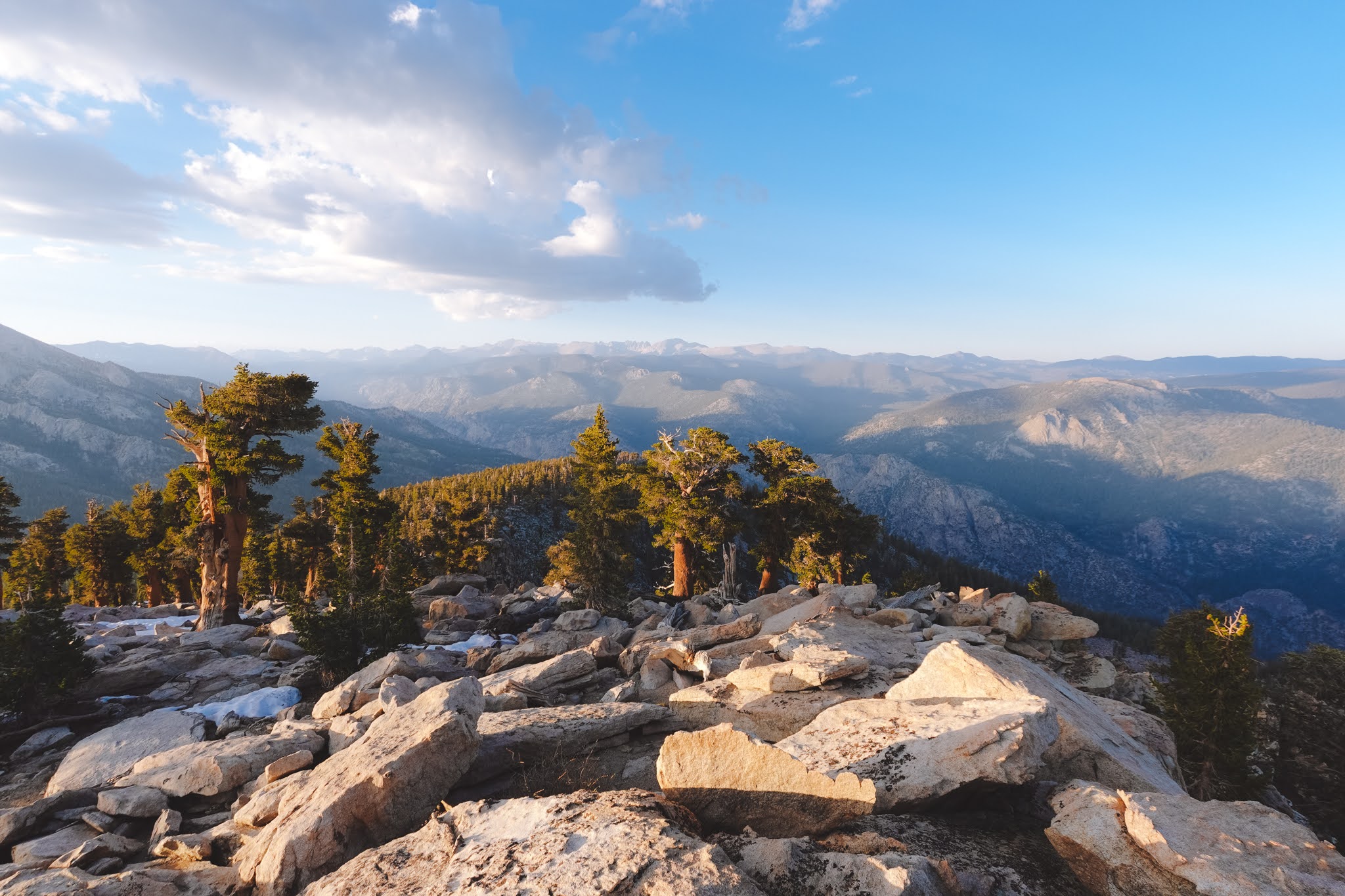
At the pass we gave each other a big hug, sat down, ate some food, and caught up. We decided to tag Coyote Peaks that night which would put us ahead of schedule for tomorrow. The climb up to the peak was a mellow one, and we tagged both of the twin summits (hence Coyote Peaks not Peak). From the top we caught a view of Angorra Mountain, our objective for tomorrow. It was a somewhat underwhelming peak, being below the treeline, but nonetheless fairly prominent in the area.
Once off the peak, we made it to the turn off to Coyote Lake. I started feeling awful at this point. Altitude sickness hit me like a train out of nowhere, and I had to take a seat. I suppose my strategy of working furiously for the days leading up to the trip so I could take three days off, skimping out on sleep, crushing a huge drive and a huge hike with no time to acclimatize was not a winning one. Anthony kindly offered to grab us water from the lake while I set up camp. I was happy to be stopping for the night, but still felt like death was upon me. Fortunately, I neither died nor vomitted that night, and by morning I actually felt pretty good. We threw our gear in my tent and hiked out to Angorra peak with just a couple bottles of water and some snacks.
On the way, Anthony nearly stepped on a dying bird. Both of its wings appeared broken, its eyes were crusted over, and it pathetically opened and closed its beak, desperate, but unable, to make a plea for help. Anthony asked me if I thought we should kill it. I thought for a second and said “probably should.” He agreed. So I grabbed a big rock for the job. I kneeled down next to the bird and told him “Alright little buddy, this is it. Sorry God if this was the wrong thing to do.” I lifted the rock over my head and thrust it down onto the bird. I didn’t even feel its little body, only the loud clack of my rock against the ground. The deed was done. Nature is a savage place, and I was reminded then that most animals come to a fairly gruesome, or at least unpleasant, end. But I suppose I’d still rather go like that little bird, out in the wild, the life draining out of me with each desperate breath of thin, crisp mountain air than in some shoddy retirement home in the middle of a city two thousand miles from any friends or family.
We kept hiking and eventually were on the summit of Angorra. It afforded us stupendous views of the seldom visited southern Sierra. From there, we hiked back to our gear, packed up, and started back towards Farewell Gap. Navigating was fairly easy, as I remembered the route pretty well from the previous day. We eventually made it to the Little Kern River drainage, where we would set up camp for the night in order to climb a couple more peaks the next morning.
After a good night’s rest on perhaps one of the most beautiful perches I’ve camped at in the past few years, Anthony and I headed up to Florence peak with our small day packs. The route was purported to be class three, but we feared that snow might complicate things. We both brought ice axes and micro-spikes for the ascent.
There was indeed plenty of snow. Instead of shooting up the southwest slopes, we decided to aim for a saddle to the peak’s west and ascent the west ridge. Some steep and sketchy snowfields that were still rock hard saw us to the saddle. A slip here would have been bad news.
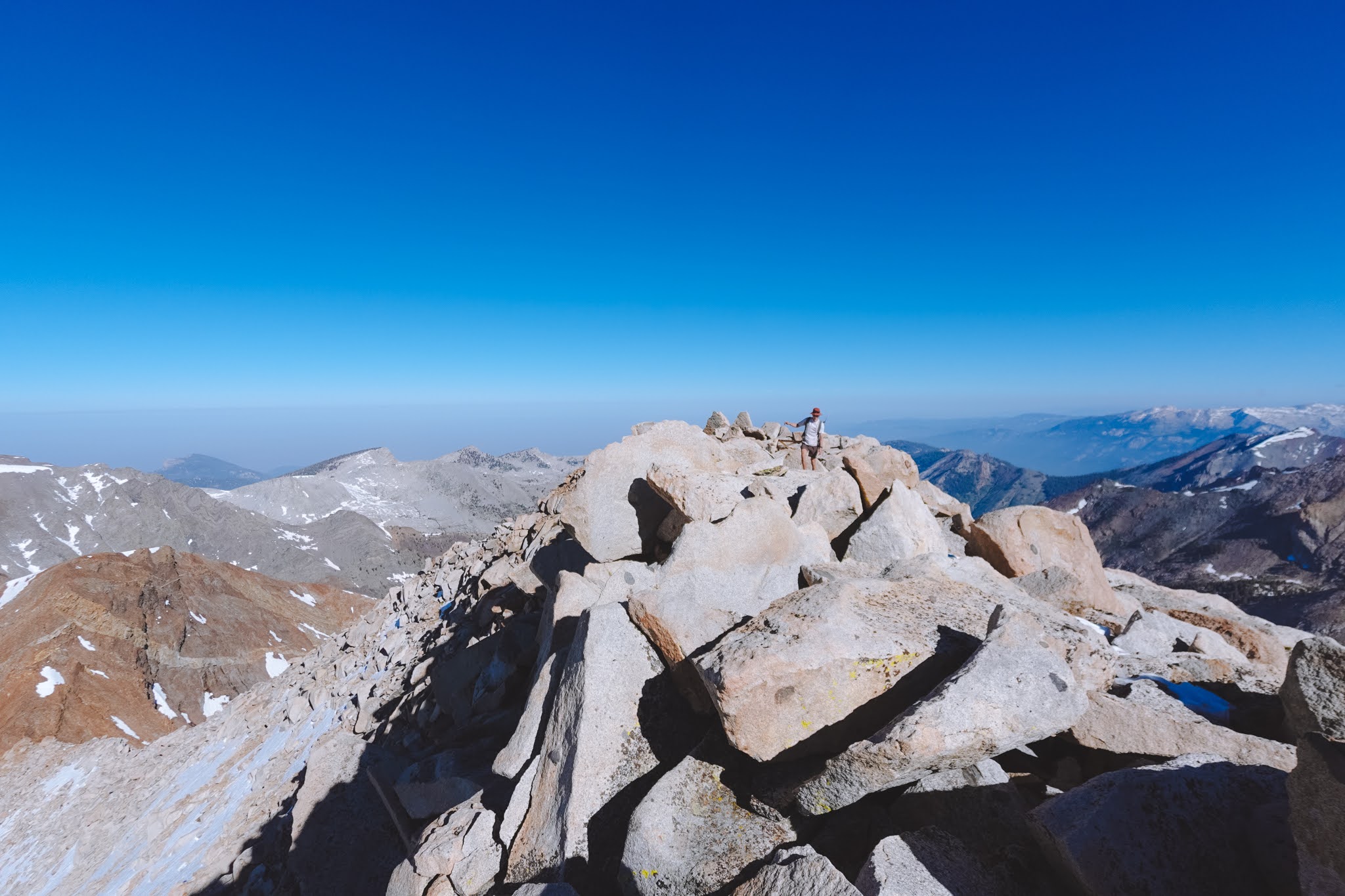
The ridge was mostly snow free, and extremely fun class three scrambling led to the summit. Looking at the summit register, we realized that we were the first to climb the peak in over two years. After taking in the views of Whitney, Langley, the Kaweahs, and even the faint outline of Ritter and Banner, we began our descent.
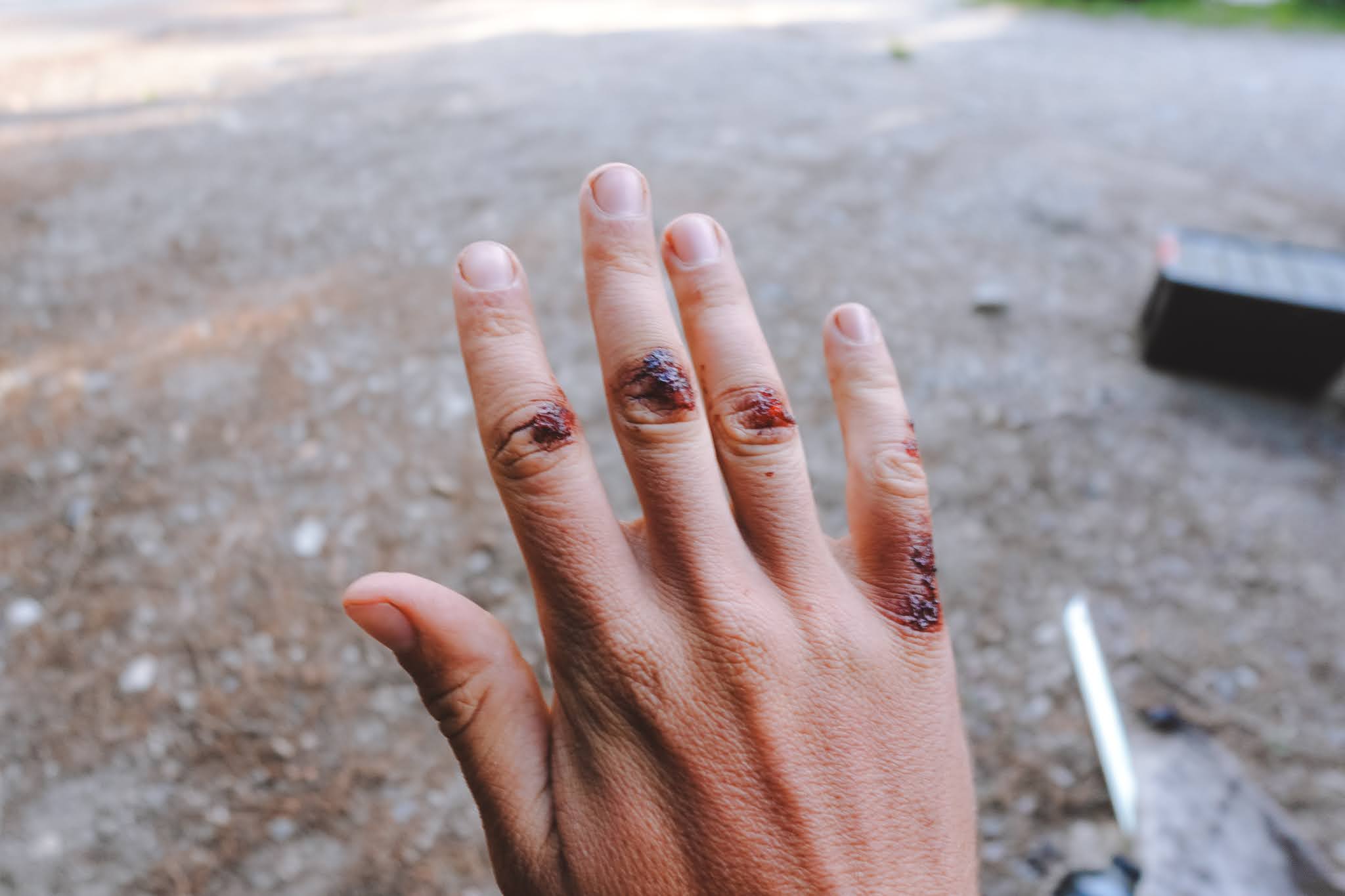
Once back at the treacherous snowfields, Anthony decided he would try glissading down. I said that was way too sketchy for me, and slowly picked my way down a route involving some rock and some snow. I head a loud “SHIT!” come from above and turned around to see Anthony sliding rapidly out of control down the steep bank. He picked up speed insanely quickly and things were not looking good. Fortunately, Anthony did everything right during the fall: he swung around so he was on his butt, rotated to his hip and drove his ice axe as deeply as possible into the ground to self-arrest. He camp to a stop just before an outcropping of rock. Some deep cuts on the hand he drove the ice axe head into the snow with were his only injuries.
“Nice job on that arrest. That was textbook!” I told him, trying to cheer him up and play down the gravity of what just happened. He was still a bit shaken up, but the mood settled once we were on solid rock again.
After some silence, Anthony muttered “I think I got a little cocky with the glissading this season. That was a good reminder.”
I agreed.
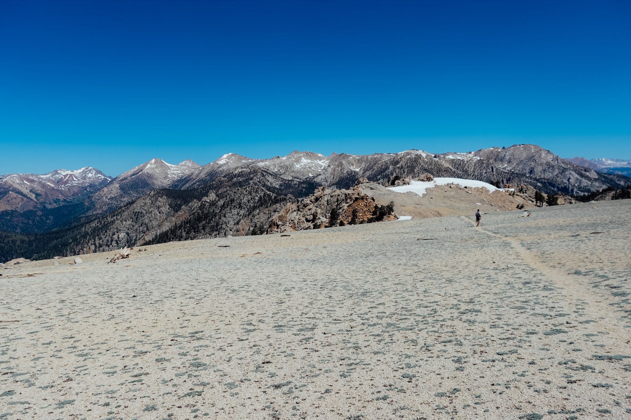
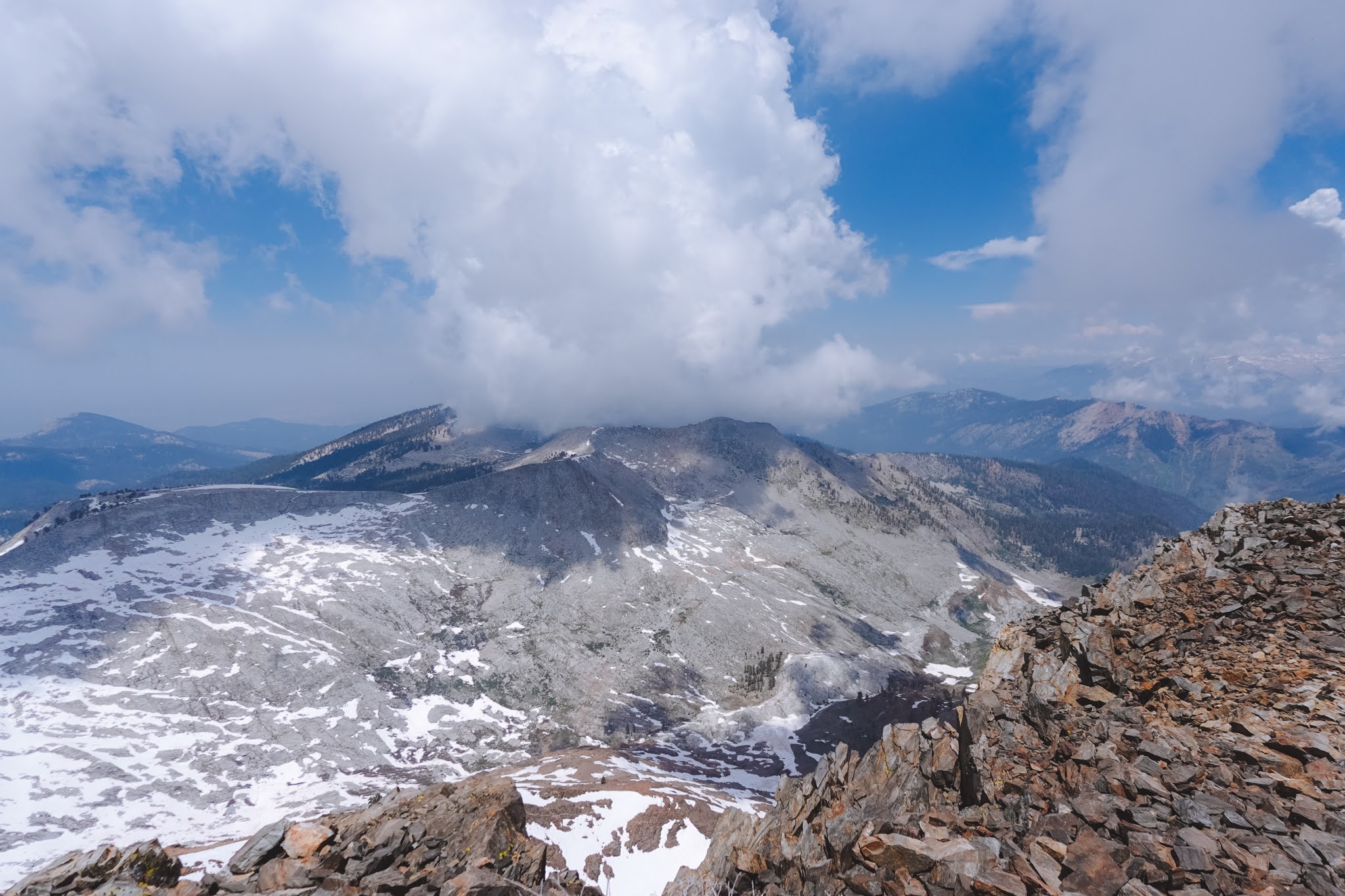
Once back at the tent, we packed all our things and hoofed our way up to Farewell Gap. From there we had a 1,200 foot climb to Vandever Mountain, which we miraculously crushed in less than thirty minutes. Try as I would to keep up with Anthony, I simply couldn’t hold his pace and made it to the summit a couple minutes after him. He was a veritable mountain goat at this point, a month of so into his Sierra season. Clouds rapidly moved in on us on the summit. We had just a couple minutes to scope out the peaks to our east that we’d attempt to climb the following day before we were totally blinded by white and gray.
The descent went smoothly, though thunder started booming before long. Once at the car, we made some food and sat under the porch of an old cabin to eat. Rain pattered down all afternoon, and we were happy to be fed, watered, and sheltered. We rested up for the remainder of the day since our objective in the morning was Sawtooth Peak and Needham Mountain. The storm abated by night, and we stealth camped in the bushes.