San Diego Trans County Trail
February 2026
Day 1
This obscure thru-hike had been on both my and Anthony’s radars for years now. Finally, for whatever reason, we decided to pull the trigger and strike out on the roughly 155 mile San Diego Trans Country Trail, traversing from the Salton Sea to the Pacific Ocean. Lexi kindly drove me to our friend Max’s house, who also kindly offered to drive us all the way to the eastern terminus. Before leaving Max’s house, Max and Anthony cooked up this disgusting concoction of what I think were carbohydrates and electrolytes they called Gu. It is what all our food would look like if you left it up to the efficiency-loving Bay Area technologists. They slurped it down and Anthony even daringly bagged some for the trip. We had a lively discussion for the entire drive, we cached a bit of water on a couple of the road crossings, and before we knew it, we were at the start of the trail.
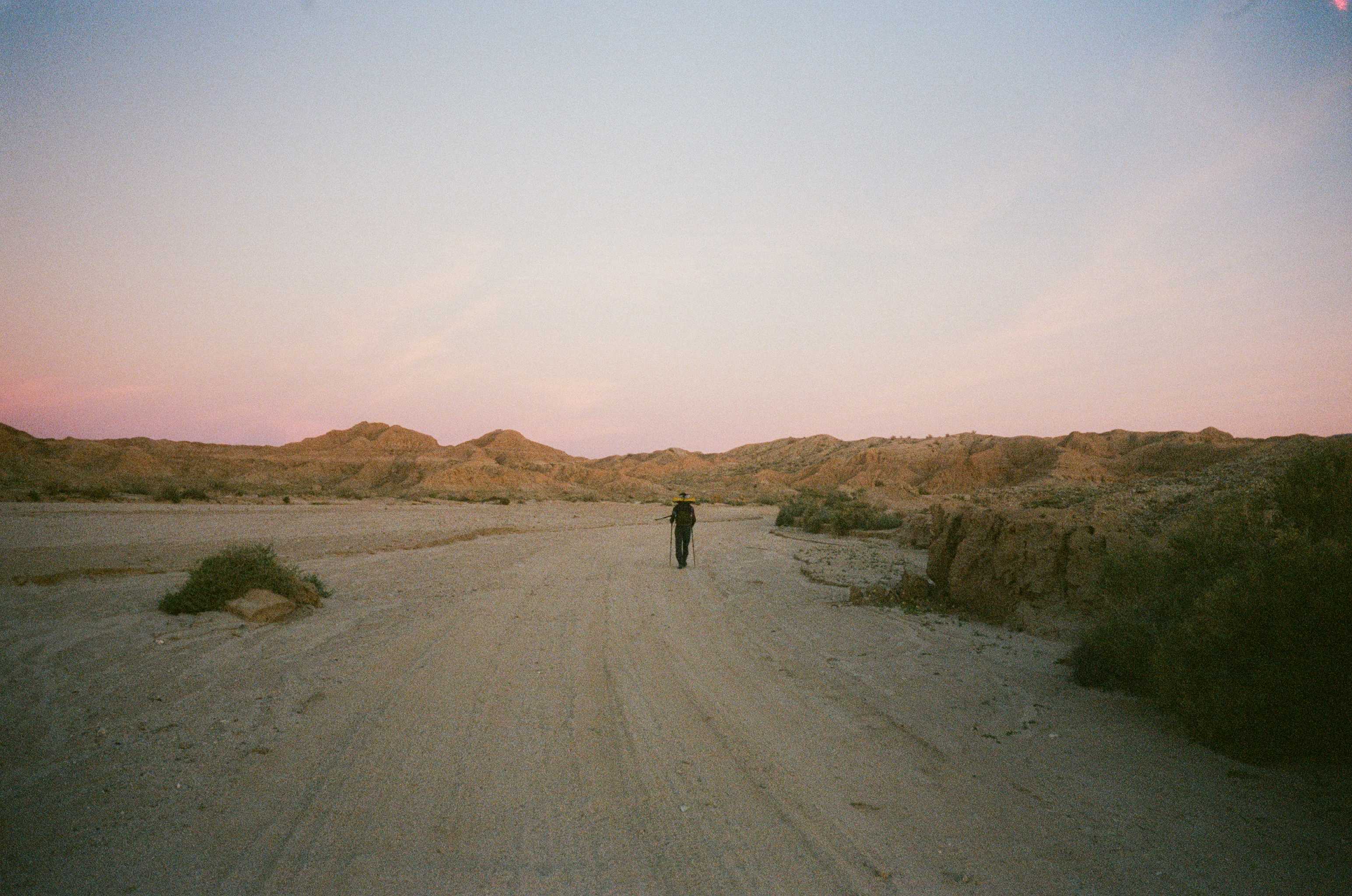
The trail starts at the end of an inconspicuous neighborhood road in the town of Salton City. There is something melancholy about the town, or at least I felt melancholy while driving past run down houses and trailers in this brutal desert landscape. But we met a lovely older lady who lived right by the start of the trail as soon as we got out of the car to sort gear who lifted my spirits. Max hiked half a mile or so with us before turning back for civilization. Then it was just Anthony and I traipsing along a desert wash, the temperatures bearable, but the penetrating desert sun still making us work for every step. We crossed a road and then entered another wash that got progressively deeper and more canyon-like. At some point our little canyon become the whole universe—hour after hour where the only direction was ahead and our gaze was limited to the terrain between these two steep walls, and the section of blue sky we could see above.
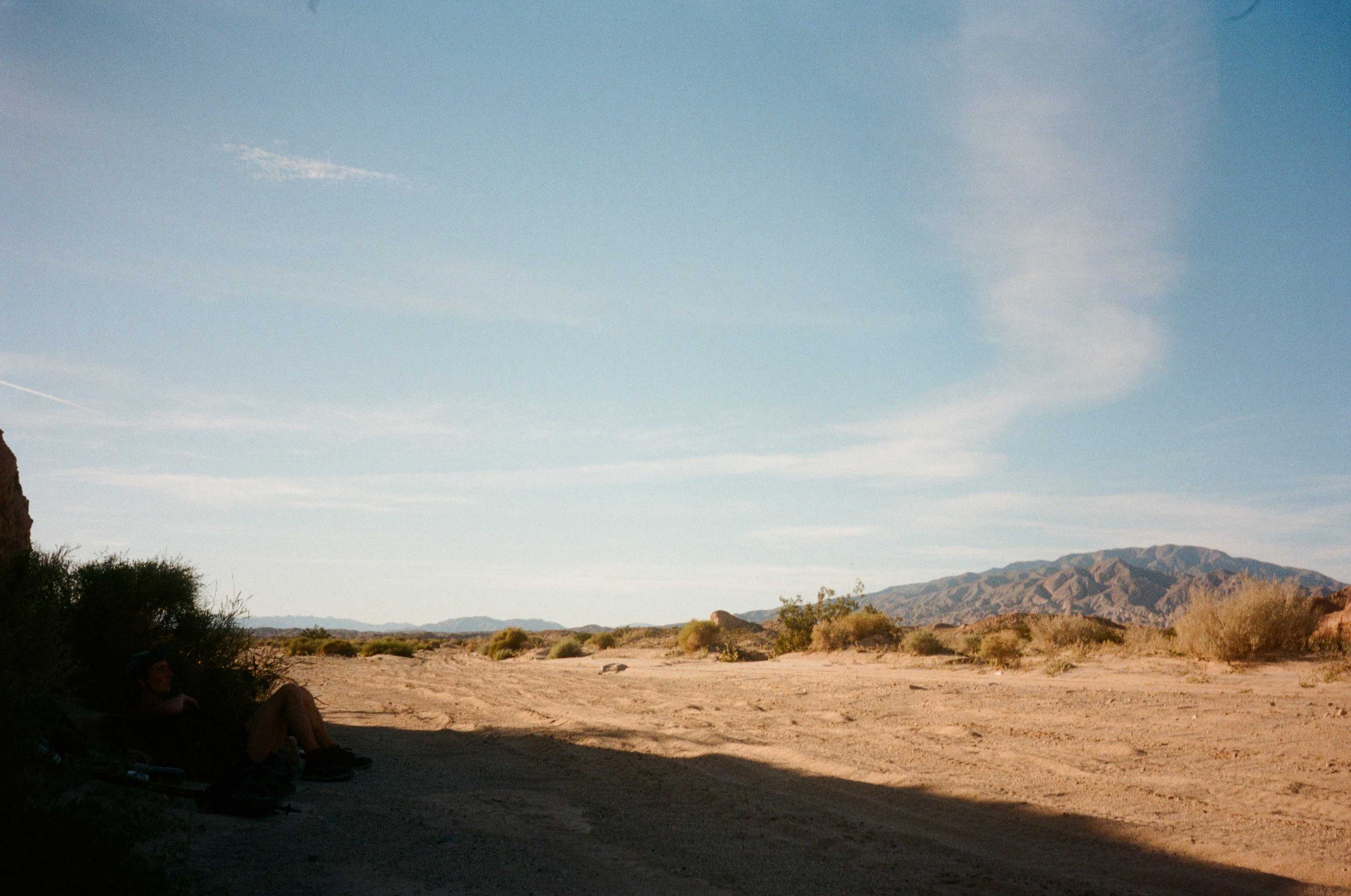
Eventually we clamored out of the canyon and saw that we were in the middle of a vast and desolate expanse—it was almost unfathomable to think that we were a two hour drive from the sprawling metropolis of San Diego. Towering deserts peaks loomed in the distance, but dozens of miles of desert floor separated us from them. The temperature was still not hot, but the sun was relentless, the lack of shade didn’t help either. Once in a while we’d see a sturdy bush, a well-oriented cliff, or, if we were lucky, a small tree to seek shelter under to cool off. Anthony slurped down Gu at ever break—a snack that became more unwieldy every time it was retrieved from his bag. As evening came it cooled off. We passed a few car campers—the wise San Deigns who knew where to find some peace—and we also found our first cache. About a mile past our cache we slept under the desert sky. The night stayed a balmy 55 degrees for its duration.
Day 2
We were up around first light and struck out for Borrego Springs, the first town the trail passes through. The town reminds me of Radiator Springs from the movie Cars. By midday after more pleasant flat hiking and a few miles of road walking, we were there. We went to the no longer aptly named Dollar general and bought some overpriced junk, then stopped at a lovely park in the middle of town. Rested, ate, filled water, planned. We got burritos and cracked on. I had been flirting with the idea of climbing Indian Head Mountain on our trip—and 8 mile 3500 ft detour up a class three rib, but reality set in as my pack, filled with 4 liters of water and a fresh resupply, dug into my shoulders and that inevitable mid-day desert sun beat down on my whole being. Looking up at its cliffy summit, far, far off-route, I told Anthony I’d skip it.
We walked a road out of town for an hour or so, made it to a trailhead, and took what might have been the nicest rest of my life under the solitary shade of the trailhead sign. What followed was a terrible end to our rest—leaving the only patch of shade for miles to climb 2500 feet into the range above us. The climb went off without a hitch despite Anthony having some knee and nausea issues. Never one to complain, he didn’t mention anything, but I could tell he was pushing on through some serious discomfort. We finished the climb and searched for some time at last light for a decent campsite. Eventually we found one and set up camp.
Day 3
We descended for a long while down an absolutely stunning valley. We reached a road where our second cache was hidden, and cracked on for our next resupply—an RV park general store a several miles ahead. Within a few hours the store was in sight, and we debated staying on trail or crossing a large field to get to the store. We debated the likelihood of getting shot or jumped by some disgruntled ranch owner, but ultimately decided it was worth the risk. We had no issues crossing the field, but the store was out of power and closed when we arrived. Mike, the manager of the store was there to fill us in. He said it was a planned outage and the building would be back up and running around 2pm. Anthony and I debated our options and ultimately decided to wait for a couple hours for the store to open. We ate, napped, lounged, read, daydreamed, napped some more, and lo and behold at 2pm sharp the store grumbled back to life—fans churning, lights humming, motors spinning. We got a decent resupply of candy and frozen burritos and struck on. We crossed the PCT not too much longer which always manages to be a profound experience, no matter how many times I’ve set foot on that trail since thru-hiking it in 2019.
Day 4
The next morning we hit Lake Cuyamaca. The recreation area around the lake was a bit of a ghost town. All the picnic areas looked abandoned and the water spigots we planned on using were turned off and capped. The lake itself was underwhelming but the surrounding area was magnificent—high desert and a little bit of an alpine zone complete with pines and a few dashes of snow. At this point we jumped on our alternate route, following the California Riding and Hiking Trail for some time before linking back with the canonical route. This was to skip some sketchy private property sections. Our alternate would miss El Cajon so Anthony thought it would be fitting to climb Cuyamaca Peak, the second highest in the county. It was an easy climb and from its summit we got our first view of the Pacific Ocean, our objective, sitting way out on the horizon. We could see our starting point, the western edge of the Salton Sea some ways behind us too. It was a stupendous peak.
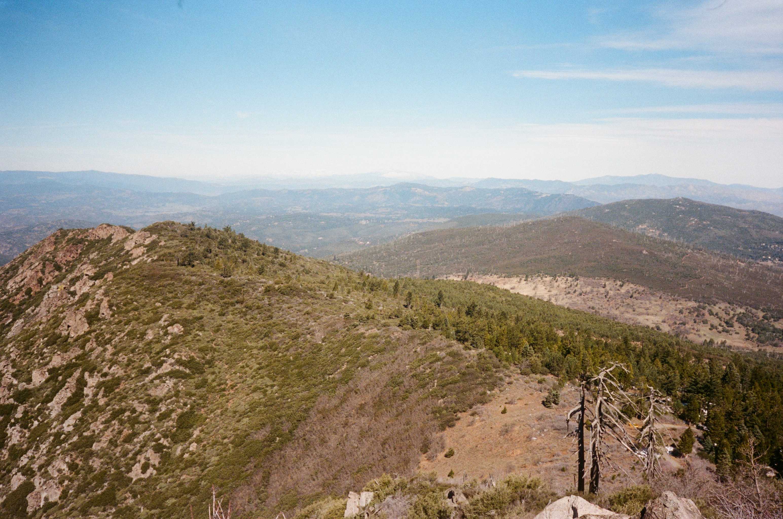
We started descending from the summit, walking for a few minutes, to our surprise, on snow! We would be descending for the next dozen or so miles, an incredibly long and easy descent. The miles flew by as we made our way to Descanso, a charming little town where we’d get a little resupply. Once in town we hit the gas station for some food and water. Apparently, Anthony tried filling up in the sink, after purchasing some food, and was chewed out by the very serious Armenian proprietor. I decided to not push our luck with this fellow, so we started hiking on and eventually I found a hose I could use to fill up.
Eventually, we made it our of town, away from the neighborhoods the route meandered through, and onto a lovely dirt road that descended for miles. We had the dense, scrubby, beautiful national forest to our right and views of San Diego unfurling to our left. Unfortunately, we pushed it a little to far towards civilization, and by the time we were looking for camp, there were an uncomfortable amount of houses lining the dirt road. We scurried off into the bushes and stealthily, and I mean stealthily, set up camp. I could hear one guy dropping the recycling into his bin in his yard, and I could hear the soft clank of tags on a dog collar in another yard. Suffice it to say, we were not in an ideal place for the night.
Day 5
After a paranoid night of semi-sleep, we woke up around 4:40am and happily got up and got the hell out of there. We stopped at Albertsons in Alpine for a resupply and trudged on through the uninspiring town. The urban walking was really getting to me at this point. Loud cars, the hot sun reflecting off the black asphalt, trash everywhere, either rows of suburban sprawl or large industrial facilities, no pedestrians other than the down-and-out. All that on top of the fatigue that was setting in was dragging my spirits down.
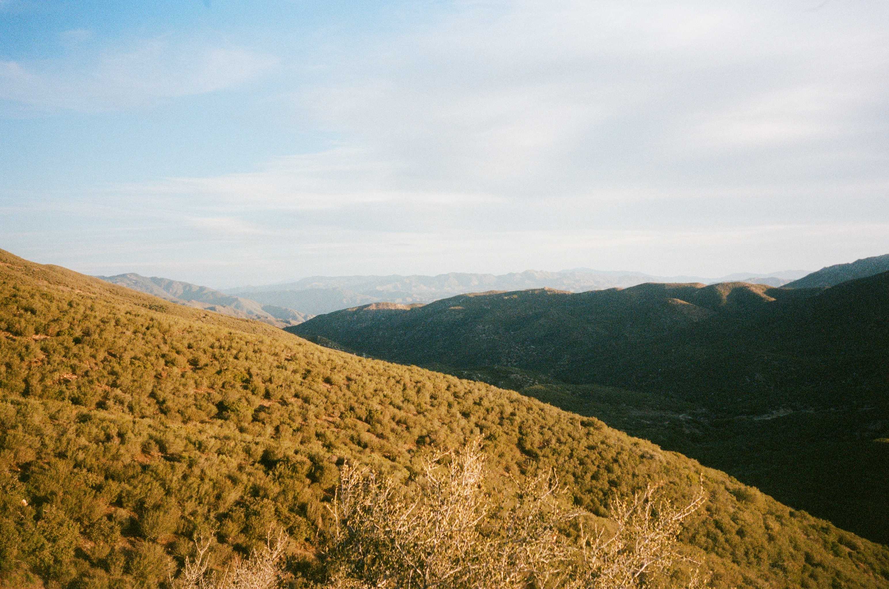
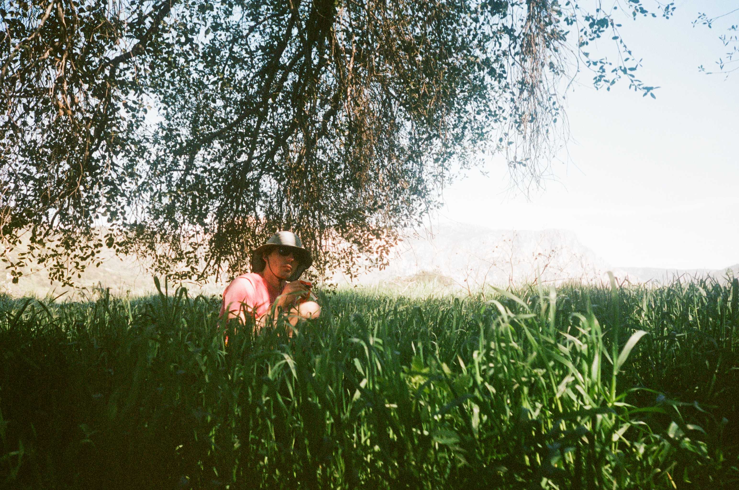
But things took a turn for the better when we finally set foot on dirt again. We followed a little trail called the Flume Trail out of civilization and into the valley below El Cajon Mountain. Once down in the valley we linked up with a dirt road and eventually took a break in the tall grass under and oak tree. It was absolutely idyllic, a veritable desert Yosemite! And there are few joys that compare to lounging in the shade of a big tree on a hot day. Paradise! We cracked on after dragging out our break as long as we possibly could. Having covered more miles than we thought that morning and having relatively easy fire road ahead of us, we cracked on with higher spirits.
Our spirits were mildly dashed as we got back into “civilization.” I realized I should have been putting this word in quotations sooner, but I just realized how barbarous “civilization” felt on that trip compared to the subtle beauty of the natural world. Anyways, we got to a Rocket Gas and bought some snacks and drinks. I asked the cashier if I could fill up some water somewhere, opting for a more direct strategy than we tried at the last gas station, and it worked. She was an older lady who was a bit strung-out and probably had had a gnarly life, but after mumbling to herself for some time and being generally flummoxed by my question, she said I could use the soda fountain’s water to fill up. She was a real nice lady and we chatted for a bit after I filled up. Anthony and I rested and napped out front of the gas station for a while in the shade. At some point Anthony prodded me awake and said that we should crack on, and so we did.
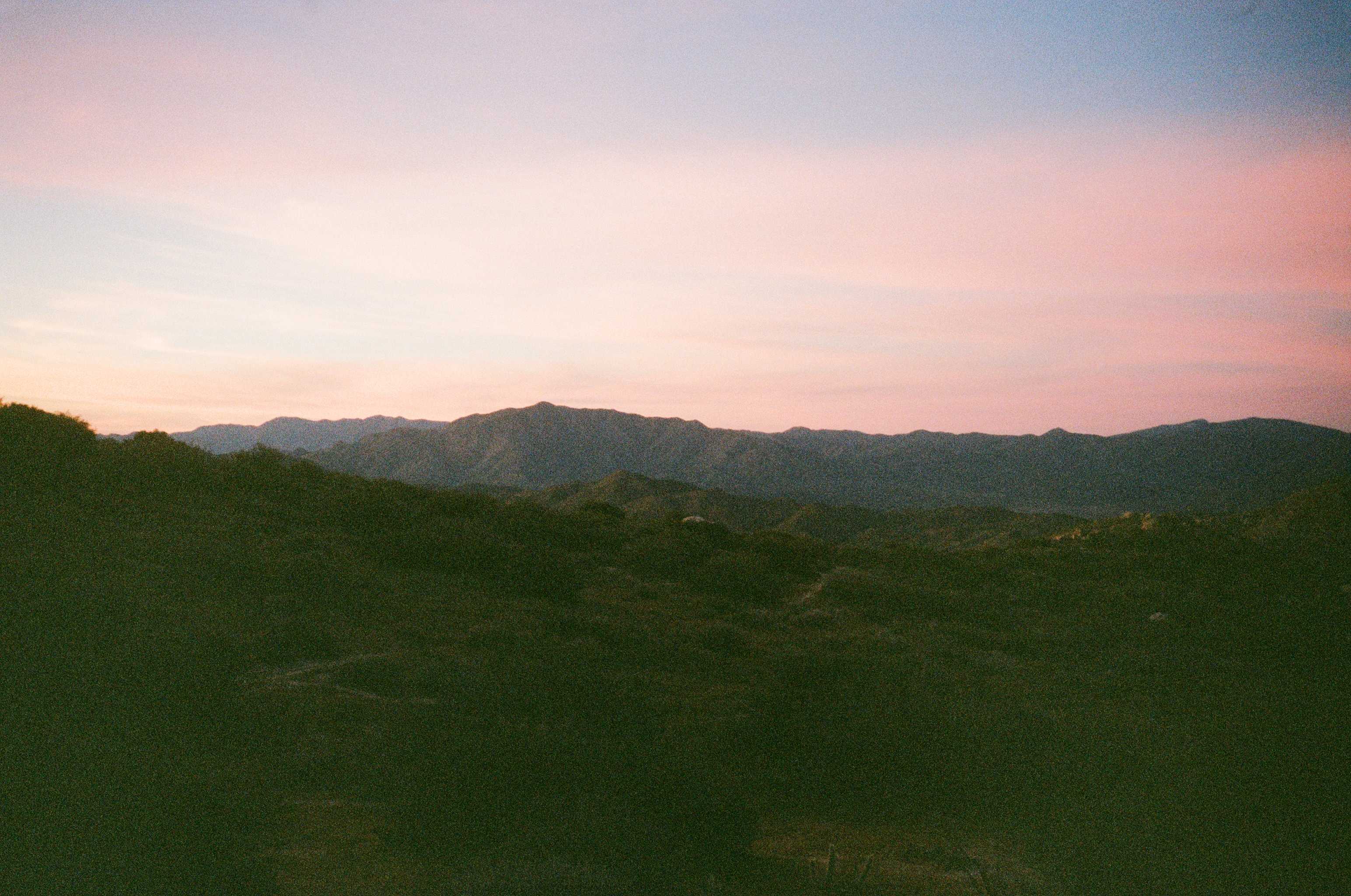
We walked through an extremely industrial district, up some private residential road, and finally up into some nature preserve, I think it was Goodan Ranch. Somewhere along the steep climb to the ridge of this preserve I lost my phone. So I dropped my bag and trotted back a mile or so, finding it, and retracing my steps back up the ridge once again. We were treated to a stupendous sunset. This preserve was a real highlight of the trip.
We dropped out of the preserve, crossed under a road via a very interesting tunnel, and traipsed along some more singletrack as the last light of the evening faded. We had a bit of trouble finding a good campsite, but eventually climbed off-route and found a lovely spot on a minor peak a few minutes from the trail. We slept soundly.
Day 6
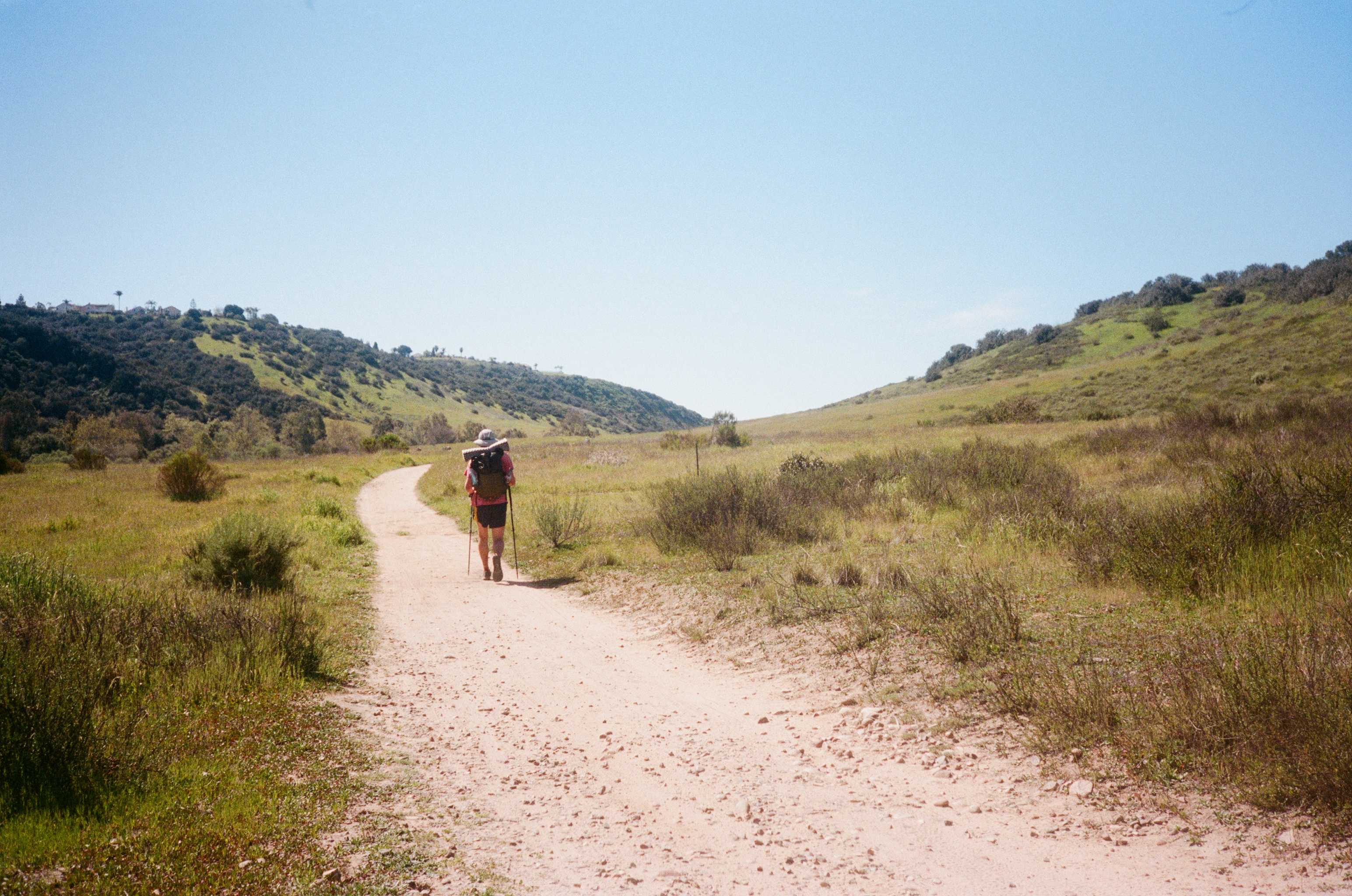
We rose again sometime around 4:30 am, wanting to make some progress before it got too hot, and made quick work of passing through Poway. If you look at the route on a map, it looks like the last thirty miles are incredibly urban. However, we were both shocked at how beautiful this section of the route was. For almost the entire day, we followed creeks, crossed rivers, traipsed down verdant valleys, dense oak forests, and were even treated to a waterfall. Sometimes you couldn’t even see a single house despite being in the middle of one of the biggest cities in the state. Whoever laid out the SDTCT certainly optimized the last thirty miles.
But all good things come to an end, and a few miles before finishing the route, the SDTCT hiker must navigate a true urban hellscape. We emerged from the trail following Los Peñasquitos Creek and were deposited behind an abandoned office park. We were greeted by empty parking lots, boarded up windows, shattered glass, and a sidewalk that probably hadn’t seen feet on it since the last lonely SDTCT hiker set foot on it. Above us was a serpentine network of millions of tons of concrete and rebar—interstate highway after interstate highway zig-zagging each other hundreds of feet in the air. Thousands of car schizophrenically rushing every second, all urgently trying to get to the next thing. Large amounts of trash blew by where tumbleweeds must have once skittered past. Literal war planes and attack helicopters flew overhead from the nearest military base, swarming the sky and producing such noise that you couldn’t hear yourself think as they passed. This is the part of San Diego that everyone knows as San Diego, and it is the absolute worst part of the county. Little do all these city slickers know that wild forests, spartan deserts, rivers, canyons, valleys, wilderness all stretch out infinitely to their east. Maybe it is better they don’t all know, or know and don’t care.
Anyways, this hellscape was mercifully short and the last couple miles were actually on some nice trails winding through coastal wetlands. We crossed the Pacific Coast Highway and set foot on the beach, the Pacific Ocean now just a few hundred feet away. We dropped our bags, removed our shoes, and triumphantly ran towards the water. Splash! And the San Diego Trans County Trail was over. Six days gone in a flash. Back to reality.