Sierra High Route: Part 2
July 2022
I hiked most of the Sierra High Route (SHR) with Anthony and Dan in 2017, and always intended to return to the route at some point. The summer of 2022 seemed to be a logical time to do it, as I had nothing but time and no summer plans other than exploring the Sierra. I had a 90 mile section of the PCT to finish as well that I had skipped due to perilous river crossings tin 2019. And so I attempted to secure a permit for this route, whose shape vaguely approximated an infinity sign.
A 10,000 word polemic on the permitting process in the Sierra is in order at some point, but I will spare the reader for now. Suffice it to say, after a frustrating hour or so, I was able to get a semi-accurate permit starting out just east of Mammoth. The permitting website does not allow one to fill in his campsites for each night, but rather offers an extremely confusing and incomplete dropdown menu with several campsites that one must pick from. There is no map showing where any of these campsites are, and it seems none of them are off-trail, where I would be spending most of my time on the SHR. So I picked sites at random, and made my permit a month long so I could use it for other missions in the Sierra after this trip. recreation.gov be damned!
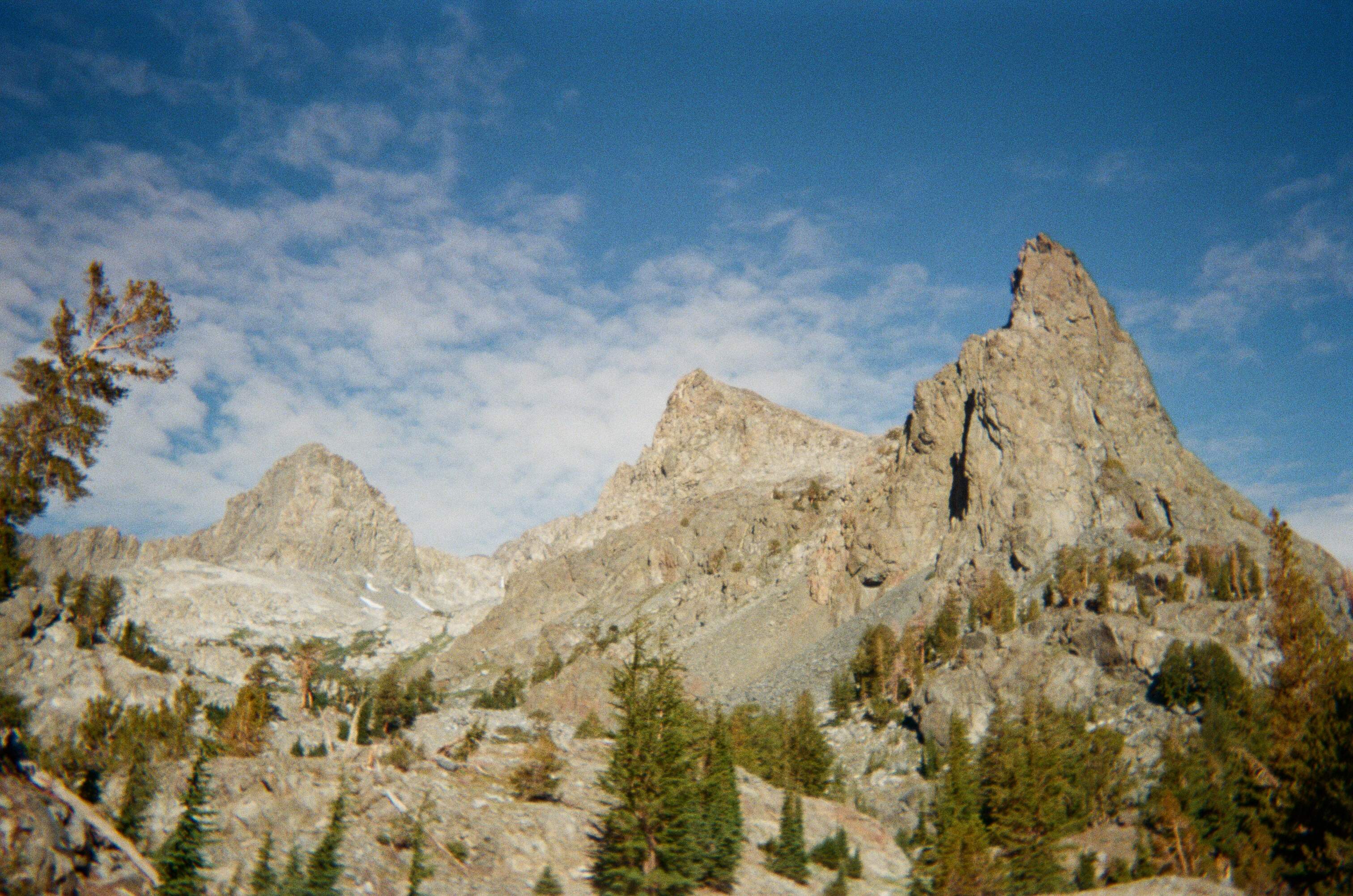
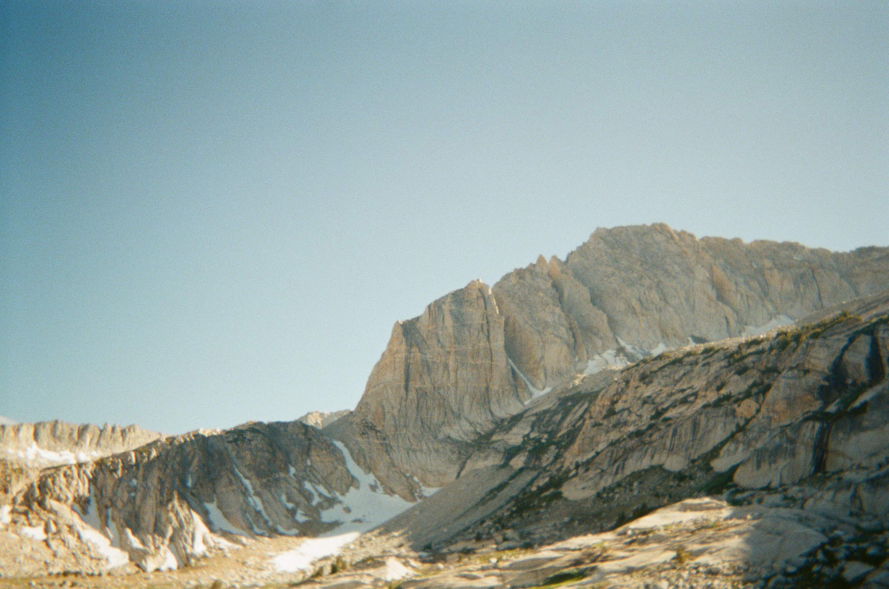
I set off from Mammoth mid-morning, and slogged up the large climb to Mammoth pass. Eventually, after passing Red’s Meadow, I turned off-trail. How spectacular that felt! To be off all of the dirt highways, to enjoy solitude in the Sierra that is increasingly hard to find! I careened over Nancy and Deadhorse Pass, and eventually scurried past the Minarets. I had never seen these peaks up close, and it was a stupendous scene. Desolate lakes surround their imposing summits. These are perhaps the finest mountains in the entire range, and certainly some of the most inaccessible. I will certainly be back.
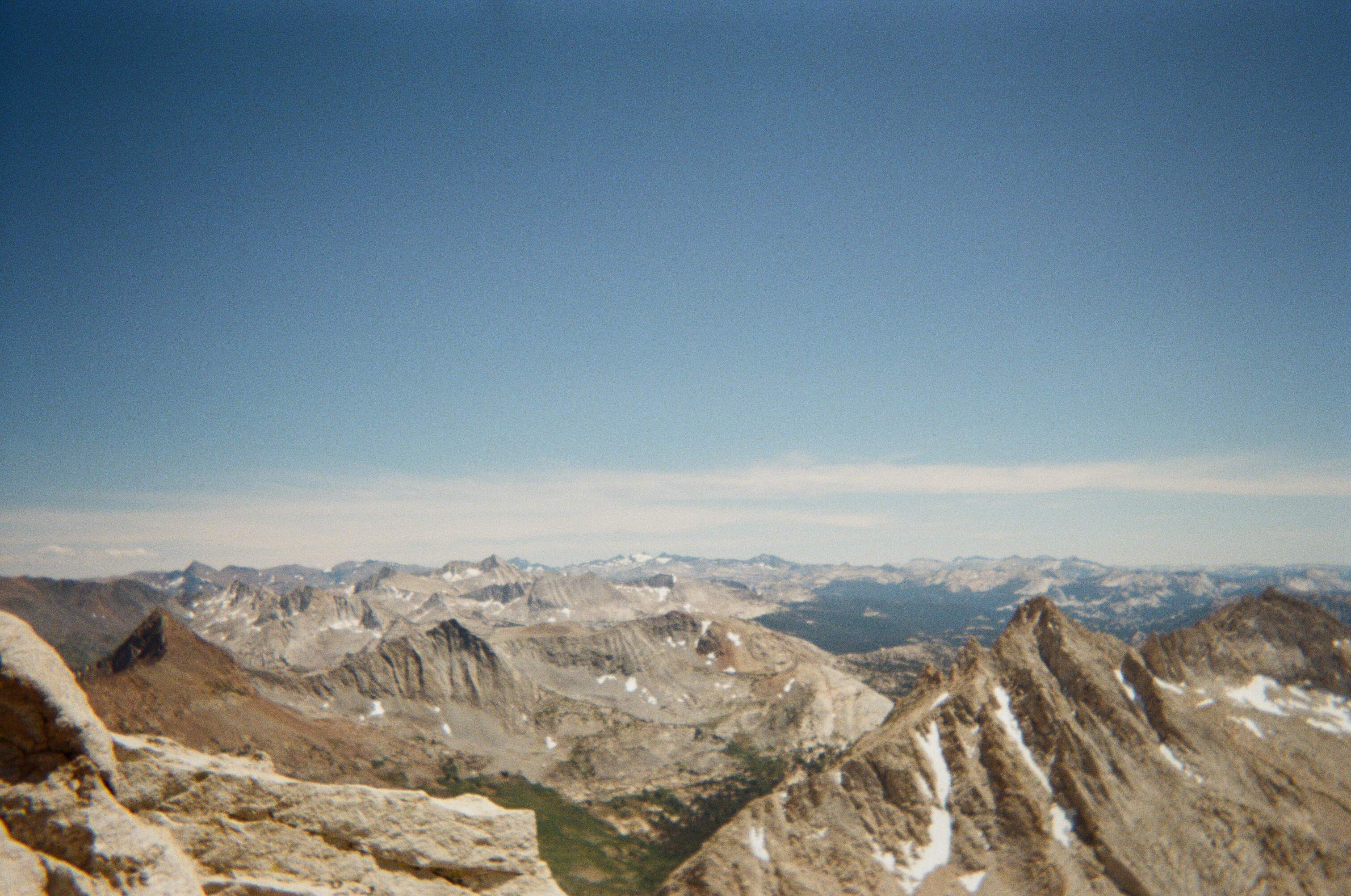
Eventually, I made my way to Thousand Island Lake, maybe one of the prettiest—and certainly one of the busiest—lakes in this part of the Sierra. Fortunately, I was not on the trail for long, as I cut sharply west to ascend North Glacier Pass. I looked for Water Ouzels as I climbed alongside a stream that seemed to be a perfect place for them to lounge, but saw none. Perhaps they were seeking shelter from the ominous clouds that loomed above. I felt a couple drops of water as I climbed, and was a bit nervous as to what the weather would do. I crested over the pass, where I had been previously to climb Ritter and Banner, and now continued on into uncharted territory.
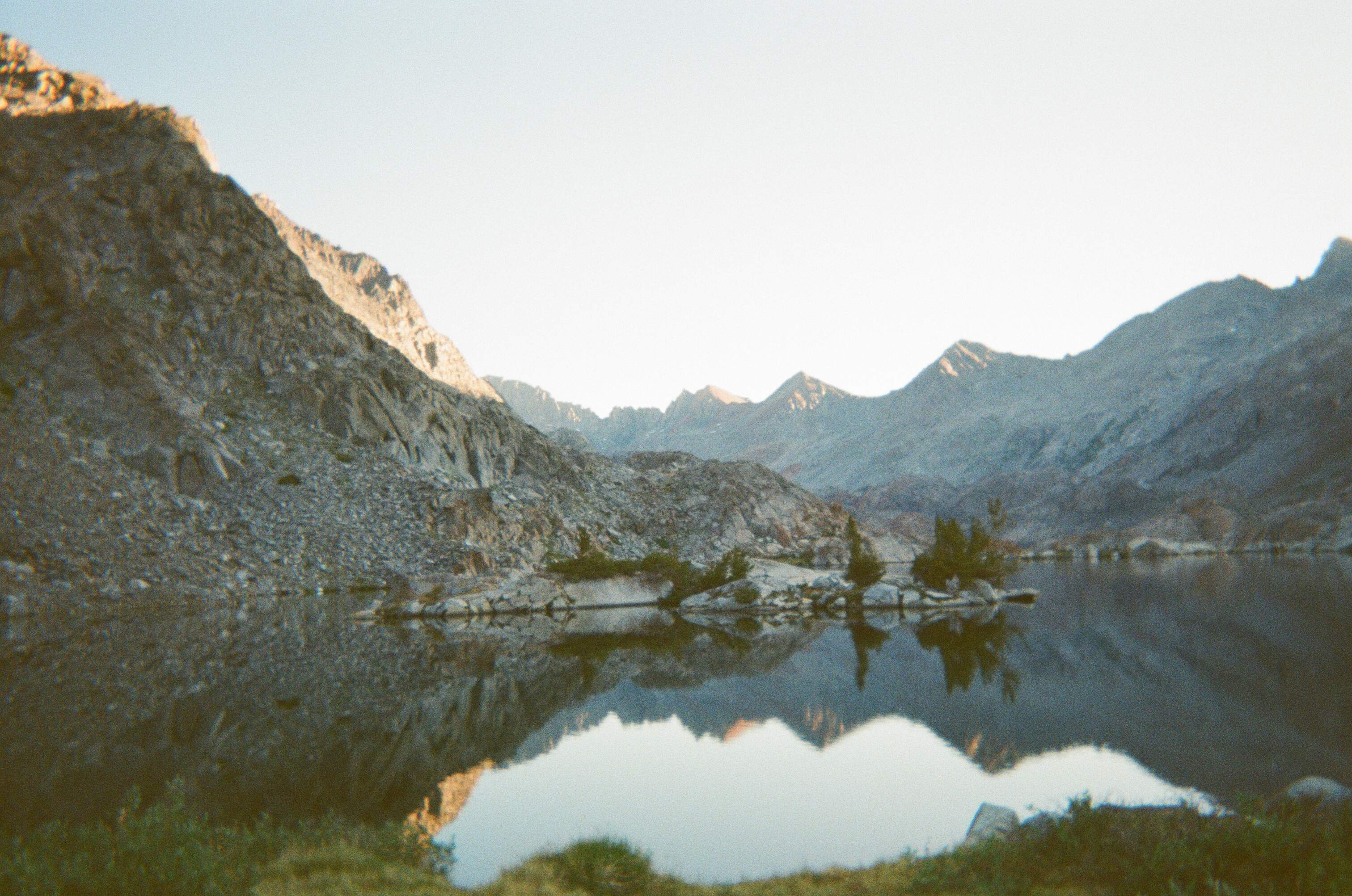
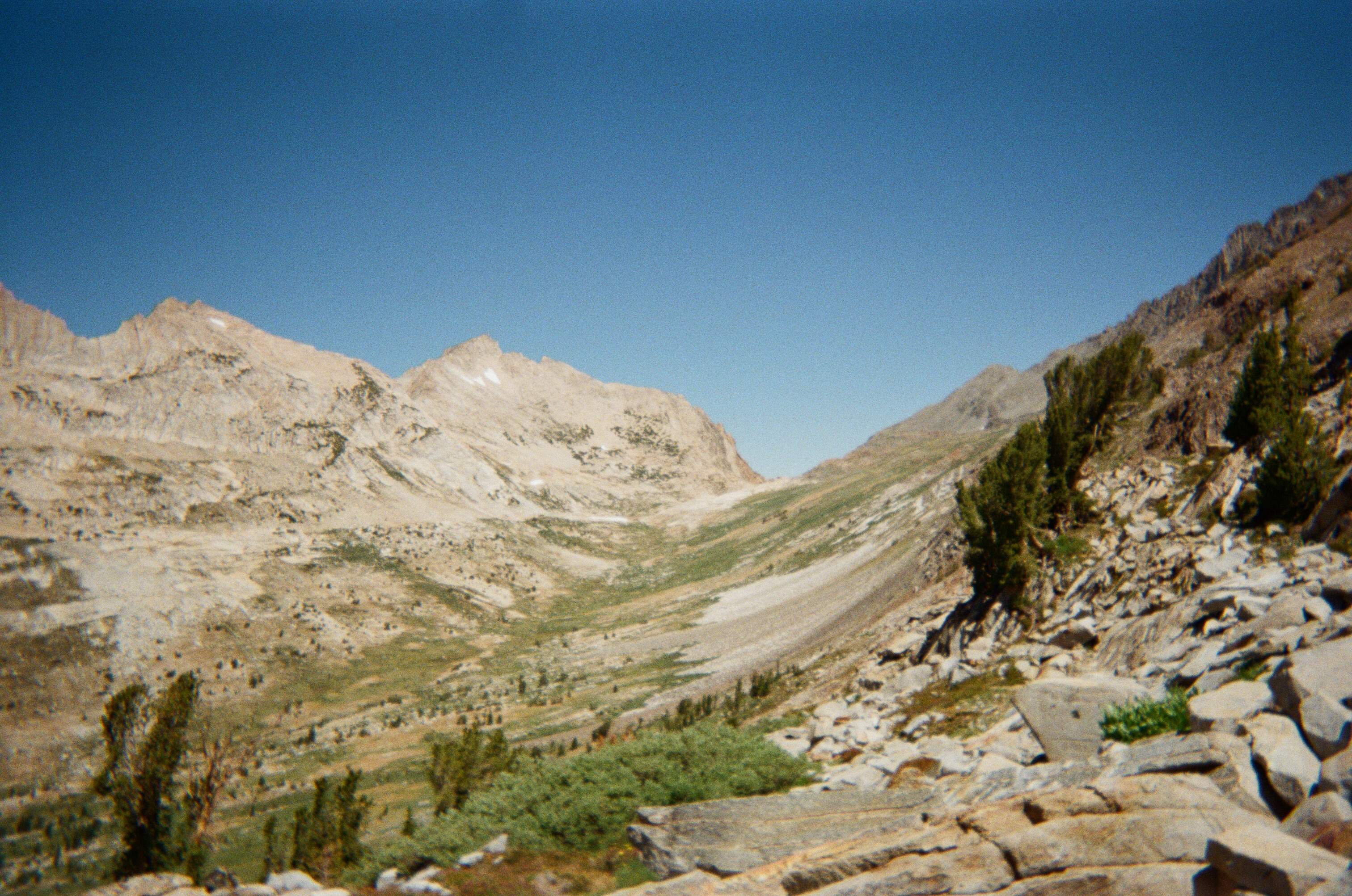
I descended labyrinthine class 3 terrain, but eventually made my way towards Twin Island Lakes. The sun was setting, and I was treated to my most serene evening yet in the Sierra. These two lakes are named after the tiny “islands" that each one houses. The islands are nothing more but some granite, some dirt, and small trees, but their beauty is somehow boundless. Twin Island Lakes are also the source of the mighty North Fork of the San Joaquin River, nothing more than a calf-high stream at this point. It may have been the buzz of my first night back on the High Route, but there was a certain magic in the air as I lay my sleeping bag out.
The next morning, I tramped west, descending into Bench Canyon. This is one of the most untrammeled sections of the route. Despite this, the popularity of the route, combined with the near ubiquity of GPS devices and abundant online route info, has become palpable. Even here, the odd use-path, footprint, duck, or unfortunate piece of trash makes itself apparent—a sign that others have tread before me. The remoteness is still nearly complete, but perhaps in fifteen years, this will not be the case.
I ascended Blue Lake Pass and decided to climb the ridge to Foerster Peak, not half a mile’s climb from the pass. I learned from the summit register, that the peak is an SPS Peak, one more checked off the list! Also, Nathan and Travis were attempting the SPS Peaks FKT, and so I was stoked to see their names in the register. I cracked on across beautiful meadows, eventually joining a trail that ascended Vogelsang Pass. With almost boundless energy despite the day fading to night, I decided to tramp up to Vogelsang Peak. It was a brushy and unpleasant climb, but I was rewarded with great views from the top. When I returned to the pass, I met a ranger who was diligently guarding my pack, defending it from pesky marmots. He suggested that next time I leave my bear can down at the pass and climb with my pack to avoid assaults from vermin. I thanked him for the tip, he checked my permit, and I walked on. I camped just below Vogelsang Lake, with views down into the distant Yosemite Valley. A finer night could not be had.
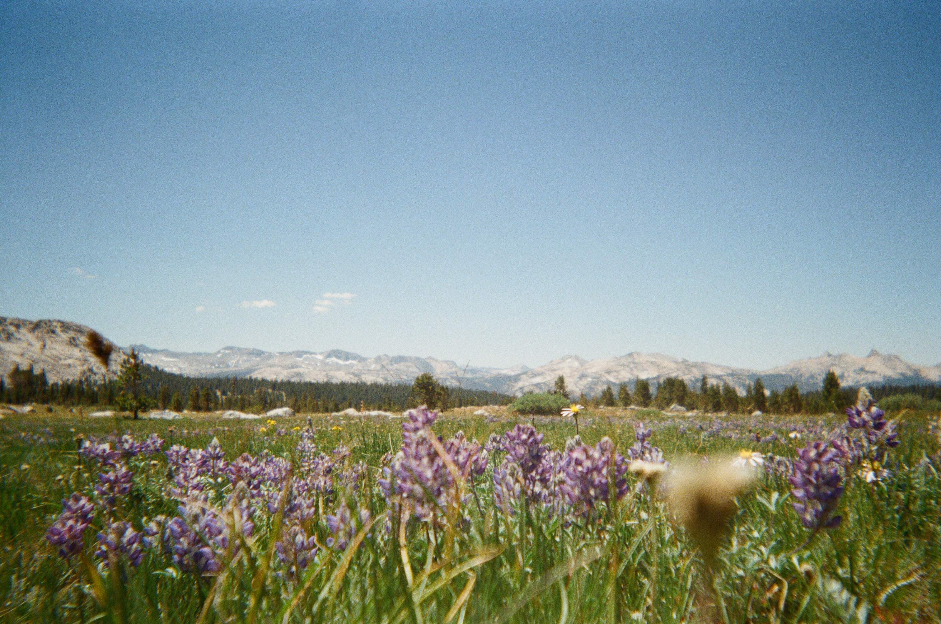
The next morning, I descended along Rafferty Creek into Tuolumne Meadows. A second ranger checked my permit. She was confused at my campsites, but my silver tongue got me out of the bureaucratic bind. The intense crowds and gawking PCT hikers of Tuolumne Meadows were a stark contrast to the relative solitude of my last few days. I made the unfortunate discover that the hiker box was now diligently guarded by the postman as a “COVID protocol” and so I begged for any and all food he was willing to part with. There seemed to be a hierarchy involved here, as he was only able to relinquish a few tortillas and one tuna packet to me, saving the good stuff for a teary-eyed PCT hiker who was been accosting him for food during my entire break there. I reluctantly purchased some overpriced peanut butter and bread at the small shop next to the post office, chatted with the very attractive cashier until she got tired of my company, and hiked northward. I was happy to part with the crowds.
Yet another diligent ranger, this one bearing a firearm, checked my permit, and asked me several questions about my route. Another group walked by at this time, who he also stopped. A young man with long golden hair looked at me with an excited spark of recognition. He said, “Matt? It’s Max from Death Valley!” I finally recognized him and was elated.
I met Max in Death Valley in January. I spent an entire month in the park, and we crossed paths on one of my rest days at an obscure campsite near Towne Pass. He was relatively new to outdoor recreation, and I suggested he try a backpacking trip. I helped him plan an overnight trip, and as it turns out, he did it, and survived to tell the tale. He was hooked after that trip, which was what ultimately led him and his girlfriend to hike the entirety of the JMT. It is a surprisingly small world. I was sad to leave Max but happy to leave the ranger as I continued on.
I wandered up through spectacular meadows, passed some old mining ruins, and eventually contoured around to the East side of Mount Conness, a fine Sierra peak. Some fun scrambling was involved on its flank, and this led me to the base of North Peak, where I found a suitable campsite next to Cascade Lake.
The next morning I climbed up and over the unique Sky Pilot Col. It was quite pretty, but involved very loose and unpleasant talus scrambling. All things come to pass, and I soon found myself in the verdant Virginia Canyon, with Sky Pilot Col well behind me. Being back below the treeline was very odd after spending most of my time in the sparse terrain of the high country. I wasted no time in getting lost, as I lacked the ability to look for landmarks in the distance. But I just kept checking my compass and making sure I was headed north, and made it up towards Soldier Lake. This lake was stupendous and offered a peaceful setting for lunch. Stanton Pass was next to conquer, and once there, I could not help but ascend Stanton Peak, which turned out to be another on the SPS list. I saluted Nathan and Travis’ names in the register and cracked on.
On the north side of this pass lay a serene valley that houses Spiller Creek. It was probably my favorite place of the whole trip. The colors were splendid, and wildflowers abounded. Matterhorn Peak lay imposingly at the end of the valley, which I intended to climb. I meandered up the valley, reaching Horse Creek Pass in the early afternoon. I rallied up Matterhorn, leaving both my bag and the ranger’s advice from Vogelsang behind me. I meditated on Jack Kerouac’s trip to Matterhorn that I read about in Dharma Bums as I slogged towards the summit. I tried to imagine all the life-force his brilliant mind must have felt in the fresh Sierra air, all the poetic musings that rushed to his head with each step. How tiring it must be to be an artist. I made it to the summit after an interminable ascent of loose scree and talus, where I met a fellow peakbagger.
He ended up catching up with me on the descent towards Twin Lakes, the High Route’s northern terminus, and we jogged to the finish together. He was a nice guy who I hope to see again somewhere deep in the Sierra. The first leg of my journey was complete. There still remained some daylight, so I hitchhiked down to Bridgeport for a resupply. The air was smoky and the sky bright orange. After asking around, I learned that a fire had broken out in southwestern Yosemite. It seemed far enough off my route to continue on and so I walked to the edge of town and started thumbing.
After some time, the sun began to set, and I still had no luck getting a ride. Eventually, a rowdy group of guys in a pickup truck and an old Crown Vic pulled over. I threw my bag in the bed, and squeezed in the back of the truck. The group mostly worked at Hostel California in Bishop and were heading up to Desolation Wilderness for the weekend. These guys were true degenerates in the best way possible. We swapped stories for the whole ride while they passed a pipe around the car. Whether the author took any hits of said pipe or not shall remain a mystery to the reader.
Eventually, I came upon my stop, the 108 up to Sonora Pass. It was quite dark by this point as I bid my friends adieu. I decided to just start walking until finding a suitable ditch on the side of the road to sleep in. I stuck my thumb out halfheartedly at the few cars that passed, not even turning around to face them, and certainly not thinking anyone would pick up a wandering stranger at this hour. But to my surprise, a car pulled over. A hulking man with long hair, a healthy beard and a kilt sat in the driver seat. He had a heavy Russian accent, and a nice looking woman in the passenger seat with him. I told him I just needed to get to the pass and he happily took me along. We had a cordial conversation that spanned the length of the long, winding ascent. I was dropped off well after dark and so I hiked about a hundred yards into the forest and broke camp.
In the morning, I was greeted by another spectacular day. Blue skies sat above me, but a thick wall of orange-gray smoke lay to the south. Unfortunately, this was the direction of my travel. I hoofed it along the trail which was quite pleasant and easy after days of off-trail navigation. I made the short detour to Leavitt Peak; another SPS peak in the bag. The views from its broad summit were striking, though it was quite windy. The landscape was sparsely populated with trees—large, bare, textured landmasses were thematic of the area.
Being back on trail, I no longer enjoyed the quiet solitude of the true backcountry. I passed several NoBo PCT hikers per hours, maybe fifteen or so. Yes, I was back on the highway. I slept somewhere north of Tuolumne that night, a bit off-trail so that I could enjoy some peace. The next morning I cracked on, hoping to get through Tuolumne that afternoon.
The trail offered faster, easier travel, than the SHR, which allowed my mind to wander any which way. What a striking difference in headspace between the two legs of my journey—this dichotomy made the trip quite fun and memorable. I saw two more bureaucrats on the trail and these two rangers both checked my permits as I voyaged south. They were sufficiently confused by the campsites listed on my permit and my vague answers to their prodding questions certainly did not offer any clarity. Nonetheless, I escaped unscathed from both encounters. The managerial state knows no bounds and has even extended its vice grip on our souls well into the wilderness, a place that was once defined by freedom, by severity, but is overwhelmingly being replaced by a sense of process, of management. One now gets the sense that, even here, he is in owned space.
I passed through Tuolumne, and camped at the base of Mount Lyell and MaClure, hoping to reach both of these cliffy summits the next morning. Unfortunately, it rained that night and through the morning, so I would have to shelve that idea for another time.
I climbed many a JMT pass over the next day or so, and eventually found myself drawing near to Reds Meadow. There, I had the great pleasure of running into Max and his girlfriend once again. I originally planned to get back to the van by nightfall, but Max offered me his shower tokens, and asked that I stay the night at camp with them. I was happy to oblige on all fronts and I had a riotous night with all the lovely JMT hikers I met that night. It warmed my heart to see folks from all over the world, of varying ages, abilities and backgrounds, all coming out to tackle the same big challenge.
The next morning I hitched to town, and puttered around for the day. I met up with a couple girls at the brewery I had met the night before, and we had a nice meal before they headed back to Texas, their journey complete. My journeys were also complete—this trip marking the official end of both my PCT and SHR thru-hikes. I felt a subtle contentment that afternoon. But by morning, it was on to the next romp in the Sierra, for one can only feel content in the city for so long before he is called back to the bush.