Cottonwood Mountains Ramble
January 2022
I spent the month of January in Death Valley. My buddy Anthony had given me several trip recommendations to keep me busy. Armed with some sketchily drawn out GPX tracks, a 1:164,000 scale topographic map, and a compass, I headed into the backcountry for the first of many trips, a route that ambled through the Cottonwood Mountains, including some peaks, canyons, and a traverse of Death Valley to top it off.
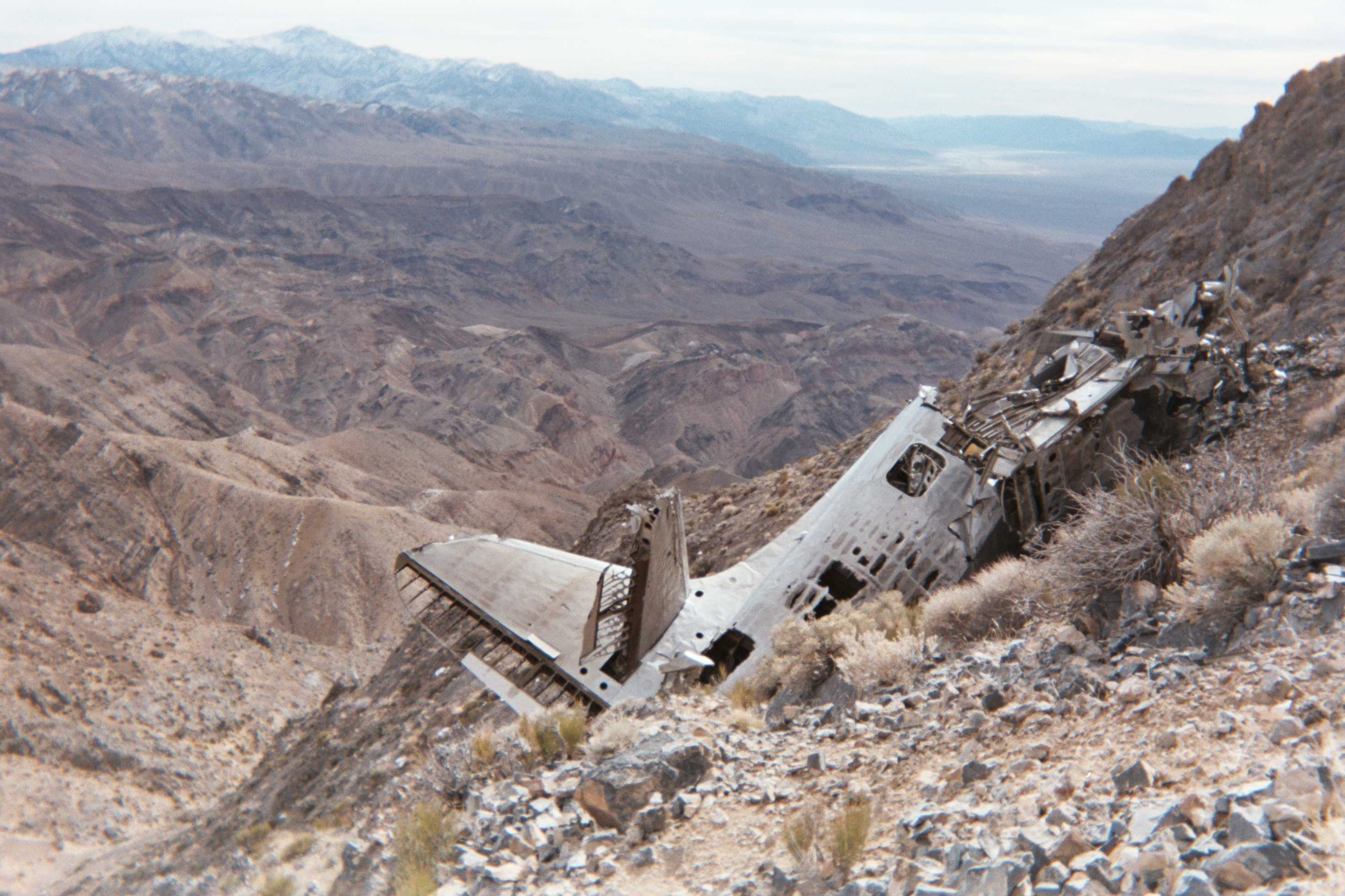
I parked my car along highway 190 and set off for Towne Peak. A couple hours of slogging saw me to the top, and the panoramic views were really quite something. There was a tiny bit of snow on the ground still, but nothing that barred progress. I had heard rumors about a CIA plane wreck on the West side of the mountain that you could spot from the summit—and they rang true, there it was! I scurried down the ridge to inspect the site, which was well worth the detour. The plane was astonishingly well preserved. Later in the month, I met a fellow named Fernando who had some more information on the flight. The plane was coming from Ohio with a classified payload when it crashed. All four on board survived, and the CIA quickly came out to recover the classified contents; all we are left to inspect are the unclassified, but still quite interesting, remains of the craft itself.
I regained the summit after inspecting the crash site, then headed down to the broad valley to my North. Cottonwood Spring was my goal for the day. I originally planned to make it all the way to Dead Horse Canyon, but the challenging off-trail terrain and tricky navigation made for slower progress than I had hoped. How quickly one forgets how hard it is to earn each mile in Death Valley. I made it to the spring around sundown, set up camp, got some water, and went to sleep.
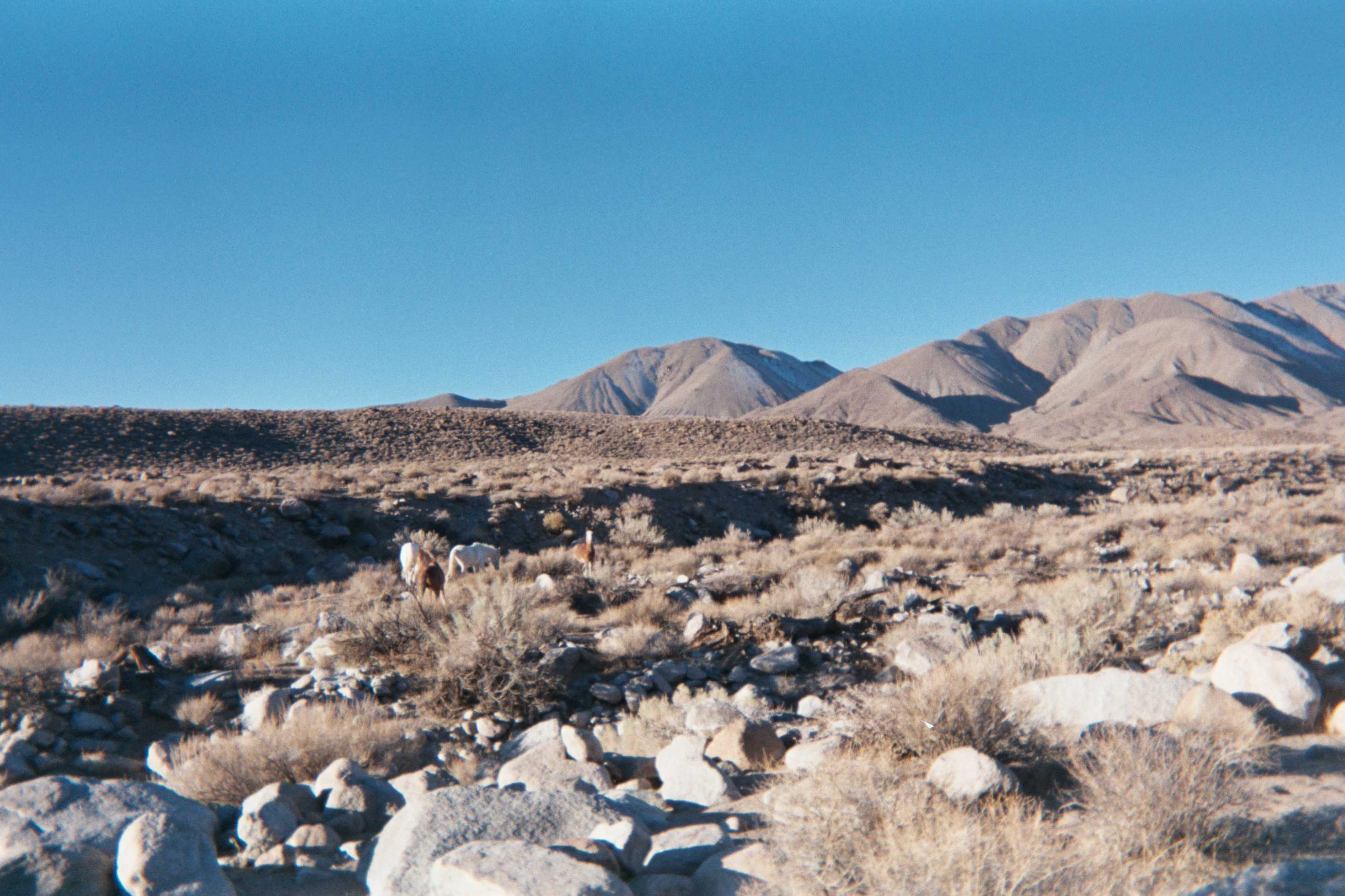
In the middle of the night, a frantic herd of burros came stampeding through the spring. I feared I would be trampled, so I jumped out of my sleeping bag, grabbed my trekking pole and made a ruckus. I avoided being trampled but failed to evict my new neighbors from the area, and so I lay back down and fell asleep to the relaxing sound of donkeys mucking about, whinnying, excreting, and fighting until sunup.
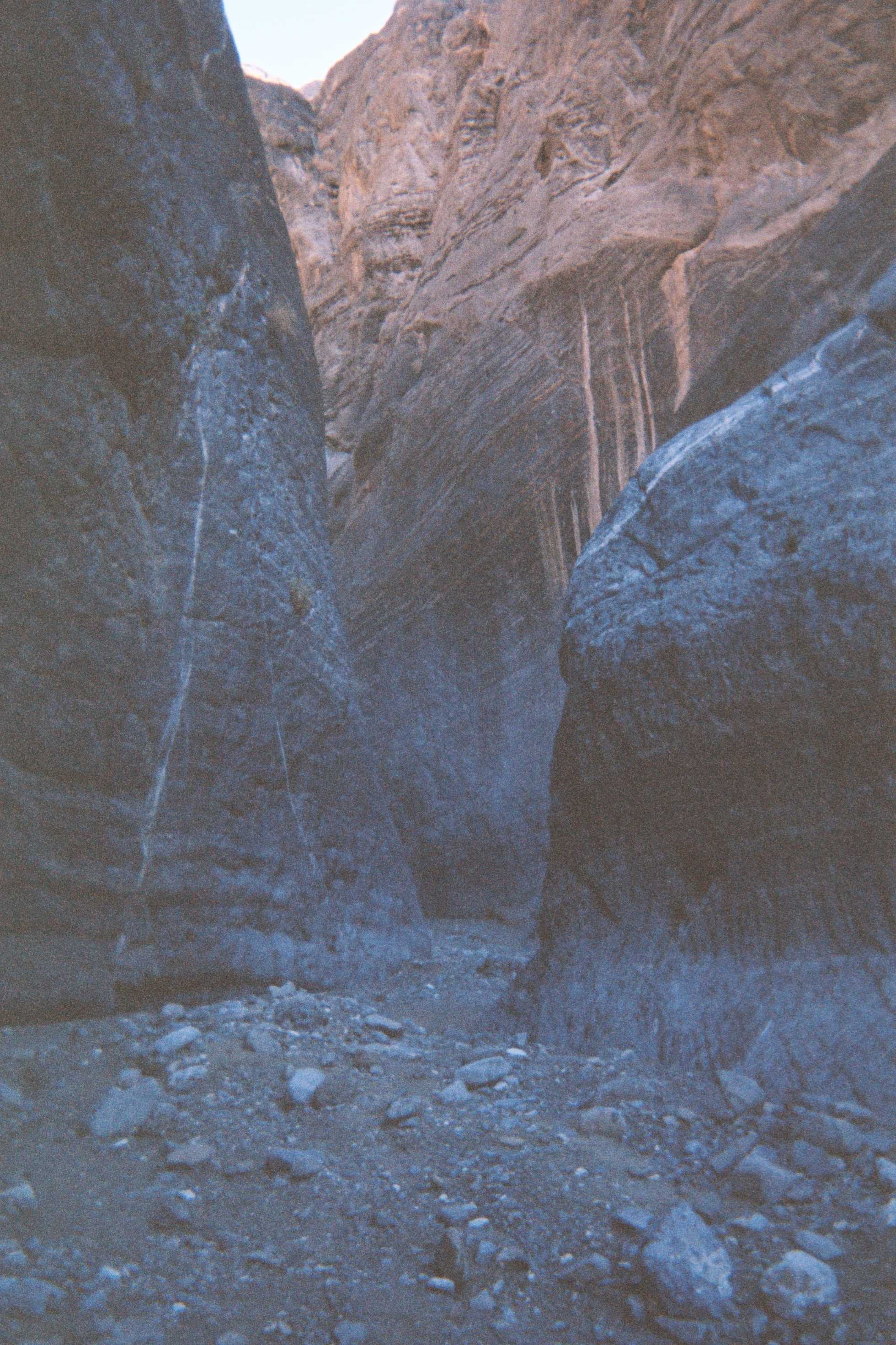
I set off for Dead Horse Canyon first thing in the morning. I tried my hand at navigating without using GPX, but my horribly scaled map lacked the fidelity I needed to pick the correct sub-canyons to get into Dead Horse. After a few hiccups and some backtracking, I found my way back on course. Eventually, I dropped into Marble Canyon, which was quite spectacular. I had never seen anything like it before—towering marble walls shooting hundreds of feet out of the gravel at your feet, sometimes creating a passage no more than five feet wide. It was otherworldly.
After a couple miles, the canyon broadened out, and I hit an old 4x4 track. With a few liters of water left, I pondered whether to continue North for another day to Hidden Bridge Canyon, or to cut South back to Stovepipe Wells that evening. For some reason Louis Zamperini’s famous phrase “be hardy” flashed across my mind and I decided to crack on towards the next canyon. There is an ever so fine line between “hardy” and “foolhardy” and this time I was definitely biased towards foolhardiness.
I made it about ten miles North, and eventually started paralleling the canyon itself. To avoid the huge dryfalls in the canyon proper, I followed Anthony’s advice and remained a few hundred feet above the floor, navigating loose scree and steep side hills. I pushed my luck with the remaining light I had, and navigation became challenging. I ended up finding myself stuck above a huge dryfall that appeared to have no navigable go around option. I was a bit worried about my predicament, but figured it was a problem for tomorrow, so I took out my sleeping bag and attempted to get some rest on some jagged rocks I found that offered some semblance of a level surface.
In the morning, a very precarious line appeared to me that looked potentially navigable. I tried it out—to my satisfaction, it went without a hitch. I eventually found myself at the mouth of the canyon, I hiked up about a quarter mile, and was greeted by an impressive natural arch, about fifty feet high. The canyon walls surrounding it made the area feel almost totally enclosed. Two ravens were perched above me. I couldn’t enjoy the arch for too long, as I was quite thirsty and almost out of water.
I darted East, out of the Cottonwoods, and headed straight across Death Valley. About nine miles of ambling on the valley floor saw me to a road on its East side. I loitered around thumbing it for a bit, and eventually got three separate rides back to my car. I was greeted with a warning notice from the CHP on my car’s antenna, saying that they thought the vehicle was abandoned and it could be subject to a tow if not removed. I was slightly offended at the notice, as I had just replaced a window in the van and thought the car looked really quite nice. How they could think that piece of fine Japanese craftsmanship could ever be abandoned by its loving owner, I do not know. Even in the desolate reaches of one of the largest national parks in the nation, the bureaucrats are never too far off your tail. C'est la vie.