Eastern Yosemite Loop
Peaks: Mt. Lyell, Mt. MaClure, Koip Peak, Mt. Gibbs, Mt. Dana
September 2023
Anthony had just finished a North American odyssey that involved hitchhiking to the east coast, hiking the entire Appalachian Trail, and hitchhiking back west across Canada. So convincing him to set out on a modest, three-day romp in the Sierra proved fairly easy. I picked him up in San Jose and we drove out to the western edge of the Yosemite.
Yosemite’s conniving cabal of rangers has started using thermal imaging techniques to catch bums who sleep in their cars within park boundaries, so we were sure to sleep outside of the park. I could rest easy that night knowing that the money we fork over each year to the Franchise Tax Board and IRS, as well as the exorbitant permit and park entry fees, are going to such noble causes as these. This is all without mentioning that many rangers in the Yosemite wilderness are now equipped with handguns or that much of the park’s income funnels directly to private corporations like Booz Allen.
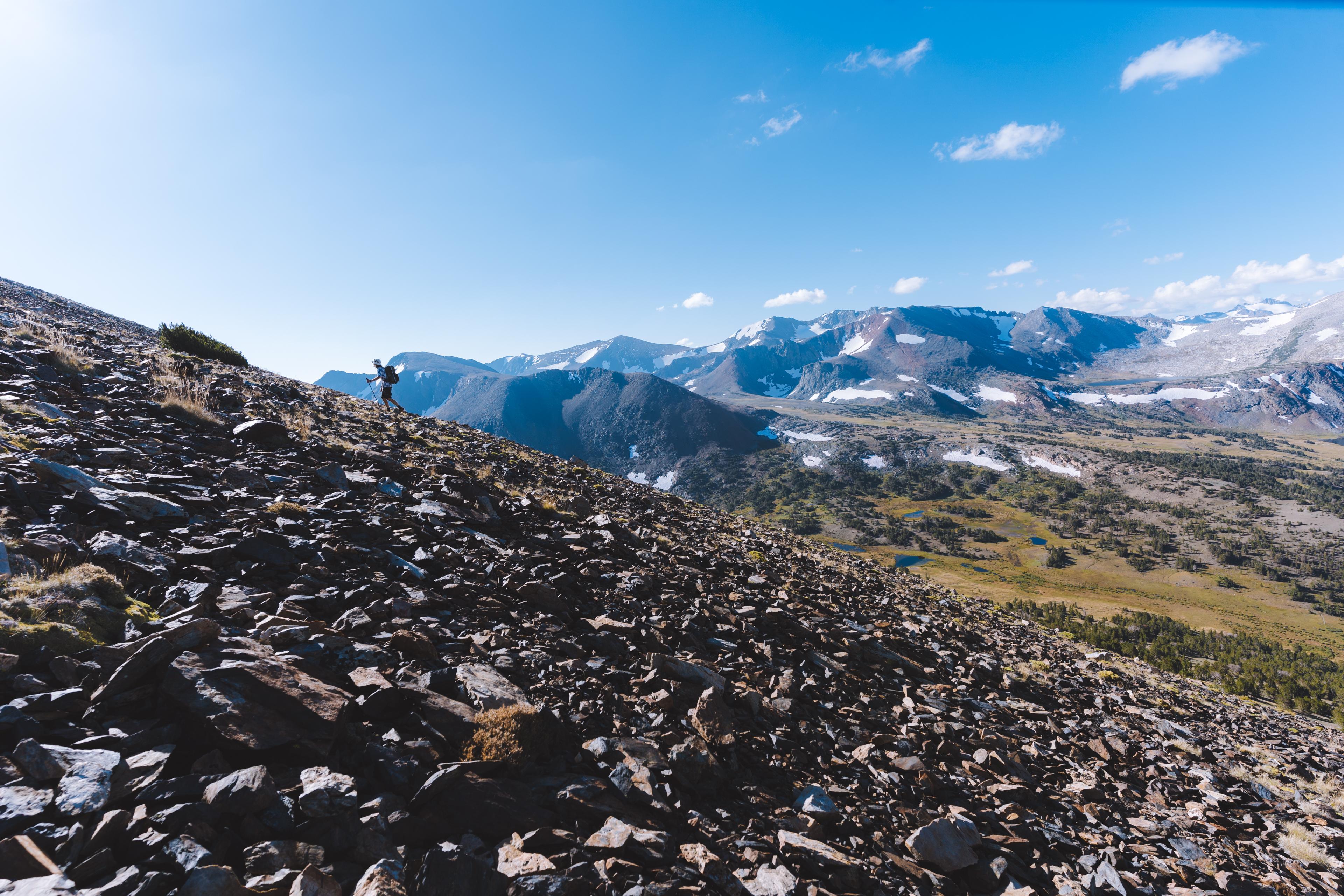
We were up at dawn to complete the rest of our drive to Tuolumne Meadows. There we picked up our permit and set off up Lyell Canyon. Our goal for the day was to climb Mt. Lyell and Mt. MaClure. Afternoon thunderstorms were in the forecast every day and so we were relying on a bit of luck to get up and down both peaks.
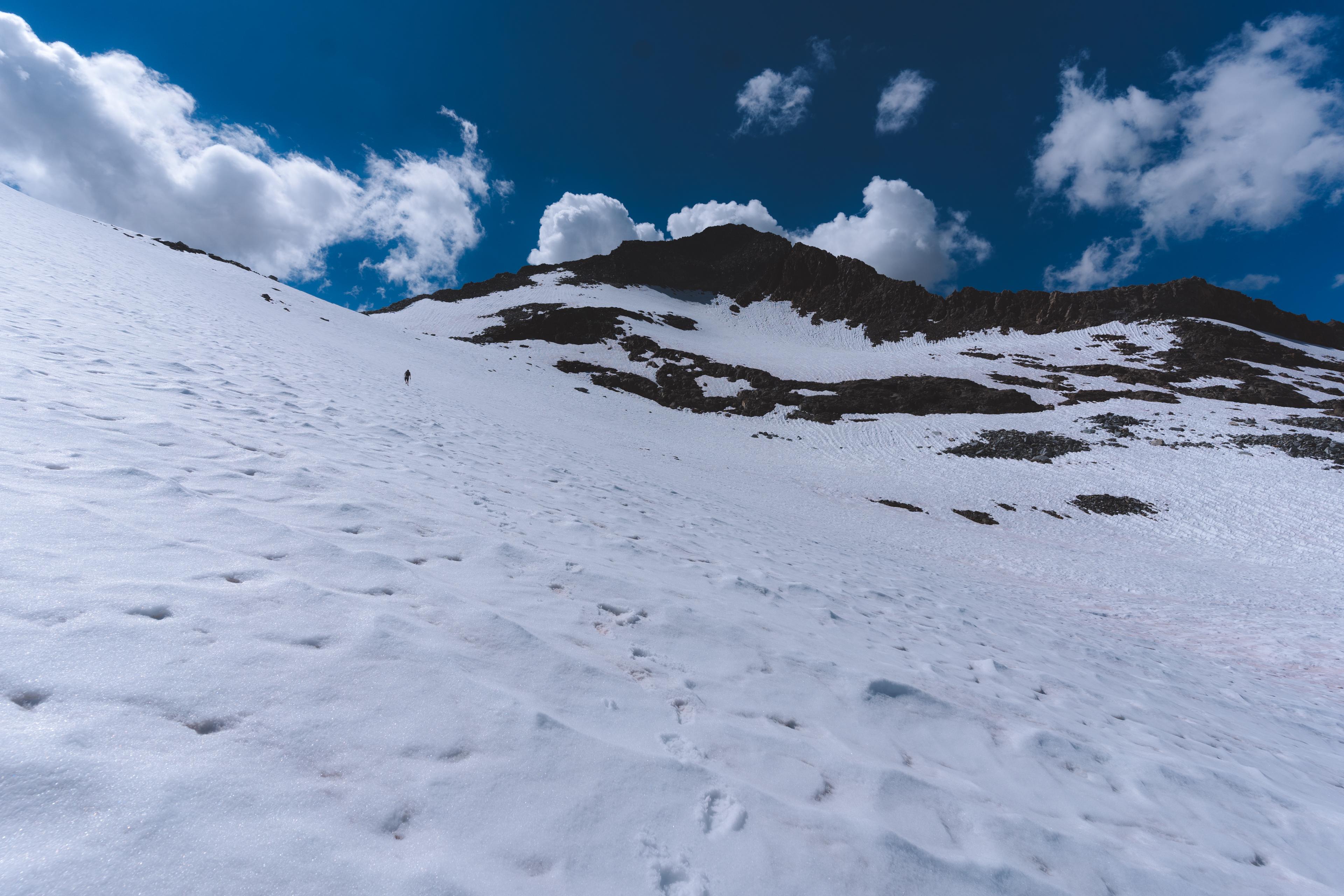
We made it to the approach of the climb by midday and set up my tent. This allowed us to ditch some weight for our climb, and to keep our important gear dry in the event that it started raining while we were out. We ascended nice slabs for an hour or so until the magnificent Lyell glacier came squarely into view. The peaks hovered above us intimidatingly as we slowly poked our way towards the saddle between the two. Eventually, we were on the glacier and forced to make use of our micro-spikes and ice axes.
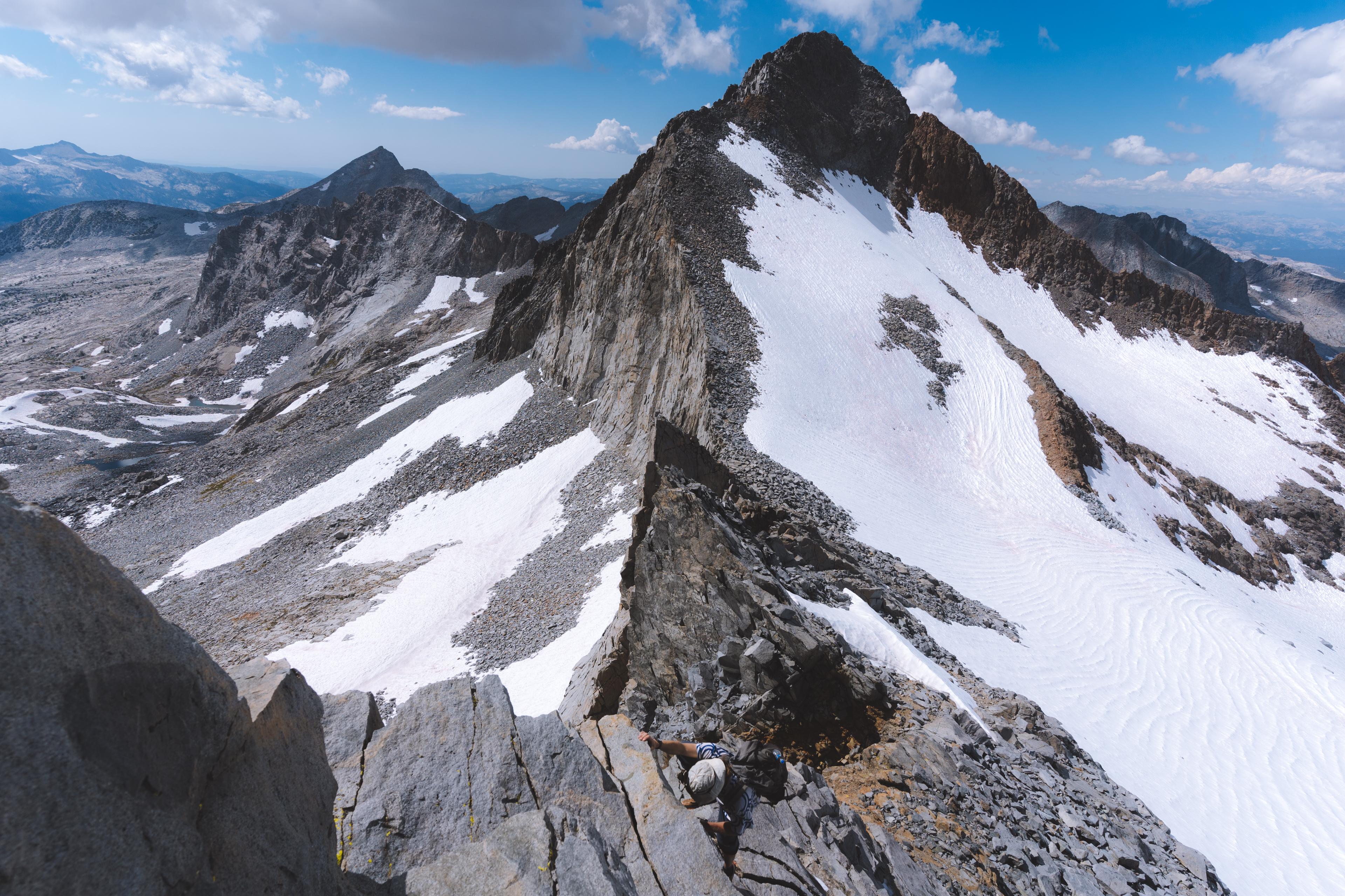
Ominous clouds started to dominate the sky as we ascended. Once at the saddle, we assessed the weather and decided to waste no time in heading up Lyell. Anthony had been up this airy class 4 route before, which gave me a huge confidence boost. Pesky patches of snow and ice persisted on the technical ridge to the summit, which complicated our climb. Small positive edges for one’s hands, and slippery downsloping ledges for one’s feet were at times all that kept us glued onto the precarious route. I kept my eyes fixed upward instead of on the open air below my feet, and in this fashion, eventually made it to the summit. The views were spectacular in all directions. We could see deep into the heart of the range to the south, with Ritter and Banner dominating the skyline. We were also able to study our route up the impossible looking ridge of Mt. MaClure which apparently went at class 3.
Both of our heads were throbbing due to the elevation and so we decided to not linger any longer. The downclimb, as usual, proved more challenging than the ascent. We found ourselves off route fairly quickly. Anthony made a daring move across a blank face at one point that I was not excited to reproduce. I looked for other options, but eventually decided to follow his path. The move in question required me to trust a small right hand crimp while my left hand moved across an otherwise blank face and my feet willed themselves to stick to an icy ledge. After this we both moved confidently down the ridge. Once at the saddle, we each took as sip of water and then cracked on.
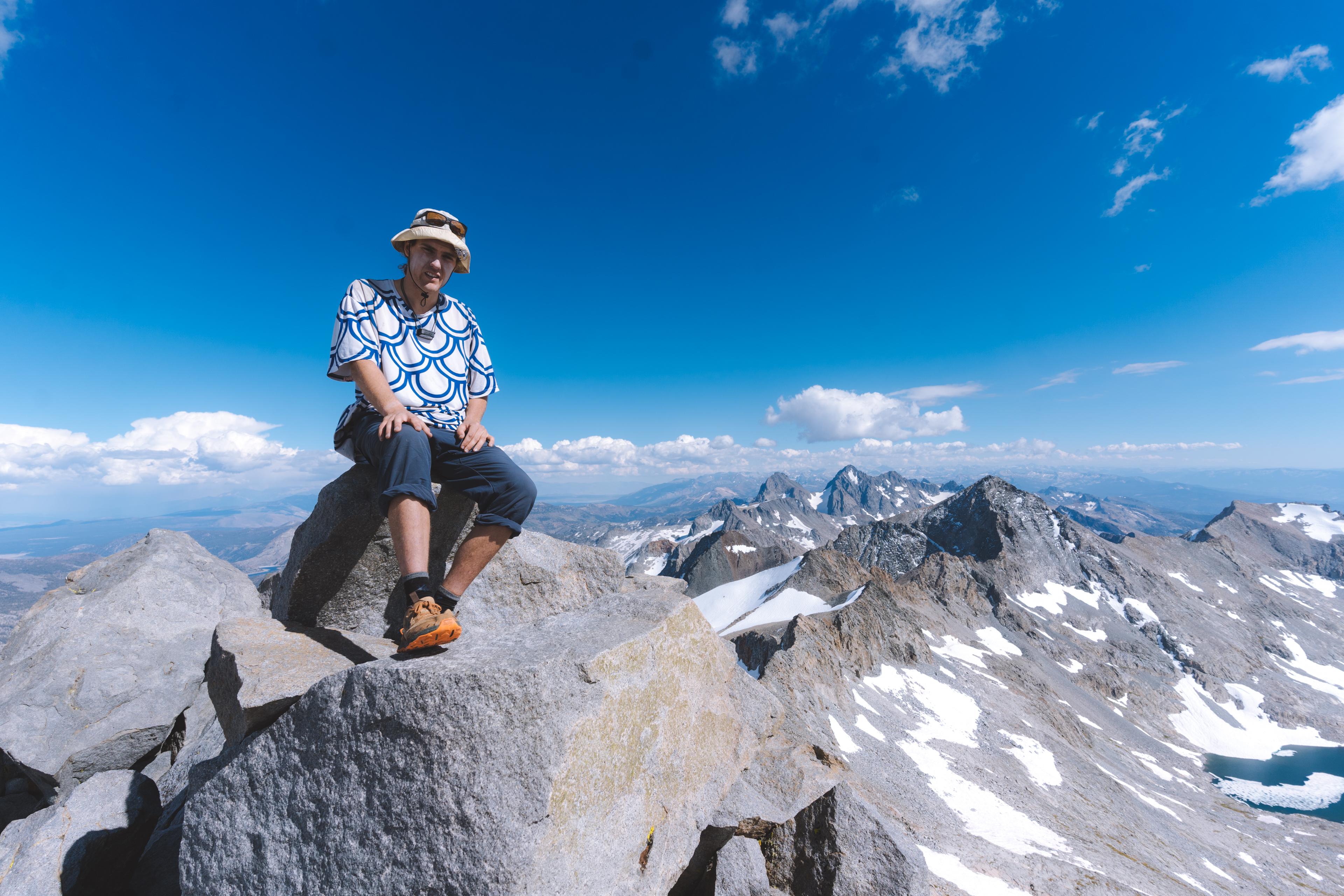
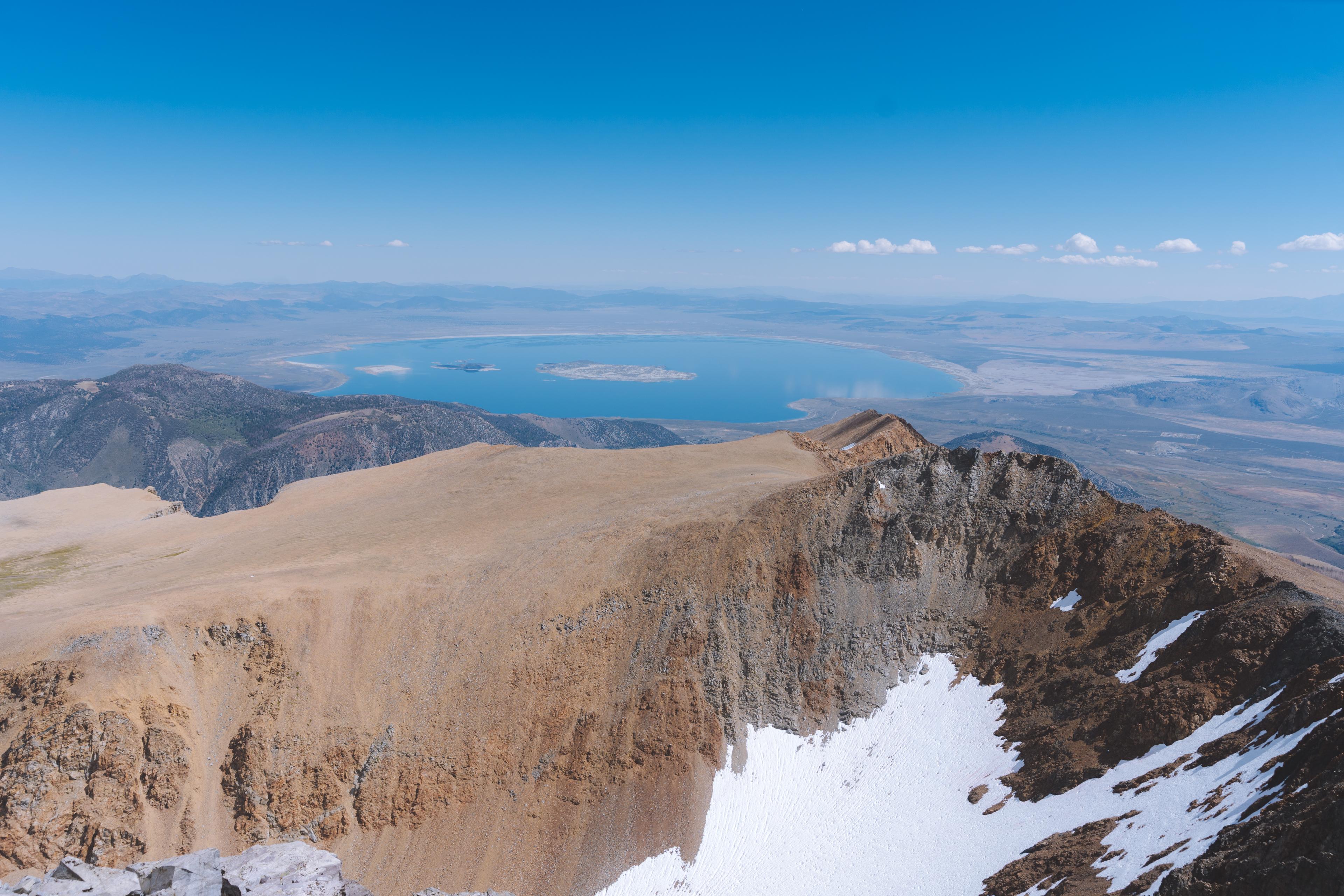
The ridge up MaClure was fairly easy until we neared the top. We moved left, to the south side of the ridge where we were greeted with a chossy knife-edge ridge, home to some of the most horrid rock I’ve ever had the displeasure of navigating. At one point I literally straddled the ridge, scooting up slowly and painfully as this was the only way to ensure that I wouldn’t pull a huge block of rock off the ridge and subsequently fall into the oblivion. Fortunately, this section was short, and we were on the summit before long. Another wonderful view greeted us at the top. I especially enjoyed looking back at Mt. Lyell’s impossible looking ridge. By this point, we were both thoroughly overcome by the altitude and decided we needed to descend swiftly. In my altitude induced stupor I managed to repeat a mantra in my head, “slow and focused,” in order to keep my mind focused on each precarious move I made down the mountain. We took a different descent route, this time staying on the north side of the ridge, which proved to be significantly easier than our ascent.
We glissaded down the glacier, saving us hours of tedious walking. This was well worth the numb and icy butts. Eventually, nearly six hours after leaving our basecamp, we were back. It just started to drizzle as we got our dinners ready. Perfect timing. We chatted and ate for an hour or so and then admired the wonderful sunset. Clouds to our south were alight with burning reds and oranges from the sun’s dying rays. A rainbow appeared to our east, shooting out of the summit of some unidentified peak. A small gap in the clouds allowed for sunlight to beam on to the cliffs near Lyell and Maclure to our north. I was overwhelmed by the display. Certainly, this must have been a terrestrial manifestation of God—the alpenglow.
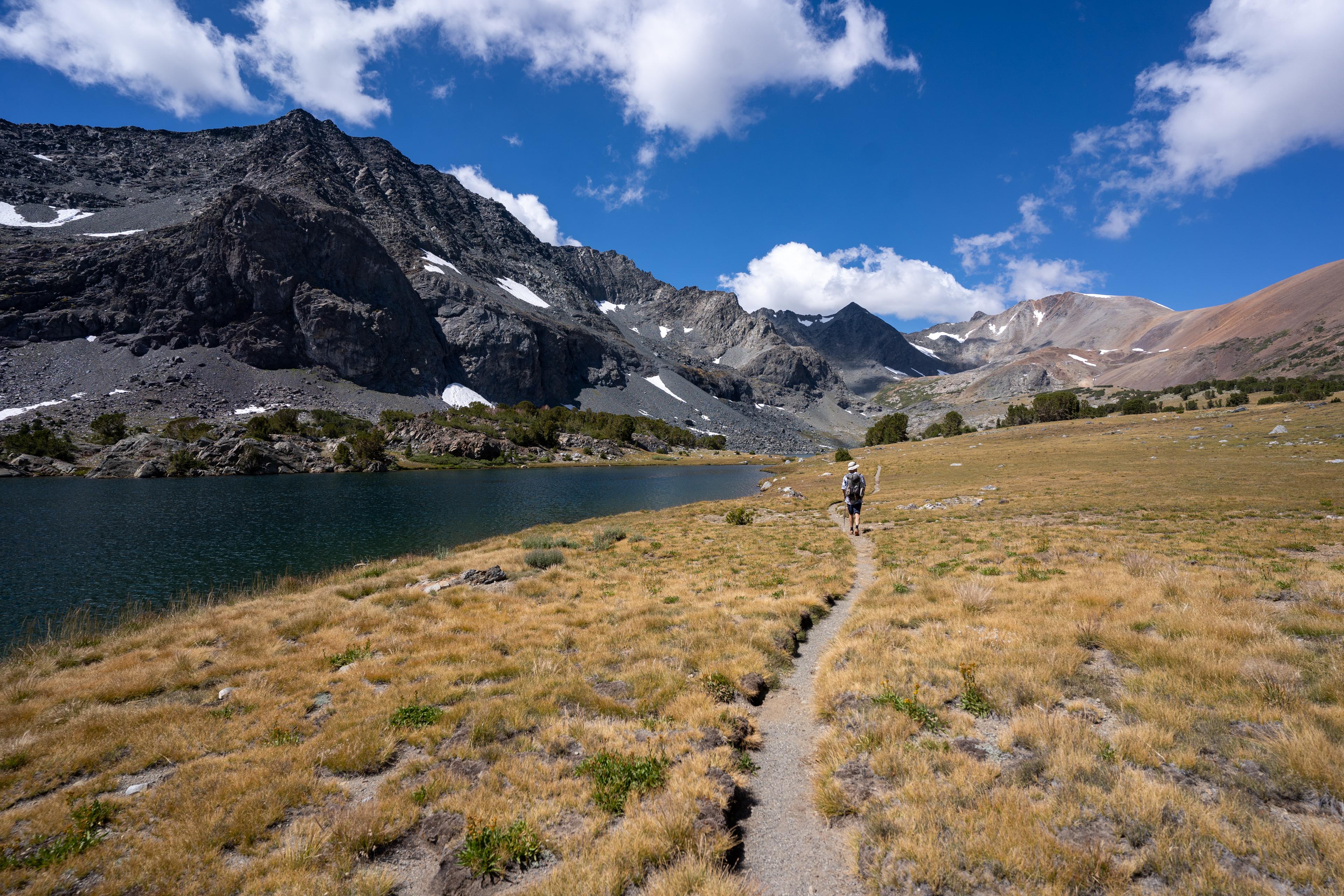
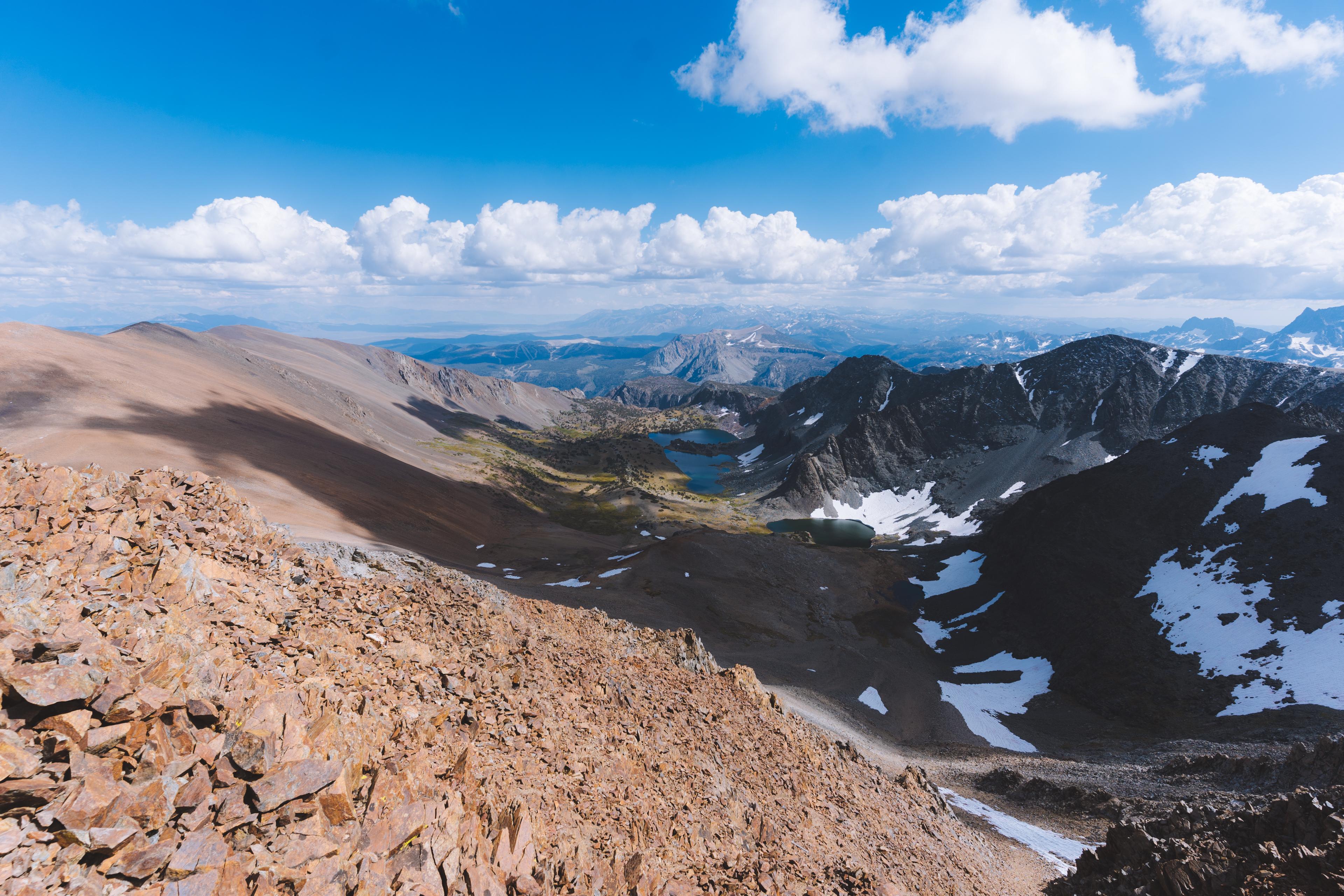
The next morning we rose with the sun and cracked on over Donohue pass. We meandered our way along the Muir Trail for a few miles before cutting east past Waugh lake. Descending further, we reached Gem Lake, which actually is a dammed reservoir. At this point we were frighteningly close to civilization, with the June Lake loop a mere couple miles away. For this reason I was happy to cut north towards Gem pass, which meant we would be retreating further into the wilderness once again. With the heavily trafficked highway that is the Muir Trail behind us, we plodded along towards Koip pass. Once at the pass, we slogged our way up class 1 scree to the summit. While we only had about 700 feet of elevation to gain, the climb was surprisingly tedious, likely due to the uniformity of the terrain.
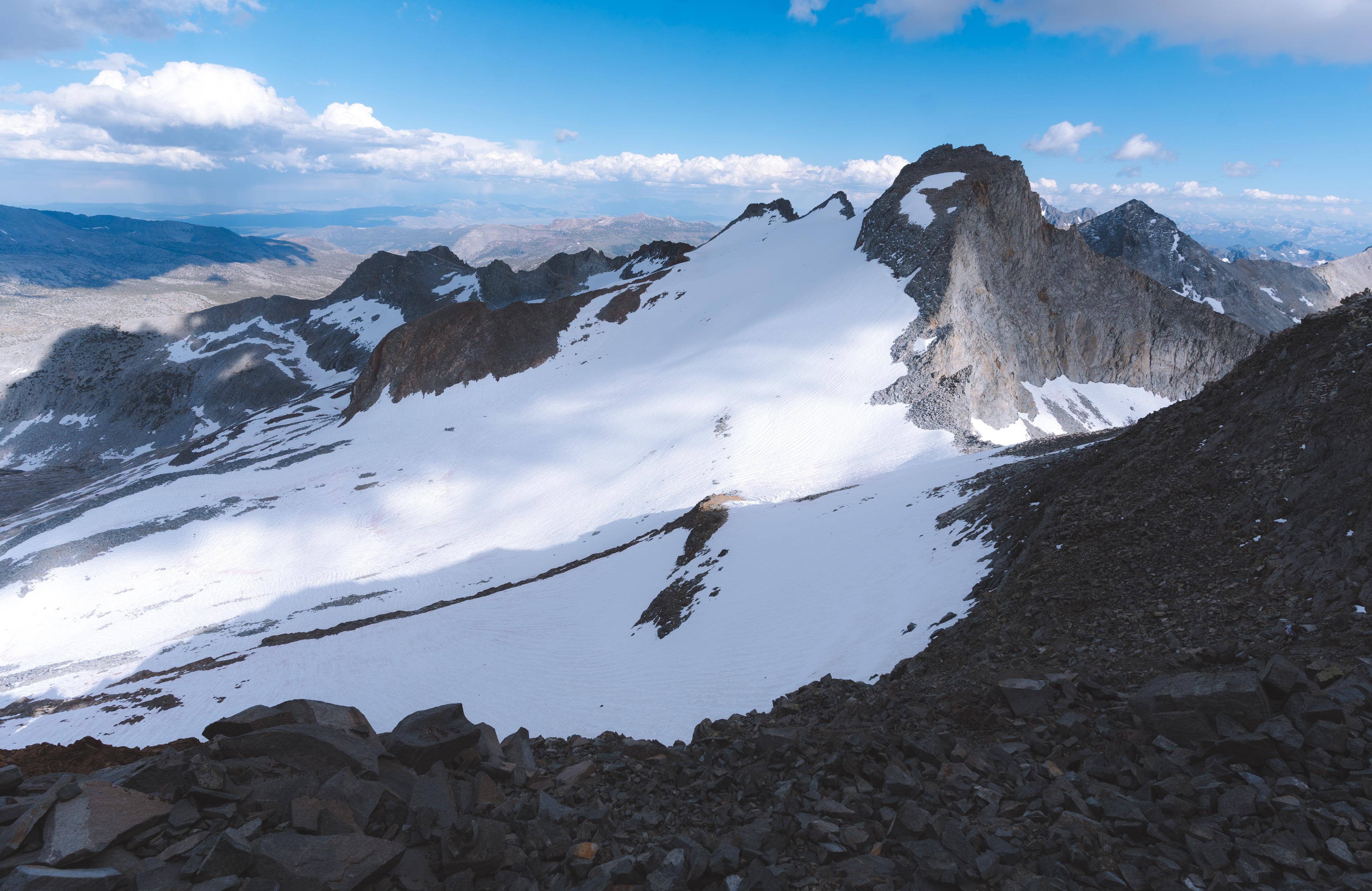
The summit views were astounding, and well worth the effort it took to achieve them. I was struck by how impressive Lyell and MaClure looked to our southwest. Gibbs and Dana loomed imposingly to our north.
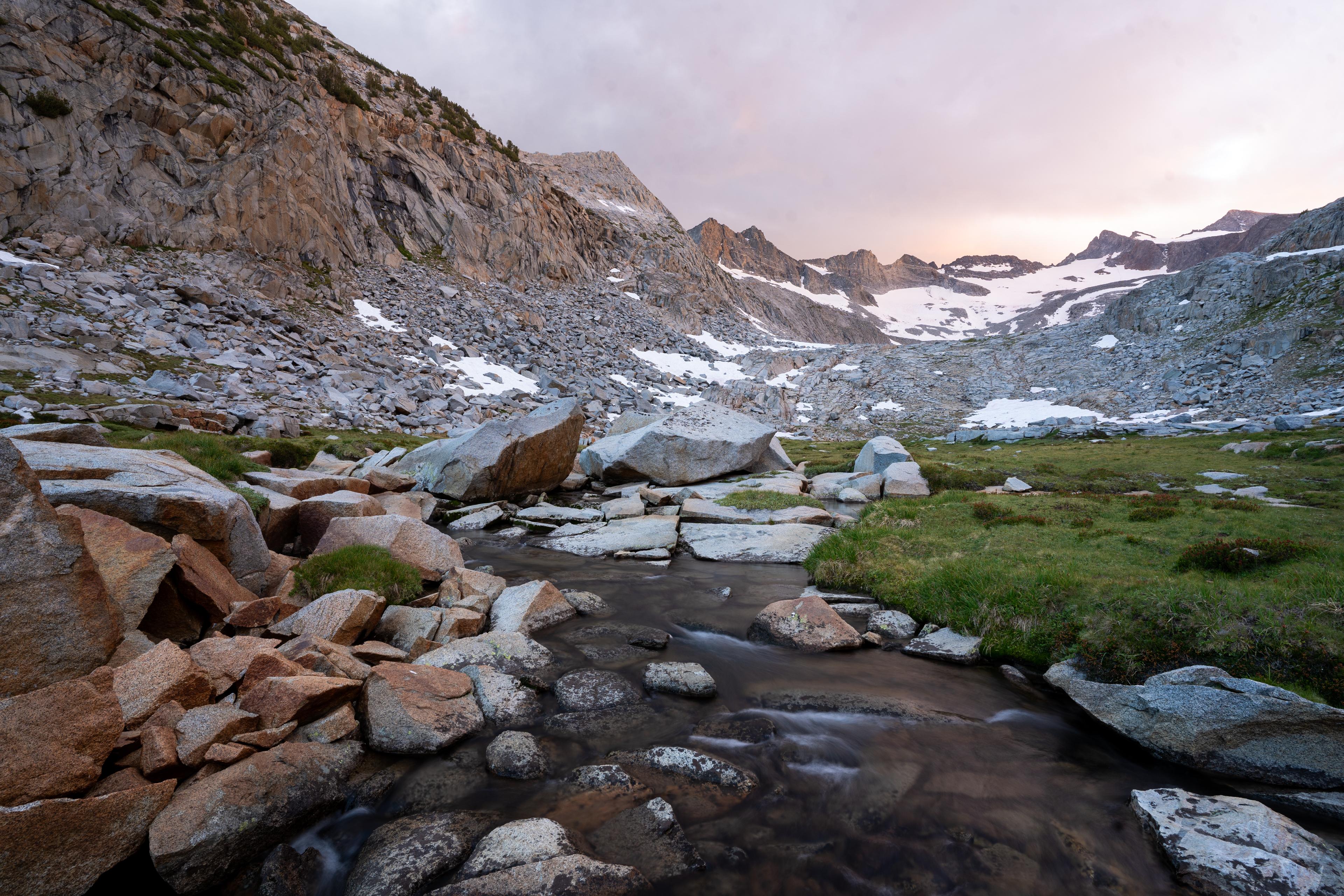
We made our way off the summit and north towards Parker pass. For some reason the Dana watershed is “the most heavily protected in the entire park” according to one ranger we spoke with and so camping north of Parker pass is strictly prohibited. Because of this, we camped shy of the pass on the water’s edge of a sublime alpine lake. Anthony and I chatted, ate, and rested for the entirety of our lazy afternoon.
After a good night’s sleep, we rose a bit after sunrise and trundled our way towards Gibbs. Its broad southern slope looked like a real pain to climb. After much hemming and hawing we agreed on what looked to be the path of least resistance. Our chosen route was tedious but straightforward. A fews hours of slogging saw us to the summit. Dana looked incredibly high and the route to its summit precipitous, but after another bout of deliberation, we decided on a good-looking line we would attempt.
The down climb of Gibbs proved to be the crux of the day as lazy route finding on my part led me into a chossy mess of terrible rock with hundreds of feet of air below my feet. In what can only be described as an extraordinarily unpleasant couple of minutes, I navigated this awful section of the down climb and made it to relatively safe terrain. The whole time Anthony looked back at me, puzzled as to how I got onto such a bad line. At one point he yelled back, “I don’t remember being on anything that hard!”
The ascent up Dana was easier than it looked from afar, as most ascents tend to be. We were soon treated to more stupendous views. Mt. Conness and North Peak were perhaps the most striking parts of the whole sweeping vista.
We took off down the use-trail leading to highway 120 which would mark the end of this stupendous trip. Once at the road, Anthony decided to hitch east to visit our buddy Abe and I decided to hitch west to loiter around Tuolumne until the rangers closed the entrance station for the night. This way, I could escape the park without paying. One final note that makes this trip special is that I was picked up by my first ever Tesla while hitching back to the van.