Fall and Red Wall Canyon Loop
Peaks: Wahguyhe Peak, Grapevine Peak
April 2024
At long last, Anthony was returning to the United States. He had been on an enviable trip down to the Southern tip of South America, traveling by boat, train, bus, foot, and thumb. Anyways, after more months than I care to count, he was back, and so our first order of business was to get a trip in. Spring was quickly giving way to warmer temperatures and drier days, but the desert was not yet unbearably hot, so we headed for Death Valley.
The van puttered its way into the Mojave, and as we got closer to our destination, conversation ceased. An uneasy silence loaded the car. No matter how many nights one spends in the desert, no matter how competent in navigating the terrain, finding the unlikely spring, predicting storm, avoiding the heat and finding the shade, even the heartiest desert rat still feels a certain unease overtake him when he makes his first trip of the season back to the desert. Anthony and I were no exception to this rule—the unfathomable size of the barren ranges, the heat, the almost hallucinatory landscape full of mind bending geological wonders made us feel very small and very fragile.
We filled up a dozen liters of water at Emigrant camp, and then headed for the mouth of Titus Canyon. It was about 6 p.m. when we arrived. I packed my bag in the still scorching 100 degree weather while Anthony sorted his food. We left our tarps in the car, not imagining that this dry heat could ever give way to rain, and we set off for Fall Canyon.
I had been thinking about this trip since 2022, a push deep into the heart of the Grapevines via the well-known Fall Canyon, a summit of several extremely remote peaks in the range, and a descent via the less well-known and more technically challenging Red Wall Canyon. I had never heard of anyone completing this route, but in the Death Valley Bible that is Michel Digonnet’s Hiking Death Valley, he suggested it may be possible.
We camped a few miles into Fall Canyon and slept soundly on its soft sandy floor. In the morning, we set off early and ran into several dryfalls. One or two of them proved easy, albeit tedious, to pass, but the last major fall was a real challenge. Anthony managed to climb a sketchy squeeze chimney, and hauled our bags up with some webbing I brought. I couldn’t quite figure out the chimney, so I opted for a horribly loose and sketchy class 3 chute on the East side of the canyon. After an extremely unpleasant minute or so, I made it to relative safety at the top of the chute. I probably would try to figure out the moves on the chimney if I ever had to ascend that fall again.
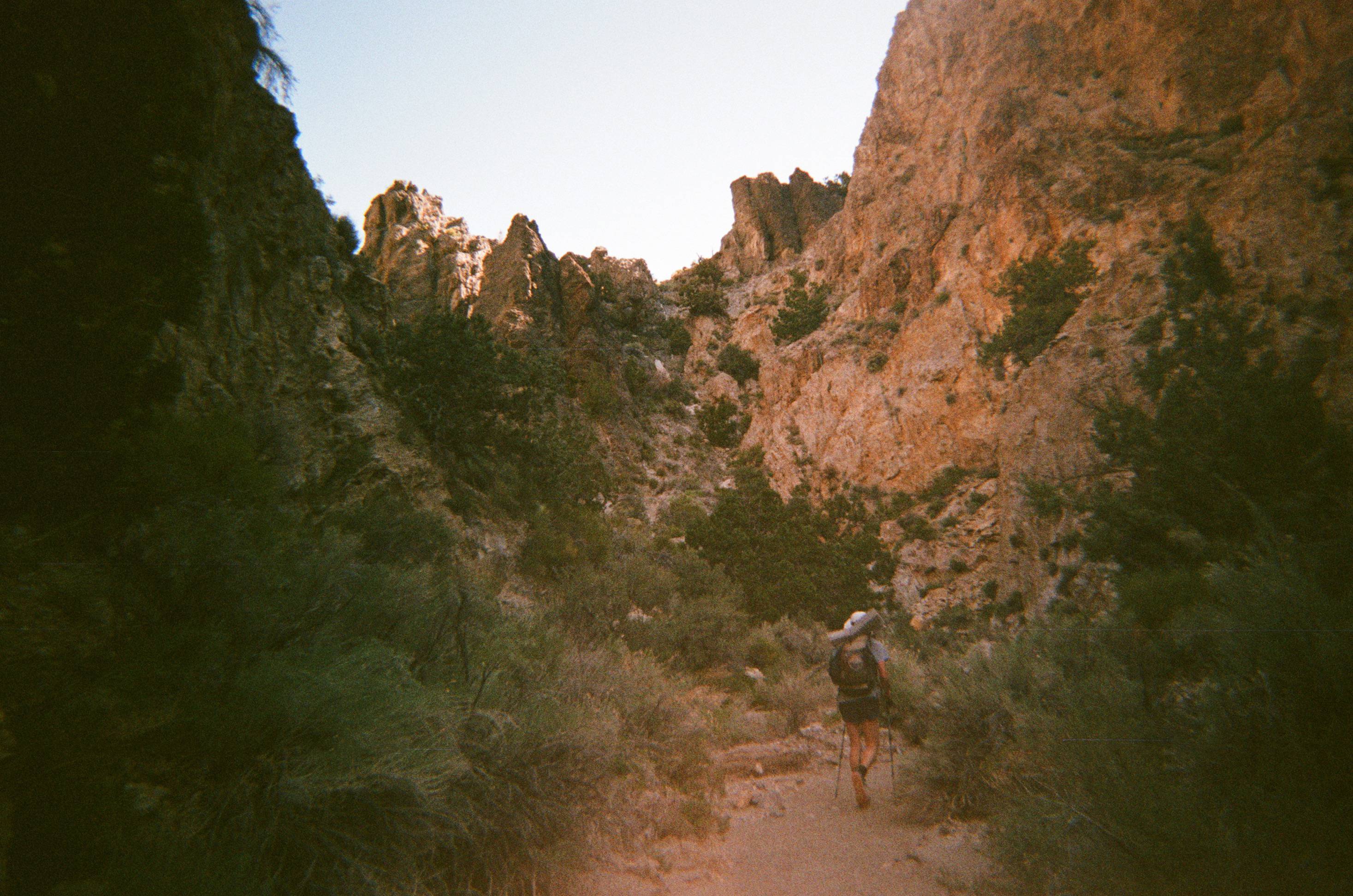
The canyon opened up slowly as we ascended, and we began passing Pinyon Pines and Junipers. It was a sight to behold. These two beautiful trees growing in some obscure part of one of the driest ranges in the world. At the head of the canyon we had to make a steep scramble to gain the ridge. I was sad to exit Fall Canyon’s shade, but since we had climbed so much, it was actually surprisingly cool in the sun.
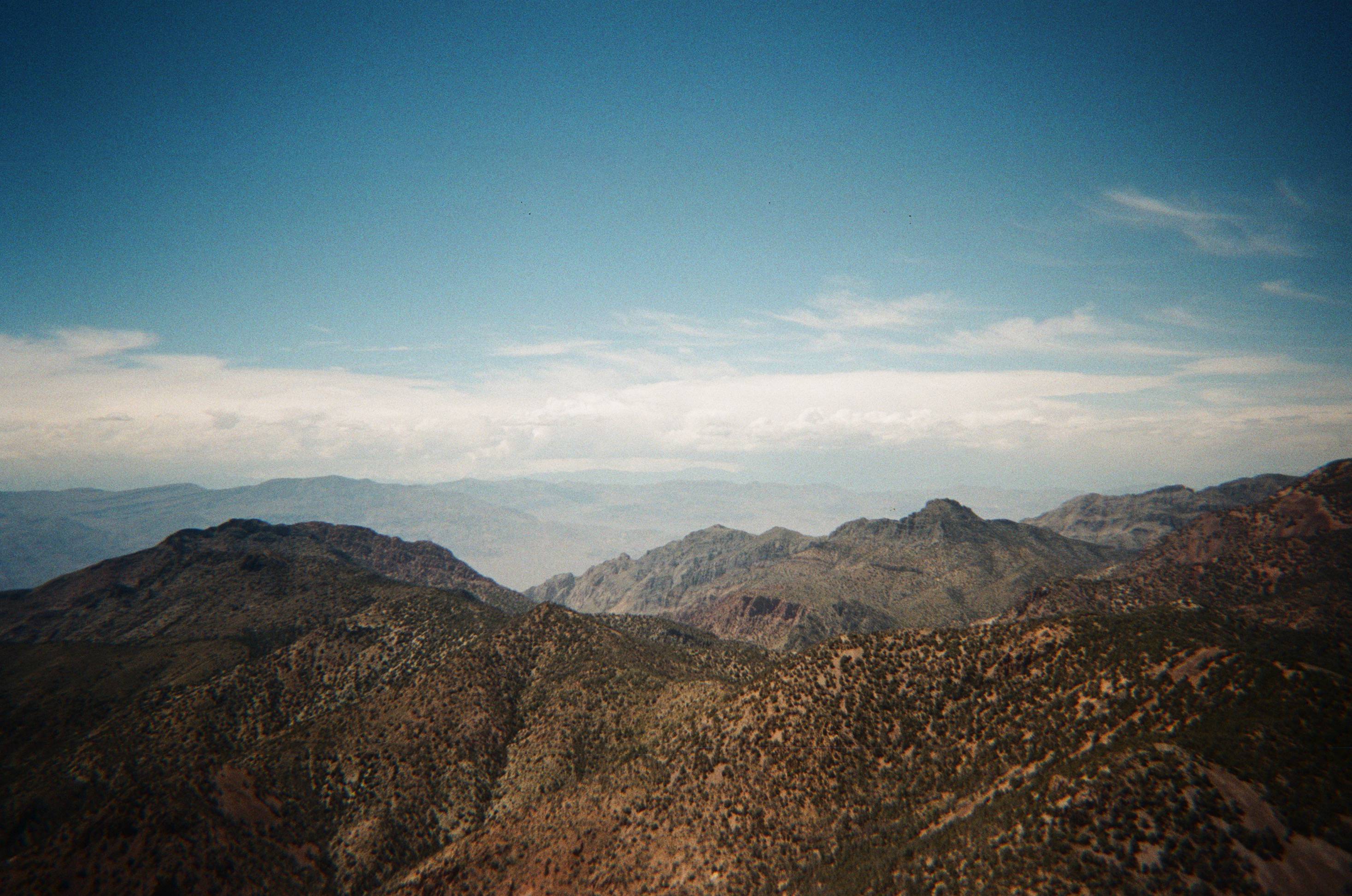
Once on the ridge, we unloaded most of the weight from our packs, as we were going to hike out-and-back to a couple peaks. After some deliberation, we decided to hike Wahguyhe first. It was a steep, but manageable scree slog to the summit. After an hour or so, we were on top of this seldom visited peak. Grapevine Mountain, the tallest in the range, looked very far away from where we stood. Anthony was hesitant when I asked if he wanted to climb it. Later I found out that he was worried about the clouds starting to form in the distance. I said we should just do it, and he relented, so we headed north. We found an unexpected stream between the two peaks, and happily filled our bottles with it’s silty water.
A few hours of walking saw us to the summit of Grapevine, a broad, but impressive peak. We could see for endless miles into Nevada to our east, and to our west the mighty Sierra loomed. The clouds which were once a comfortable distance away were now all but on top of us. They looked very dark and very menacing. Great. We started trotting our way back to our gear since the threat of rain somehow now seemed probable. There was no sign of this in the weather forecast; when we checked leading up to the trip, we saw sunny days with 100 degree highs. I chuckled at the fact that we were now running along a ridge in the Grapevines trying to outpace a storm that threatened to soak and chill us to the bone.
We started feeling the odd drop of water which heightened both the severity of our situation and our anxiety. Neither of us had shelter, I had only a down puffy that would be rendered useless if wet, and I didn’t even have a trash bag to keep my down sleeping bag dry while in my pack. On top of this, we had a technical canyon with at least one 5.6 down climb on it that would be rendered difficult, to say the least, in the wet. We got back to our gear as the rain intensified. Anthony charitably offered to stuff by sleeping bag into his trash bag and I carried some of his food and water in exchange. His bag started ripping pathetically as he tried to stuff all sorts of gear into it to keep dry. I felt like a huge ass at that point. I imagine we both did, rookie mistakes in the place where the margin for error is the smallest!
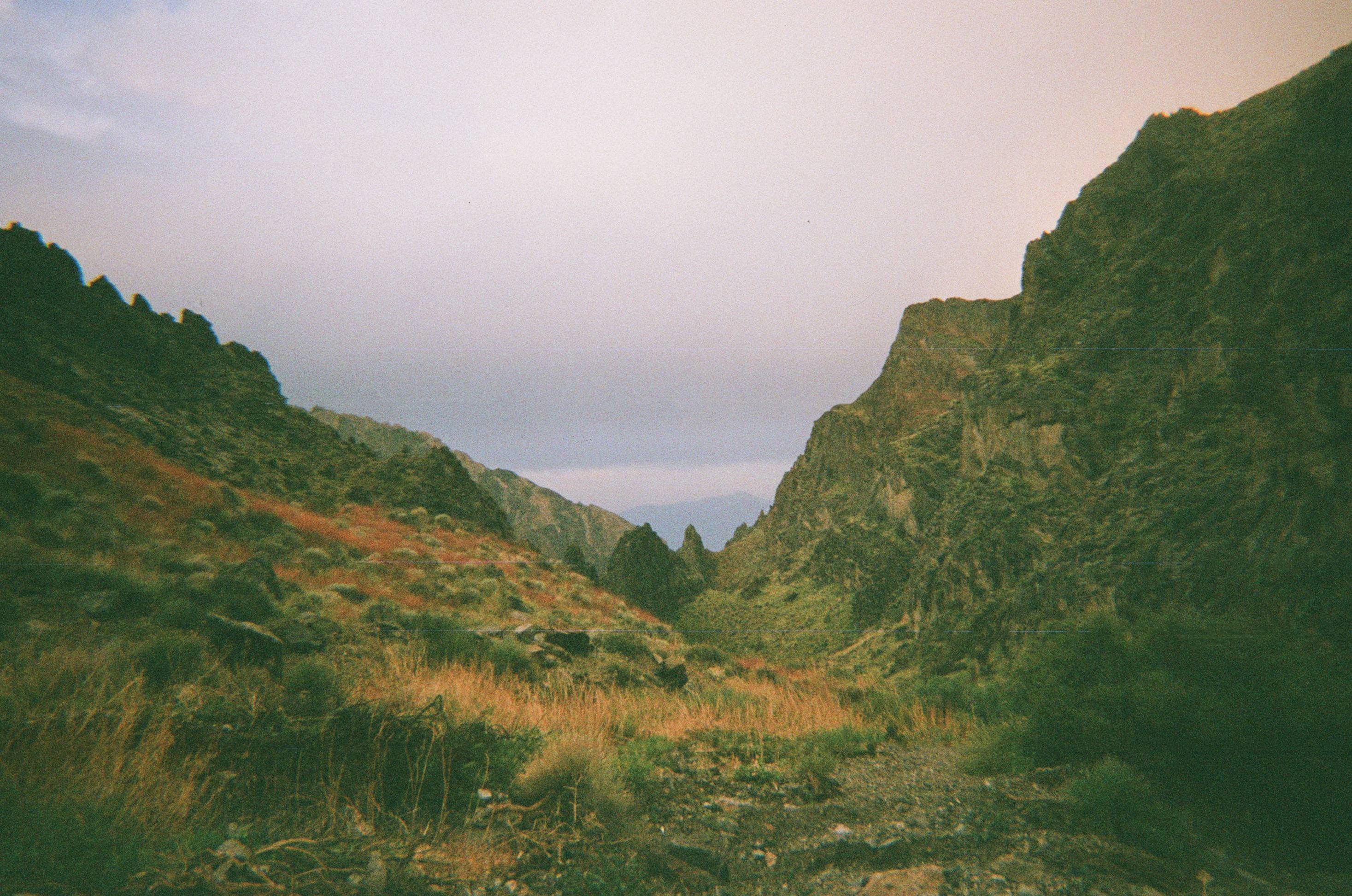
After almost descending the wrong canyon, which would have been a complete disaster, we finally dropped into Red Wall Canyon, abandoning our plans to climb Palmer Mountain in the morning. We surveyed trees we passed, hoping to find one that would provide at least a bit of shelter from the rain overnight. Eventually, we settled on one that appeared to offer some marginal coverage. We crawled underneath its canopy and slid into our bags. They did not stay dry, but they at least provided us enough insulation to sleep until about 3:30 a.m.. At that point, the rain intensified to such a degree that our bags got properly soaked, and it was too cold to sleep. At around 5 a.m. I asked Anthony if he was awake. He, of course, was. We agreed to pack as quickly as possible and get the hell out of there. I was shivering uncontrollably as I tried to pack my bag with uselessly numb fingers.
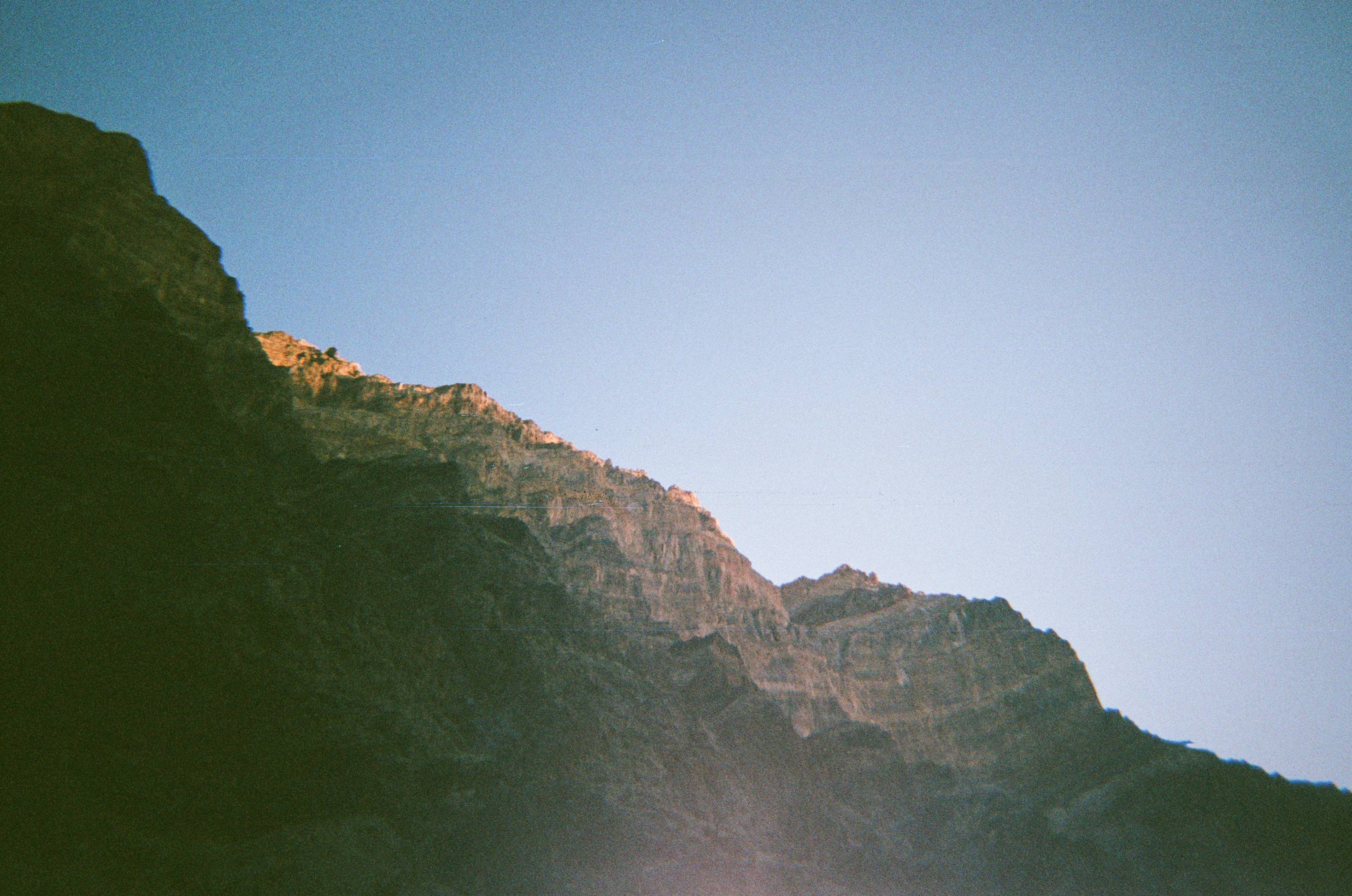
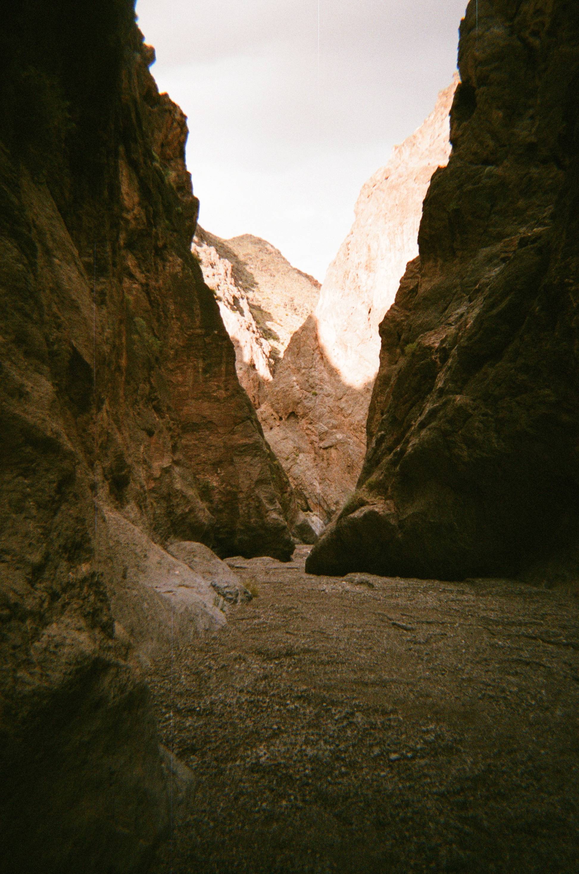
Walking warmed us up a bit, and after a couple hours the rain subsided. Descending also meant that we’d be greeted by warmer temperatures. Soon we were warmed up enough to actually enjoy the magnificent beauty of this seldom visited canyon. Red walls rose vertically out of the earth hundreds of feet. Some were even overhung. At times the canyon constricted so much that you could reach out and touch either side of its sheer stone walls with each hand at the same time.
We were nervous about the dryfalls, but had some webbing to aid in our descent. The minor ones were easy enough to navigate, and the major fall had some webbing already installed. It was easily downclimbed and soon we were at the mouth of the canyon. All that remained was a four or five mile traverse across the alluvial fan back to the car. It was exposed the whole way and quite hot. Of course, after being soaked all night and freezing in the morning, I was already complaining to myself about the unbearable heat instead of being grateful that we did not freeze to death.
We made it back to the car, took a long break in the shade of my open trunk, and then drove to Furnace Creek to prepare for our next trip, a traverse of the Panamint Range.