Gardiner Basin Loop
June 2022
Anthony and I met up in Independence for what would be the first of many successful trips of the summer. With Anthony between jobs, and me just puttering around for the year, we were able to line up about a month of hiking and climbing together. Not wanting to ease ourselves into it, we decided to go for Dragon Peak and Mount Gould, two relatively technical peaks from a scrambler’s perspective. To make things more interesting, we’d make a big loop out of it, by linking up various trails and some off-trail romping along Skurka’s Kings Canyon High Basin Route. We got up to the Onion Valley trailhead sometime in the evening, if my memory serves me. Along the way, we picked up a hitchhiker, named Catless — because apparently he hadn’t had to dig a single cat hole on his entire hike along the PCT thus far. Anthony, being fastidious about facts, asked him a few questions about long stretches without campgrounds, outhouses, and the like, which quickly poked some holes in Catless’s story. We were both dubious at best about the validity of his claim by the end of the drive. We stealth camped in the parking lot and then started hiking in the morning.
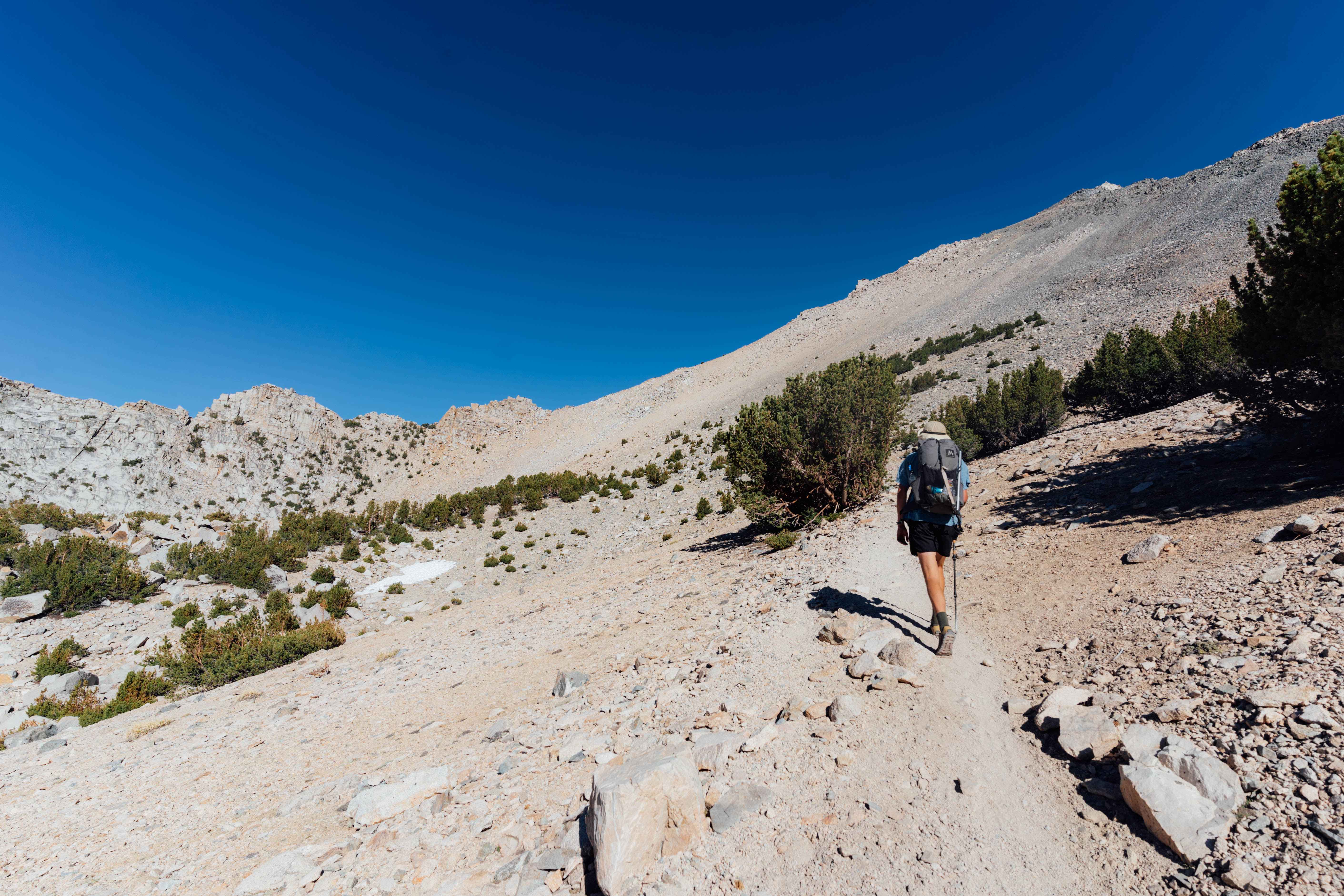
Kearsarge pass was reached in no time, as we blazed past PCT hikers who all were lugging huge amounts of food up from their latest resupply. I did not envy their predicament. We listened to a loud, self-interested Kiwi talk everyone’s ear off at the pass while we enjoyed the views and ate a snack. Soon we were to peel off the PCT and remain in relative solitude for most of the hike, which we were quite looking forward to. The humdrum of the PCT is an odd contrast to the solitude found once stepping off-trail. We made our way past Charlotte Lake, and caught our first glimpse at the incredibly impressive Charlotte Dome. The stunning granite monolith has since been added to my “to-do list”. We cut North before reaching the dome, and headed over Gardiner pass, to get to the eponymous basin below. There was a brief stretch of heinous mosquitos, but misery loves company, and the two of us braved their attacks without complaint. Eventually, we made it to a great camping spot in the basin, and with ominous clouds looming overhead, we decided to pitch our tarps.
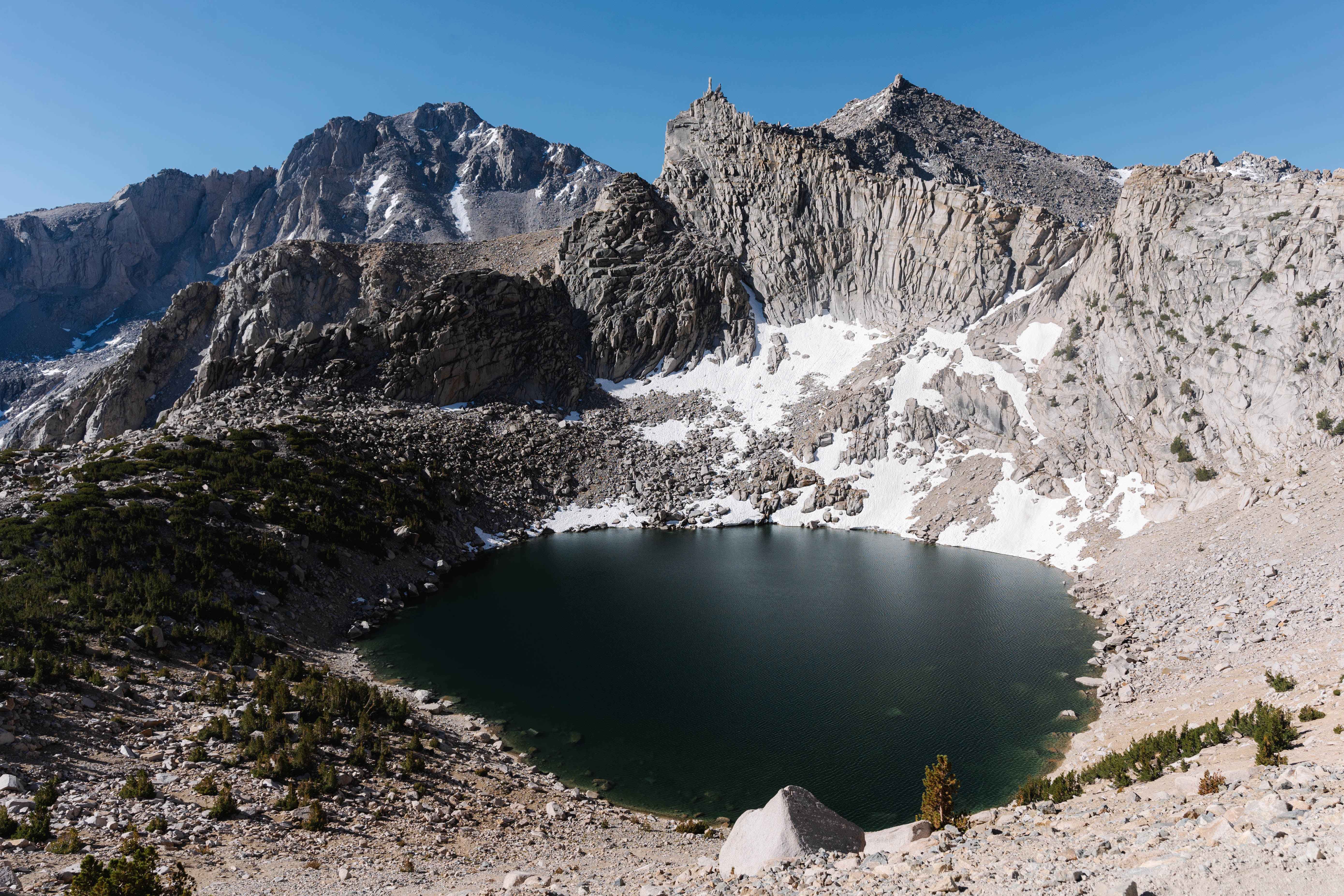
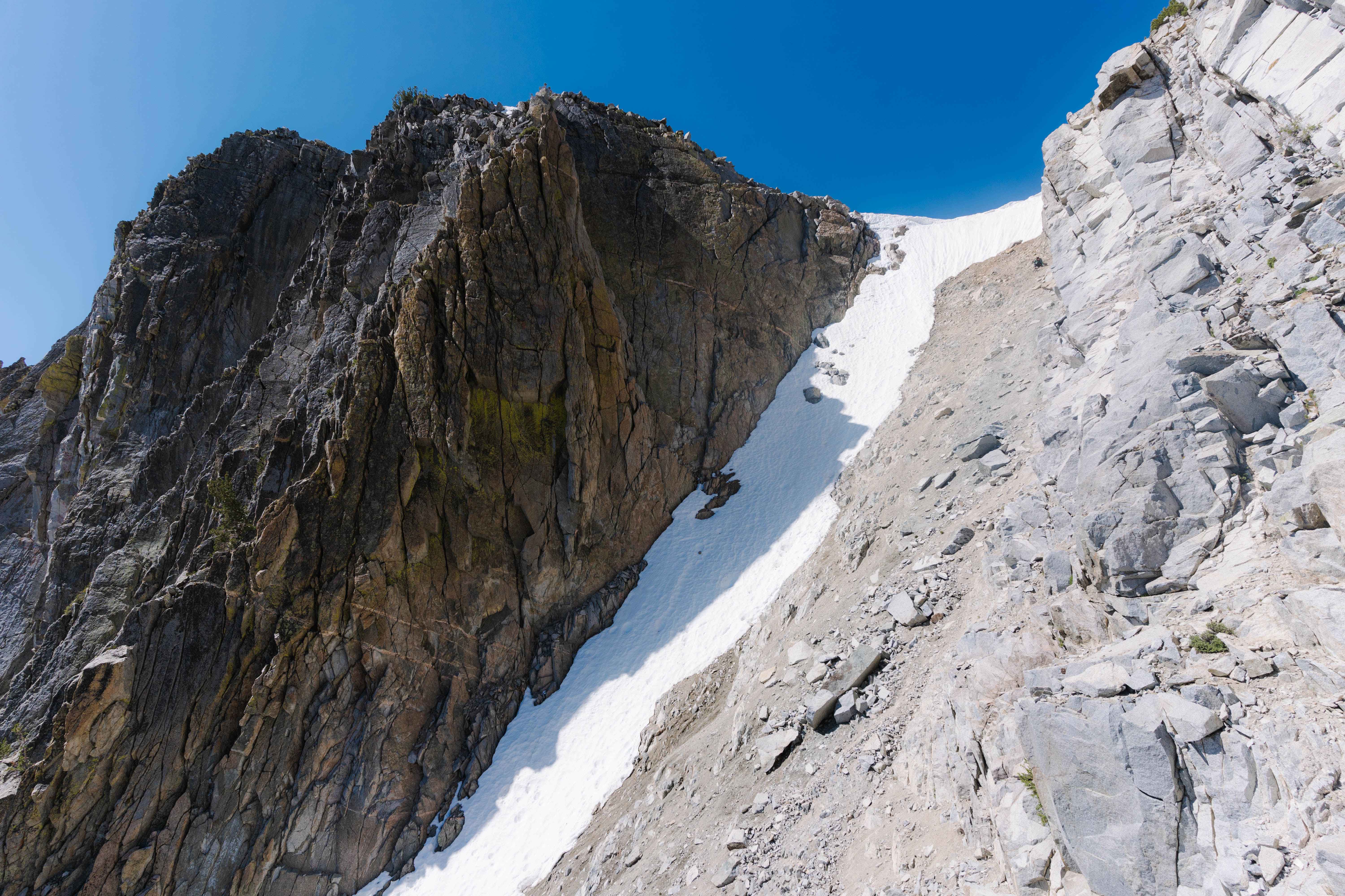
By morning, the clouds had cleared, which we were happy to see. The next objective was King Col, allegedly a class 2 couloir. We both brought traction devices and ice axes, fearing that the col would have a ton of snow and a potentially overhanging cornice at the top. Upon reaching the col, we were pleased to see that the snow had receded enough to do the descent entirely on dirt and rock. Anthony took the lead down the chute, and had trouble managing the loose dirt and incredibly steep grade. He slowly picked his way down, and just as he seemed to be getting a little more comfortable, lost his footing and fell. He slid at least fifteen feet before disappearing from my view, loud shouts from Anthony and booming crashes of rocks and dirt echoed on the sheer rock wall of the col. I thought my old pal was a goner, but a few seconds after the noise settled down, I heard him shout up to me that he was “okay”.
He gave me another yell to signify he was out of the fall line, and I cautiously picked my way down, having even more trouble than Anthony. I made a series of extremely unstable and committing moves in the “crab-walk” position which led me to safer ground. After about half an hour of groveling, we finally made it out of that damn couloir. If anyone plans on doing the entirety of Skurka’s route, I recommend bypassing King Col. Perhaps with more snow, one could cut some steps into the cornice and navigate their way down more safely, but I don’t plan on finding that out for myself.
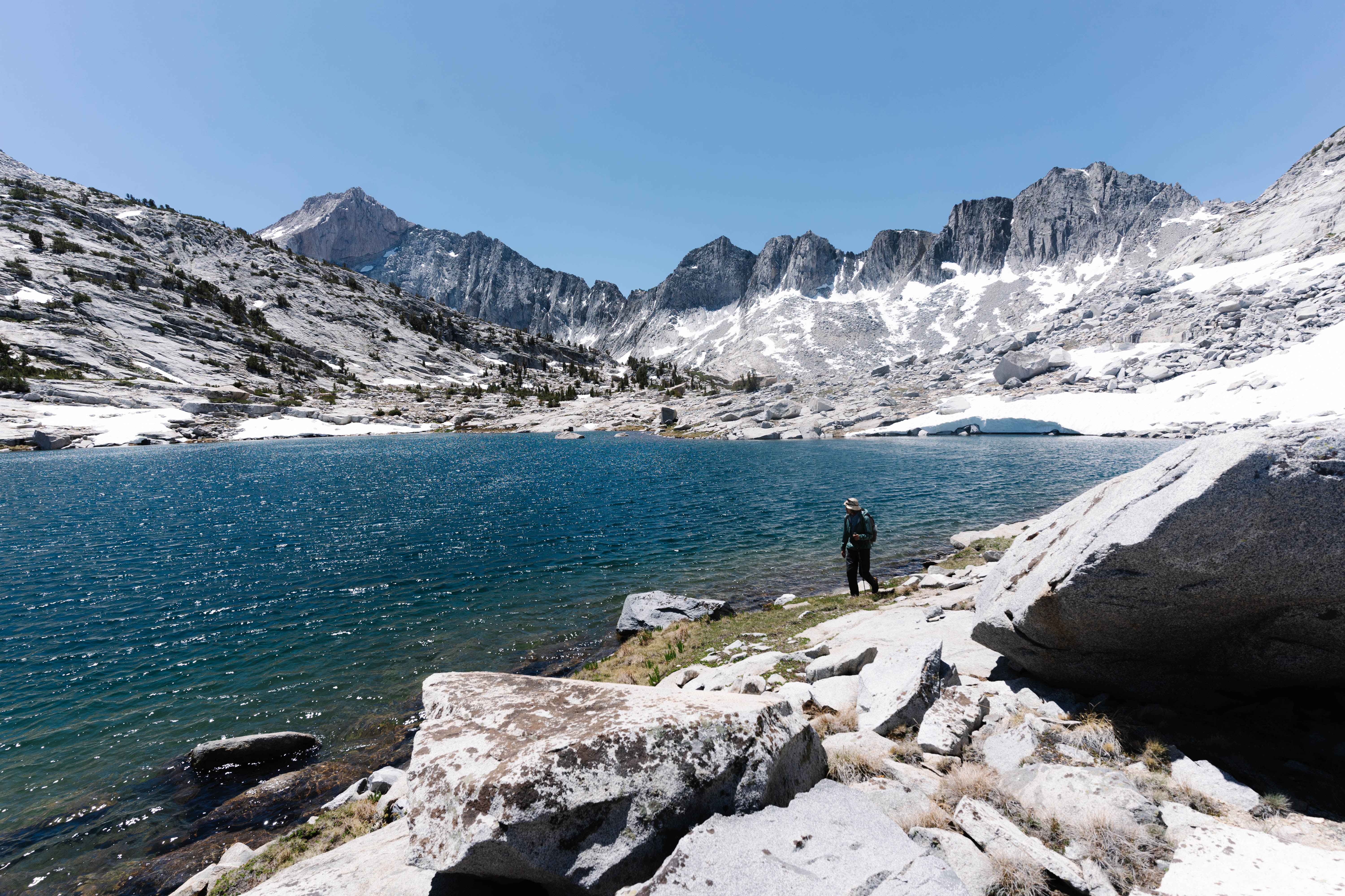
We made our way down pleasant off-trail terrain, and eventually hit Woods Creek. We paralleled the creek for a mile or so through thick brush and downed trees. Eventually, we met up with the Muir Trail and followed it for some time, eventually turning off for Dragon Lake where we broke camp.
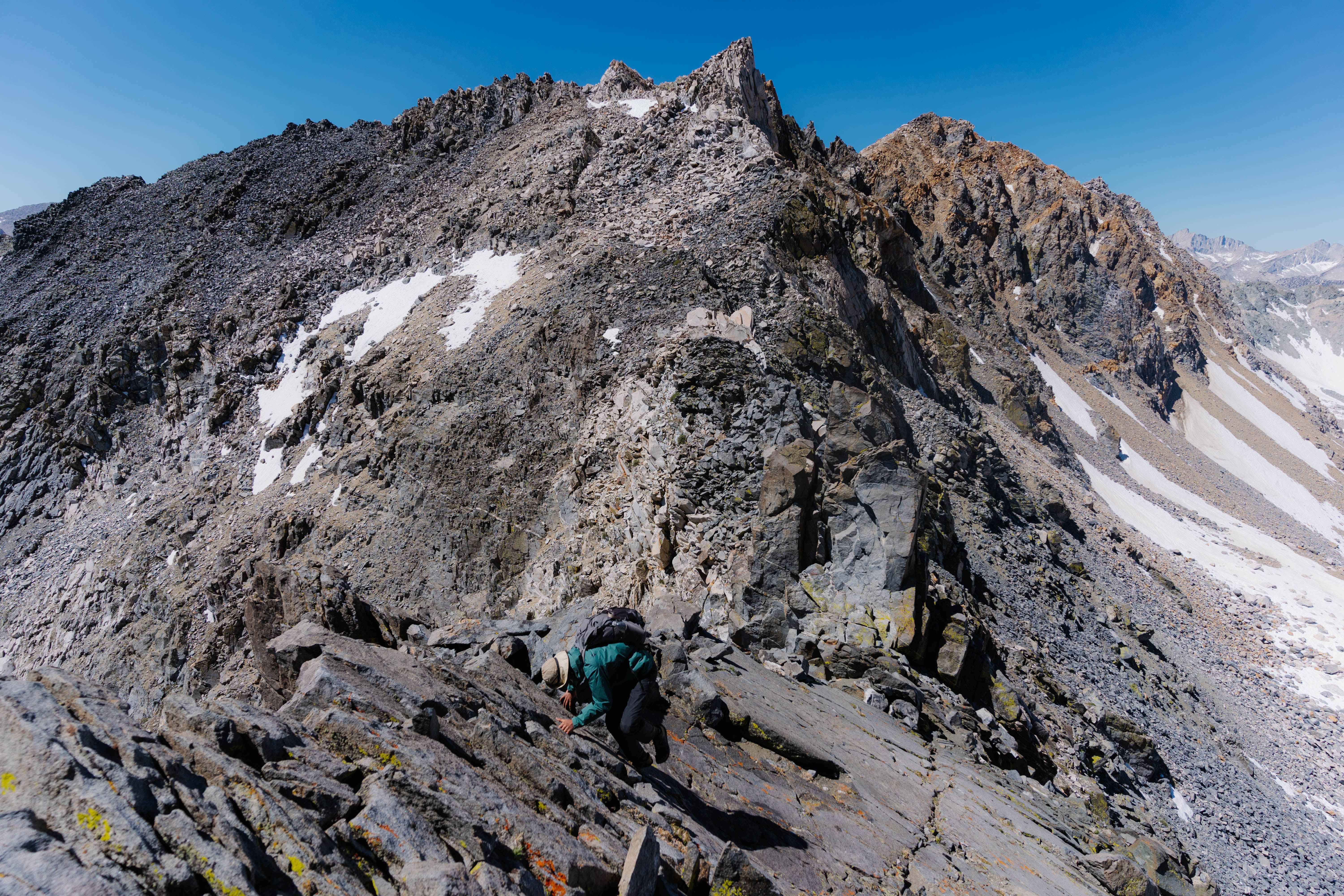
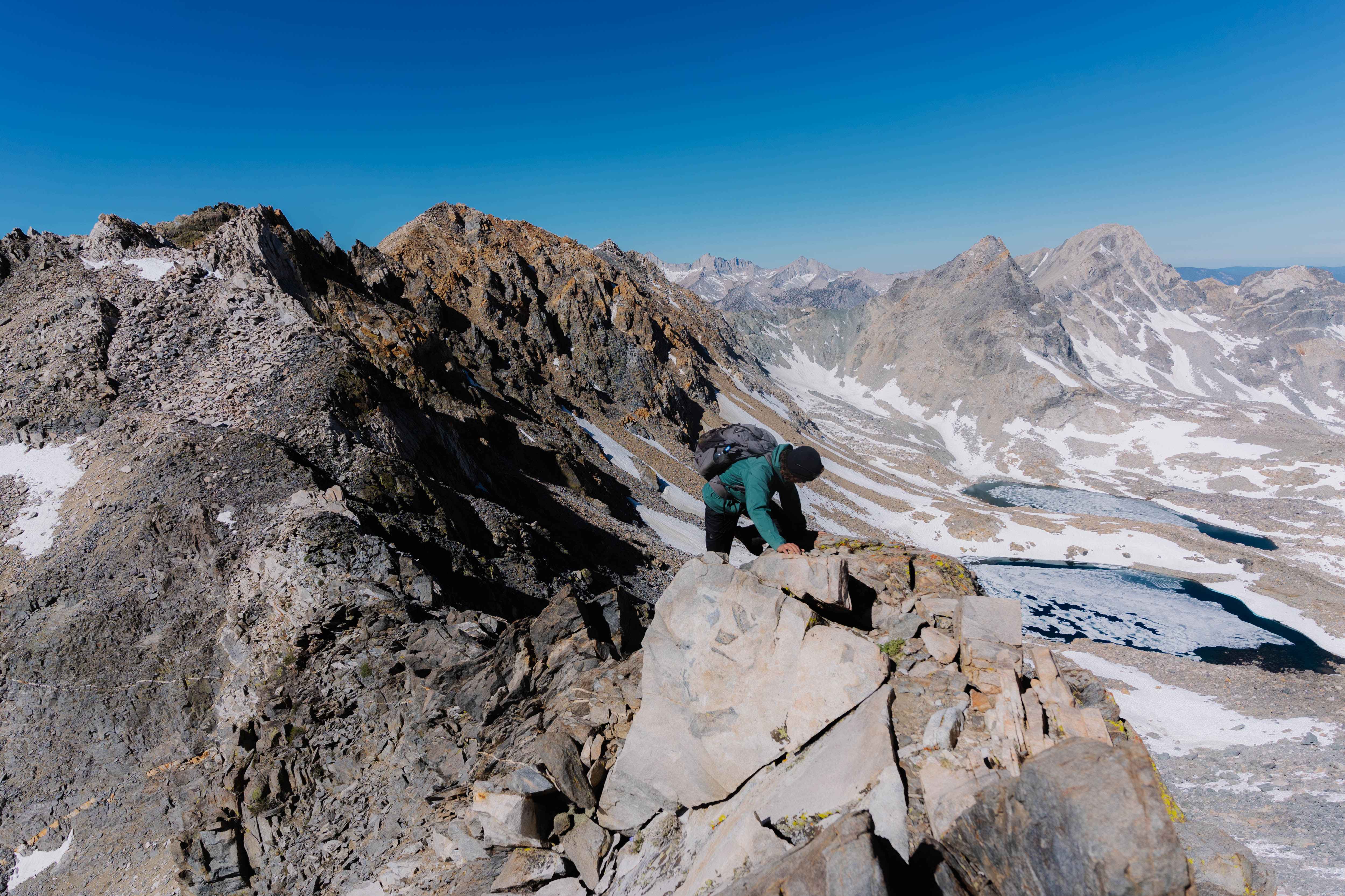
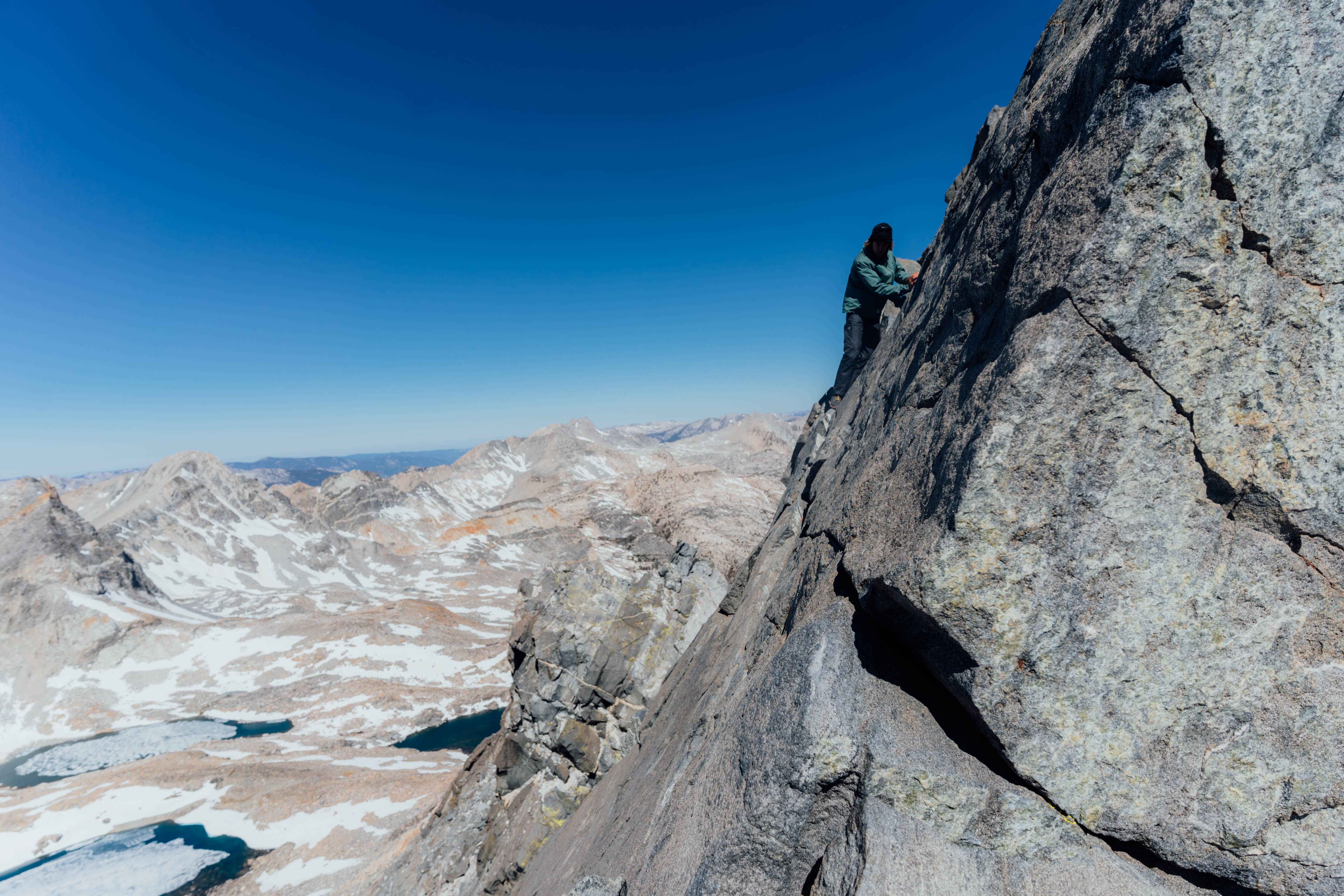
The next morning saw us up Gould Pass, and from there we cautiously picked our way up Dragon Peak’s South ridge. It was quite fun scrambling along the knife-edge ridge. The last fifty feet of vertical to the summit posed quite the navigational quandary. We meandered around all the potential summit blocks in our immediate vicinity, retraced our steps, checked screenshots of trip reports we had on our phones, and couldn’t seem to find the summit proper. Eventually, we saw the “tiger-striped” rock we were to follow. Some dicey scrambling led to the famous “Dragon Traverse”, a bold class three foot ledge with very few hands, and a bracing drop of a thousand feet looming below. Anthony pulled on and made the traverse without issue, giving me the confidence to do the same. Soon enough, we both stood on the summit, but couldn’t enjoy it too much, as we had to reverse the traverse to get back to safety. We did so without incident and then headed South for Gould’s summit.
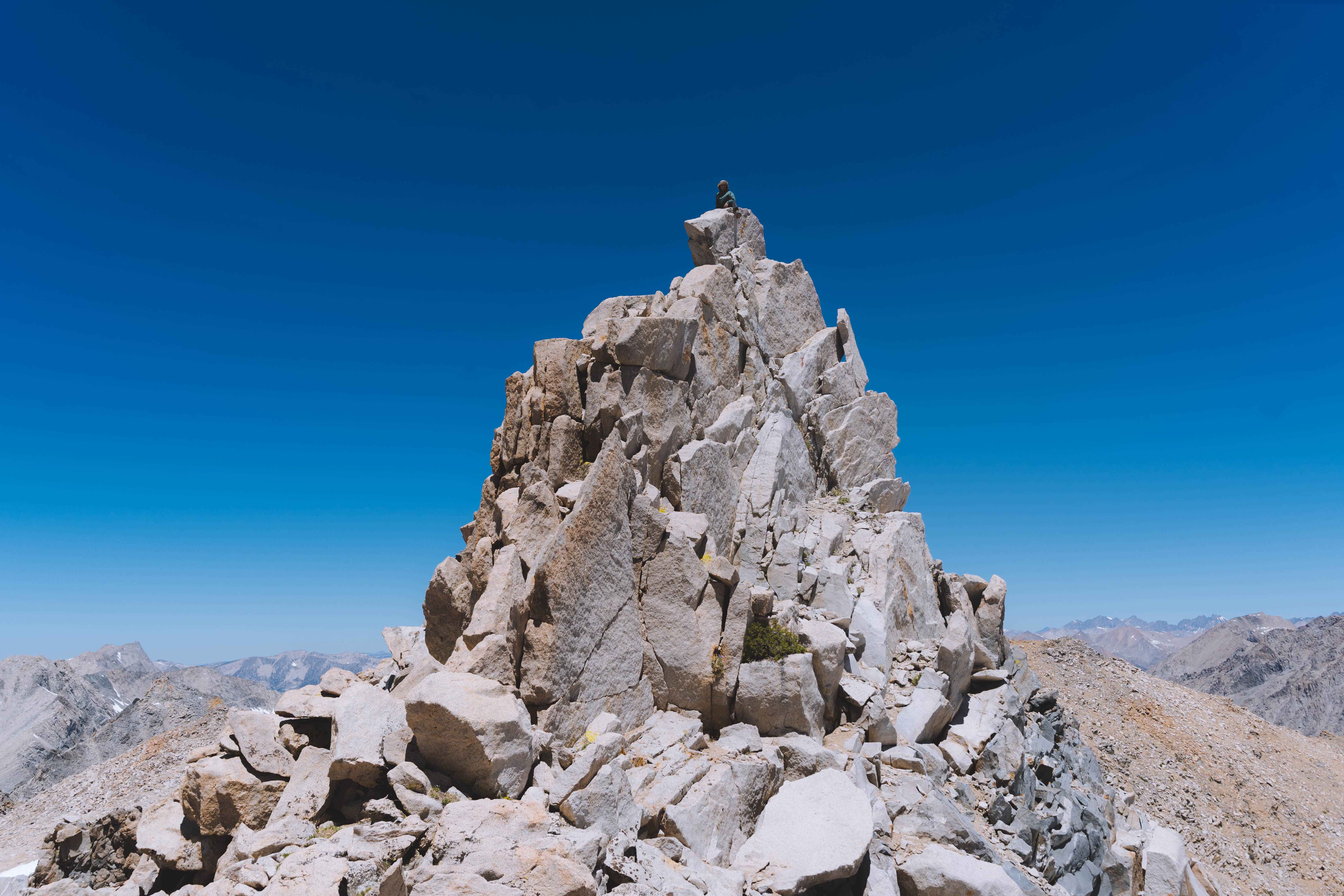
The summit of Gould involved some fun climbing. We took turns surmounting the small summit block via some delicate moves on it’s West face. After this, we made the long descent back to Onion Valley. Other than some sketchy slipping and sliding on King Col, the trip went off without a hitch, and we were warmed up for a summer of big climbs and hikes in the high country.