Lonesome Traverse
November 2022
While hiking the Lonesome Miner Trail in the spring with Anthony, I had a hunch that a ridge line version of the route could be possible. This region of the Inyo crest boasts some of its most notable peaks, including New York Butte, Voon Meng Leow, Keynot Peak, and Mt. Inyo. I could not find any information online about a linkup of all these peaks, but topographic maps suggested that the ridge did not drop too precipitously on any section of the traverse, so I decided to give what I dub to be the “Lonesome Traverse” a shot. The Inyo Mountains are great for in-between season jaunts, and so I set out into their relatively untrammeled depths in November, while the Sierra was blanketed in snow. I delayed my departure by a day due to heavy winds. Lazing about for the extra day in the valley added to my nervousness about the endeavor, since the Inyos are a severe range, and I had spent the last couple weeks house-sitting for a friend and getting soft with modernity’s luxuries.
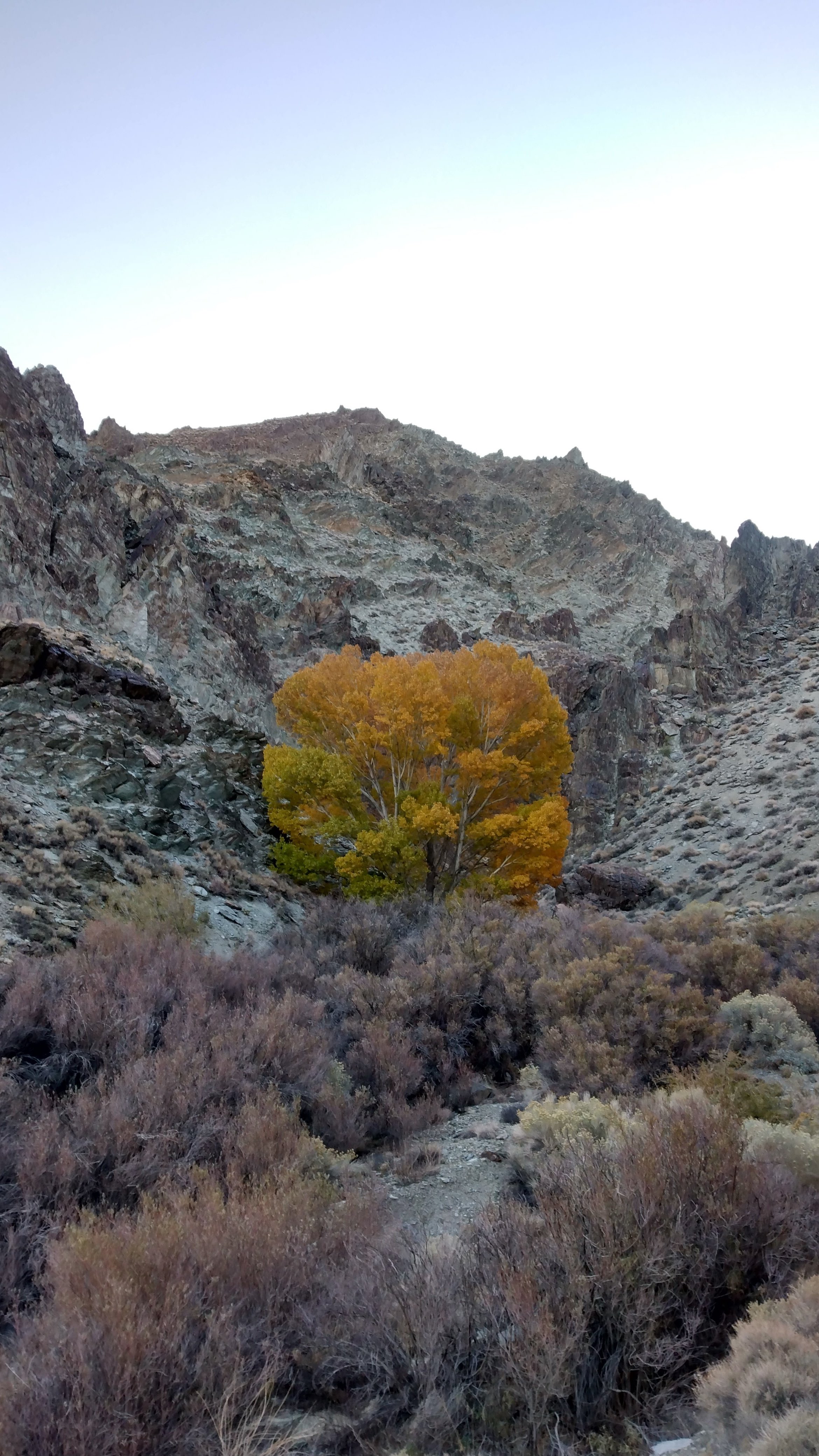
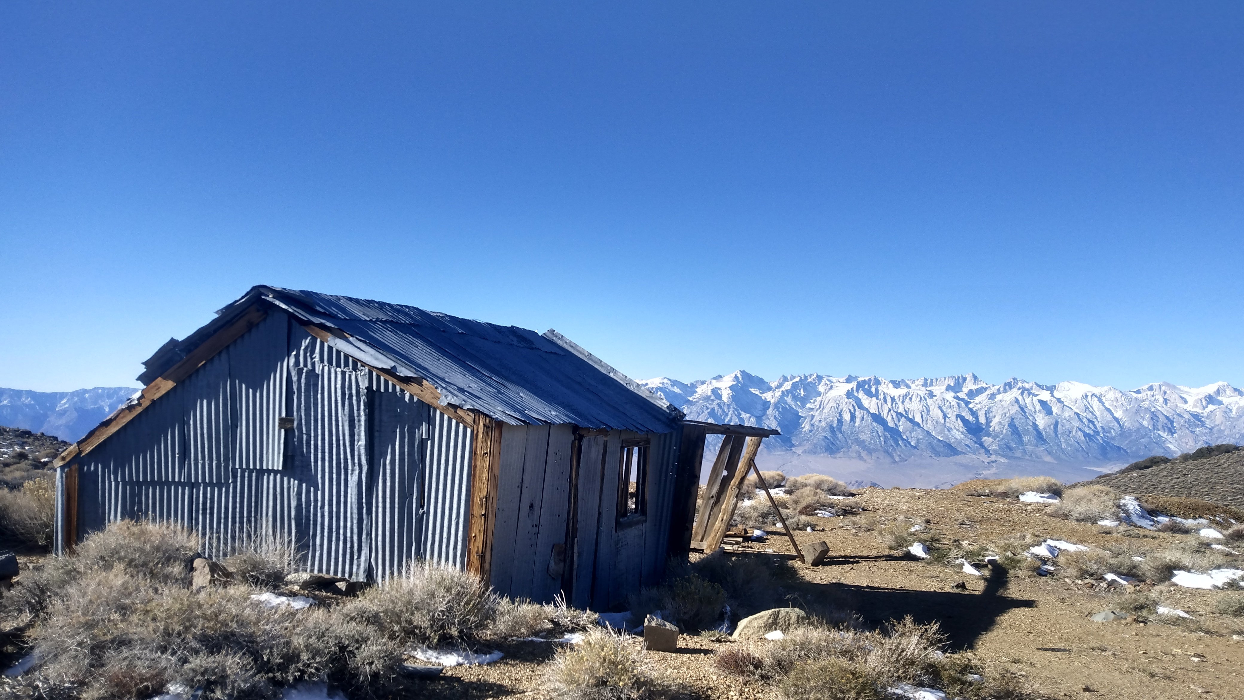
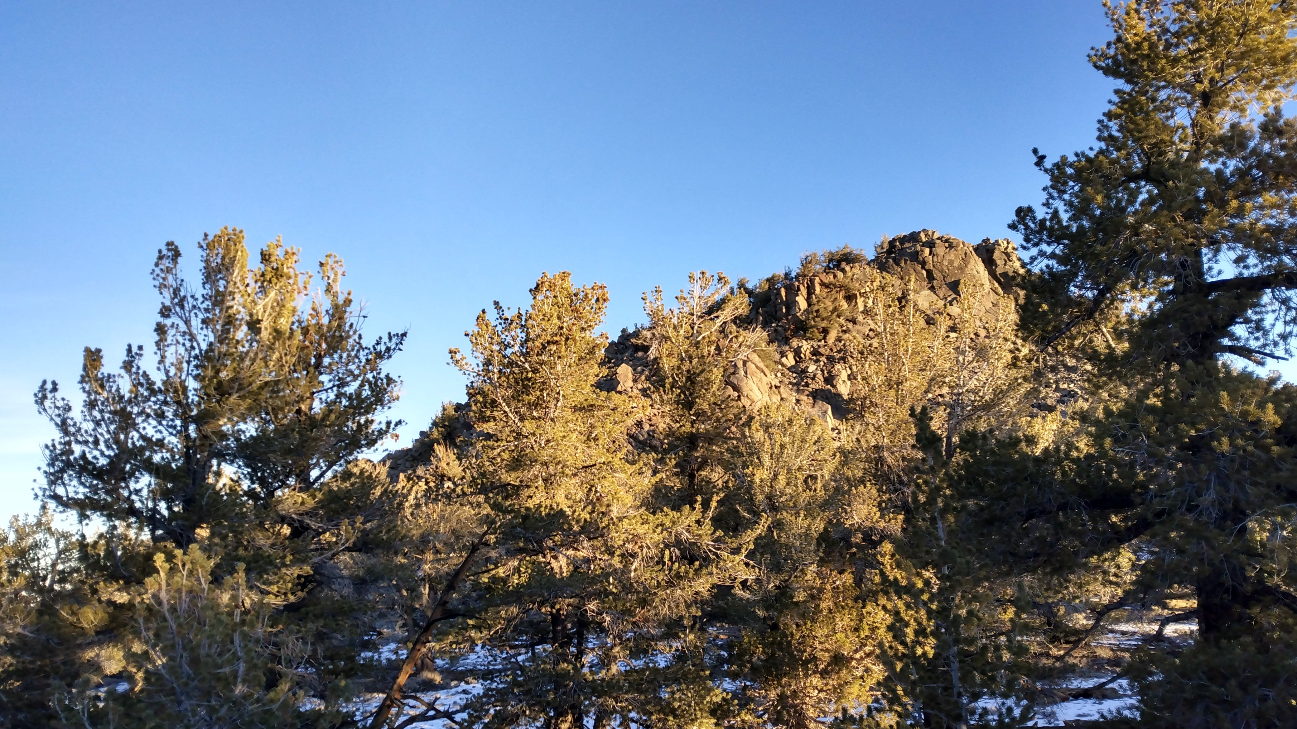
The route started and ended the same way as the Lonesome Miner Trail: up Long John Canyon, and down the Pat Keyes Trail—all I had to do was walk the ridge in between the two. This was my third time up the canyon, and I was happy to see the impressive cottonwood tree about two hours into my hike. Its leaves boasted their brightest of greens in April, and royal yellows this time around in November. From here, I followed a vague use-trail up and out of the canyon, and eventually gained the dirt roads just below the Inyo crest. I checked out an abandoned mine below New York Butte, and then followed a surprisingly good use-trail to its summit. From there, the use-trail continued on to the saddle below Voon Meng Leow Peak. Several unnamed peaks had to be conquered along the way. The ridge line itself was relatively devoid of trees and brush at this point, making for relatively quick travel.
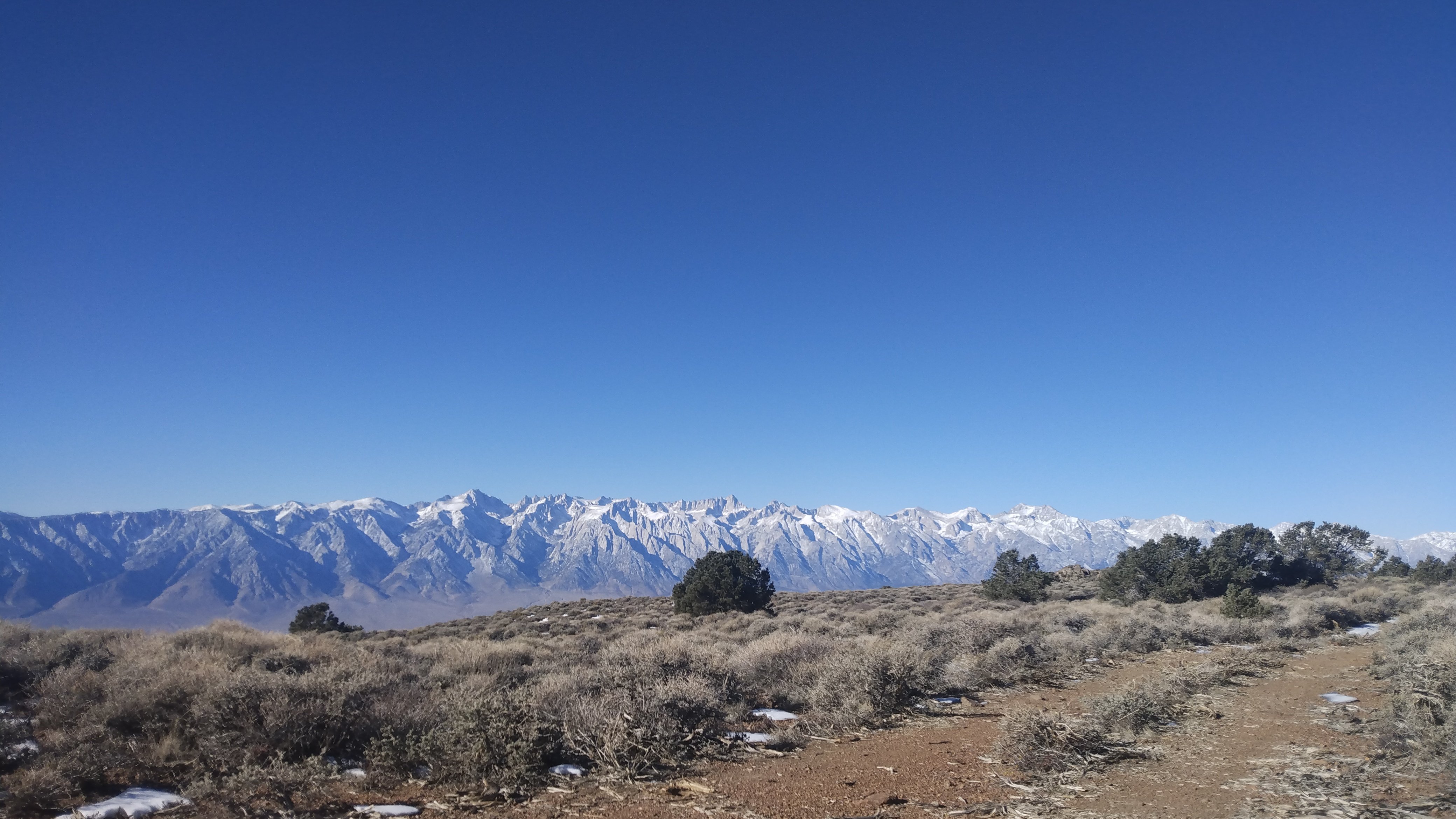
I charged up Voon Meng Leow, signed the register, and tipped my hat to the legendary Kim G. for her countless ascents of peaks in this area that were logged in all the summit registers I visited. The next stop was Forgotten Pass, where I took a break for some snacks. A great feature of traverses like this is that they offer spectacular views the entire time. I could see the Sierra to my left, and Saline Valley and its accompanying peaks to my right. For this reason, it felt less remote than the Lonesome Miner Trail where one finds himself in brush choked canyons with little-to-no line of sight much of the time.
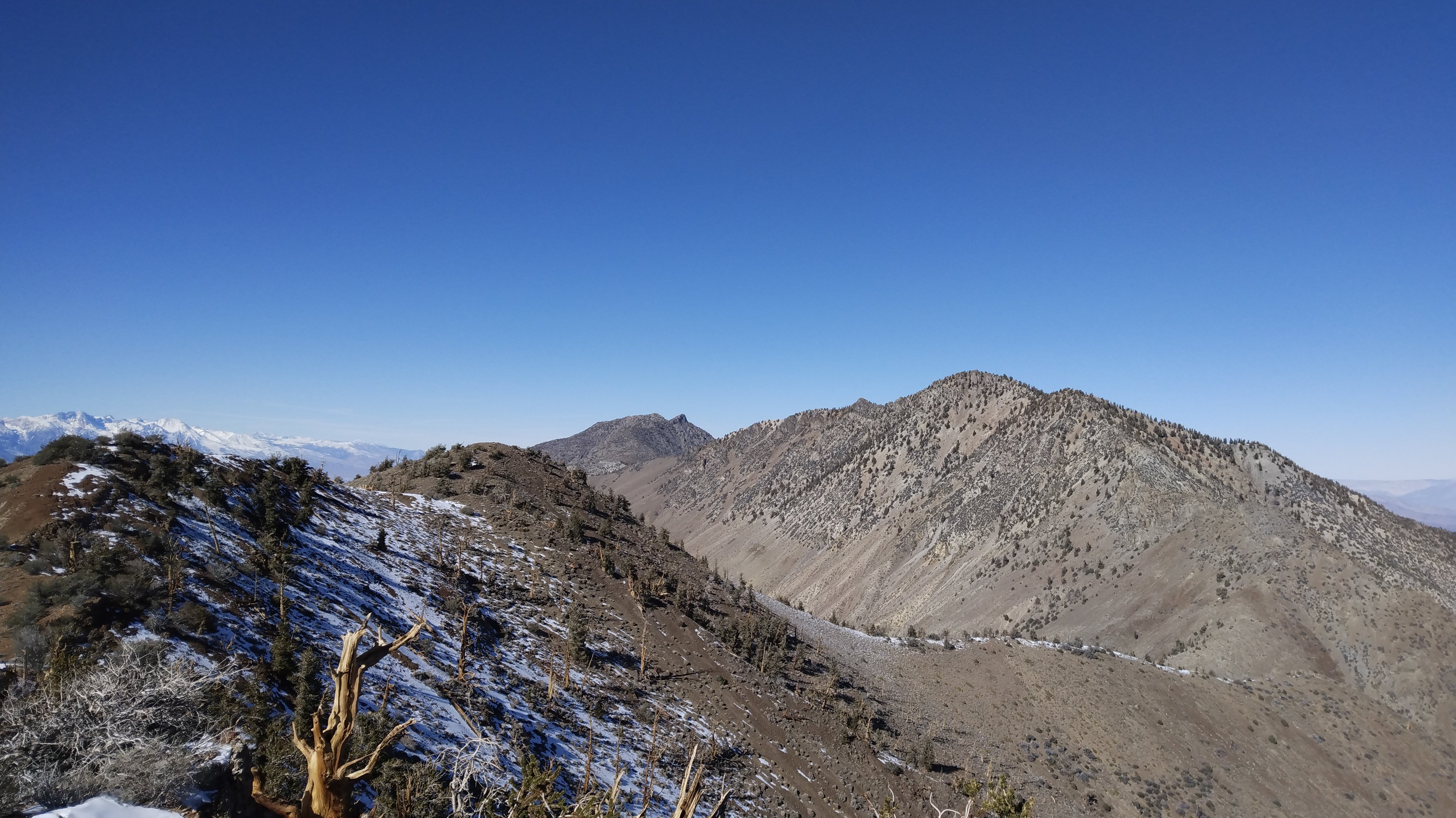
Looking up at Keynot Peak from the pass, I was uncertain if I could bypass the cliffy bluffs protecting its summit. But as I ascended, to my surprise, I picked up a faint use-trail. This allowed me to bypass the worst of the scrambling, though I still tried to gain the ridge too early and found myself thrashing around on sketchy choss and dense thickets of scraggly trees. I dropped back down and side-hilled until closer to the summit. Eventually, I topped out and was granted fantastic views from Keynot’s striking summit. I ate some more, and scoped out the ridge to my North. In each register I read all of the entries for any sign of someone doing a link up of all the peaks. While I found people who headed to Keynot from Forgotten Pass (instead of the more common Union Wash), I did not see anyone continuing on North beyond Mt. Inyo.
I picked up some faint tracks in the snow north of Keynot and descended towards the Keynot/Inyo saddle. The north and east slopes were still quite covered in snow. Having only my running shoes and a single pole, some of the steeper snowy descents became a bit sketchy. I picked up a large stick to act as a second pole, and carefully picked my way down a treacherous descent. The drop to my right was extraordinarily steep, and I surely would have been vanquished had I tripped with no ice axe to arrest my fall. Fortunately, after what seemed like days, I got out of this sketchy section and onto the West side of the ridge, where there was significantly less snow.
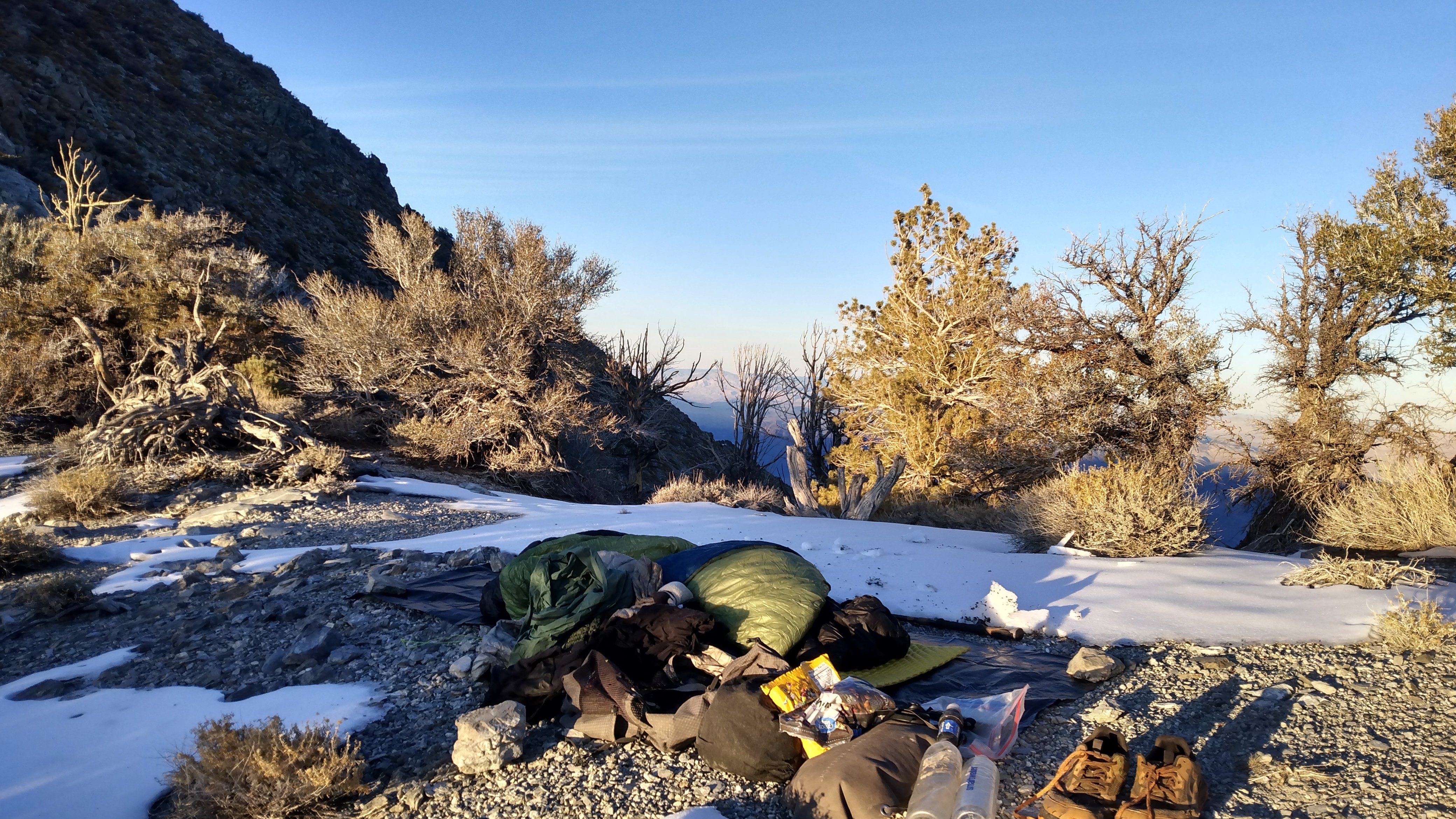
The sun was disappearing behind the Sierra crest at this point and it seemed like a good time to start looking for a campsite. With no snow in the forecast, I decided to forgo the tent in favor of a second sleeping bag for warmth. Camping up above 10,000 feet on an exposed mountain pass in late November surely wasn’t going to be particularly warm. Once the sun set, all the heat of the day was immediately sucked from the atmosphere. I was chilled to my very core. I put all my clothes on and then buried myself into the two sleeping bags on a patch dirt that was relatively devoid of snow. It turns out that perhaps a three sleeping bag solution would have been a better call, as I was extremely cold for most of the night. I suspect the temperature got close to, if not, zero degrees. I was able to sleep for a few hours though, which was a real blessing. There is nothing worse than a freezing-cold, sleepless night in the backcountry. I rose around five in the morning and started hiking well before sunrise.
A great deal of warmth was returned to me once the sun rose over Death Valley, and I was even able to take some layers off. The ridge up to Mt. Inyo was extremely long, and the terrain was slow-going. As I got closer to the summit, the trees became denser, and I had to force my way through stiff lattices of their wickedly sharp branches. Eventually, a friendlier family of Juniper greeted me near the summit, and before long I was on the top of Mt. Inyo. I scanned the summit register from any information of climbers coming from the North. There was only one entry of some such route, and the guy said he tried it from the North, failed, and then came up Union Wash from the South. Great. I was now even more unsure if the ridge would connect down to the Pat Keyes Trail. But I continued on, and to my great pleasure, it linked up without much difficulty. The chief challenge getting down again proved to be snow and dense groves of trees.
I reached the general area of the Pat Keyes trail and wandered around for a while to find the trail, which is quite faint in places. Eventually, I picked it up, took a short break and began the steep 6,000 foot descent. Before long, I found myself back in the Owens Valley. All that remained was a cathartic twelve mile dirt road walk back to my car, a nice cognitive break from the focus that off-trail travel demands. I got to my car just as the sun set, made a huge pot of pasta, consumed said bowl of pasta, and passed out for twelve hours.