The (Partial) Panamint Traverse
Peaks: Sentinal Peak
May 2024
After filling up on water and resting for a few hours at Furnace Creek, we headed for the remotest part of Death Valley: the Owlshead Mountains. Our goal for this trip was a full traverse of the Panamint range, from the Owlshead range all the way to the north end of Tucki Mountain. Unfortunately, a lot of snow still covered the upper reaches of the range, and so we had a back up plan which involved a partial traverse that cut off the ridge just before Telescope Peak.
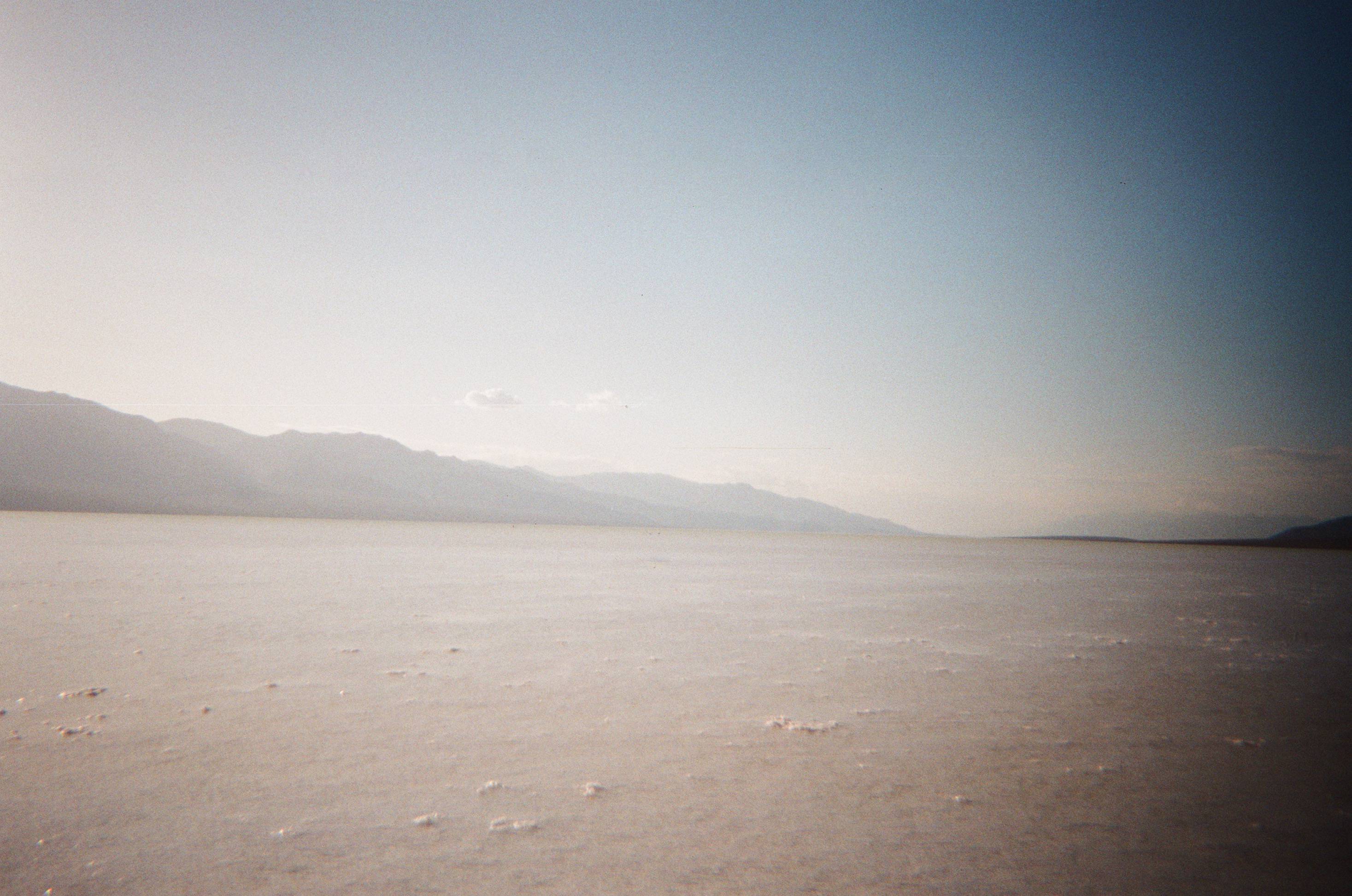
On our drive down, we stopped at Badwater Basin which still held a respectable amount of water. What an incredible gift that we were able to see this usually bone-dry basin filled with water! We stopped again in fifteen miles or so, stashing my mountain bike in the bushes at the junction where we’d be hiking out if we did the partial traverse. This would allow me to ride the last six miles to the car and save us some hot road walking on the exposed valley floor. Eventually we made it to a pullout on a dirt road just east of the Owlshead. We slept soundly that night in the warm desert air.
Early the next morning, we climbed up Contact Canyon. It was a very pretty canyon that involved some tedious route finding. Eventually, we made it to the head of the canyon, and looked down on a wonderfully remote basin. The Owlshead range gets its name because it looks like the head of an owl on topographic maps—the range is roughly circular, with big basins inside of it that make the owl’s eyes. It is a very unique piece of geology. We descended into the basin, and while we traversed to its western edge, thunder and lightning descended onto us. This time, we were prepared. We anticipated this storm and actually wanted to hike this section of the route—which was the lowest elevation and most sun-exposed—under the cloud cover. The rain kept us cool, and the plan worked perfectly. We ascended some random canyon to exit the range. Anthony marveled at the fact that we likely may have been the first people to climb this canyon in well over a hundred years. It truly is a savagely remote and isolated part of the park. That was a very cool thought to have as we toiled up the brushy terrain. I will admit, hiking over the exposed mountain pass at the top of the canyon to exit the range in the middle of a thunderstorm was a bit nerve-racking.
We spent the remainder of the day crossing the flat, exposed wash that separates the Panamints from the Owlshead. The storm ceased, but the clouds more or less remained for the remainder of the day. In the evening, as we made our way up into the southern reaches of the Panamints, we started feeling a few drops of rain. Anthony remarked, “It would be really nice to find a cave or something to sleep in, I don’t really trust our tarps in the rain.”
Surveying the valley, I found it unlikely there would be any sort of shelter like that. I said, “Damn, looks pretty sparse, I doubt we’ll find anything.”
Literally the next moment Anthony replied, “Wow, isn’t that a cave right there?” He pointed about fifty feet up the valley wall to what looked like a perfect cave for the two of us. It was probably the only hunk of solid rock for miles, and somehow we stumbled upon it at just the right time. We scrambled up to the mouth of the cave and discovered it to be a perfect shelter for the night. Again, I thought of how we were probably the first visitors in a century or so. No doubt the cave had housed a lonesome desert prospector and a hearty Shoshone native on their sojourns in the past, and I felt oddly connected to the land and this cave’s quiet chain of human history as I settled into my sleeping bag, perfectly dry, the rain intensifying in the dying light of dusk. This was the second time Anthony and I had stumbled upon an unlikely desert cave in Death Valley just as a storm was starting. God works in mysterious ways.
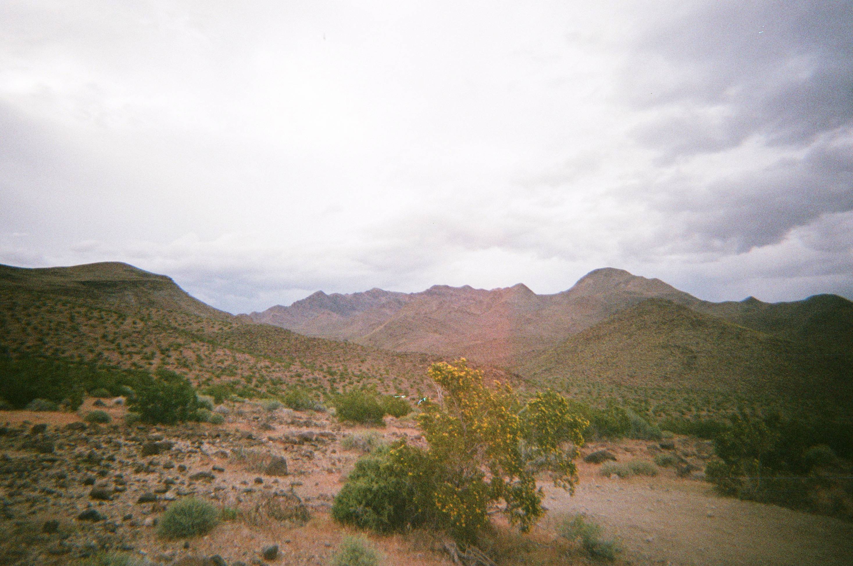
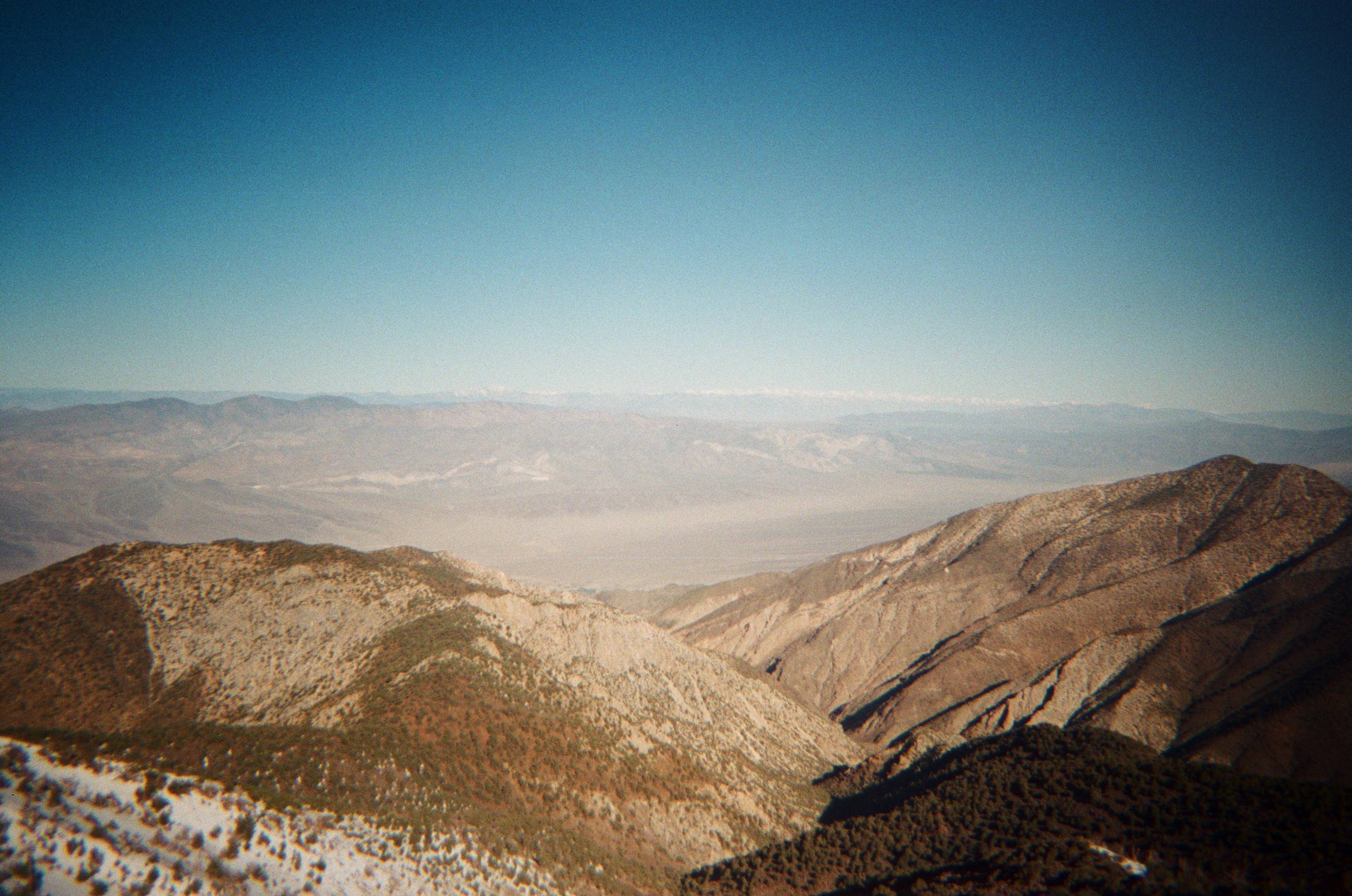
The next morning, it was clear as could be. We hiked to the old Charles Manson hideout, Barker Ranch, and stopped for an eerie snack break. Soon, we cracked on, towards Butte Valley. There, we filled our water bottles at the geologist cabin, talked with some desert rats we met, and hiked down-valley for a few miles. We peeled west and climbed a huge mountainside in order to attain the crest of the Panamints. Once on the ridge, we made rapid progress along the proud line. We camped in one of the most beautiful places I have ever been. The Sierra loomed large to the west, and the rest of Death Valley sat 11,000 feet below us to the east.
We rose early the next morning and summited Sentinal Peak without much trouble. The ridge to Telescope looked impenetrable without ice axes and crampons, so we opted for our backup plan: dropping down Johnson Canyon from Panamint Pass. The first hour of the descent was on scree, over downed trees, and along the canyon’s creeks. It was relatively fast. But about halfway down, the canyon floor is choked with dense willows and other brush and trees, becoming almost impassable. We spent several frustrating hours scaling the canyon walls to work our way down. This verdant valley once housed Hungry Bill’s Ranch, which grew and supplied fresh fruit (in Death Valley!!!) to the once booming Panamint City on the west side of the range. We saw the last vestiges of the ranch peppering the canyon floor for miles as we thrashed through its scratchy brush.
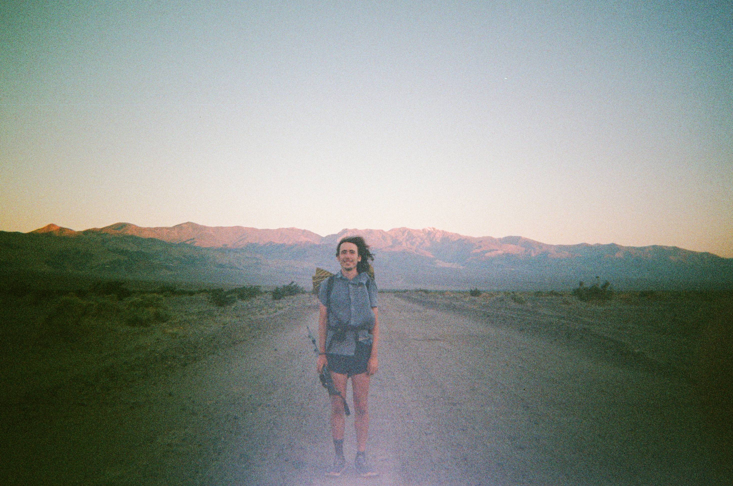
Finally, the valley opened up and a vague dirt road led us to its mouth. We loitered in the shade for a few hours, waiting for dusk to begin our twenty mile hike across the valley floor. As the sun set, we set off, and hiked well into the night. Around 11 p.m. we gave our weary feet some rest, and laid out our pads on the soft sandy floor. It was too hot for my sleeping bag, so I laid on top of it with just my hiking shorts on. I rested on my back, cupped my hands behind my head, let out a deep sigh, and smiled peacefully, drifting off to sleep. I can’t remember the last time I felt as free as I did then. Here we were, laying out smack in the middle of Death Valley, nowhere to be but right where we were, looking up at the brilliant desert stars.
The wind whipped up around 1 a.m. which prevented us from sleeping too soundly. Shards of sand were launched into our sleeping bags, at our faces, and in our eyes. It finally subsided, but by this time we had to rise and knock out the rest of the hike before it was too hot. I got to the road, hopped on my bike, and pedaled to the car. I picked Anthony up somewhere along the road and we celebrated another successful trip.
We finished a few days ahead of schedule due to our modified route, and so we headed to the Southern Sierra, the only part of the range not loaded with snow, to bag some peaks. We said farewell to the desert and looked forward to the lush alpine zones that lay ahead.